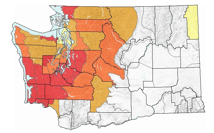
This map shows landslide risks across the state, with the red areas signifying extreme risk and the orange areas showing high risk.
Lewis County is in extreme and high levels of landslide risk after the recent rainfall.
According to the Washington State Department of Natural Resources website, the western portion of the county is at an extreme risk of landslides while a high risk has been issued for East Lewis County.
Extreme risk means landslide initiation is expected to be very frequent and widespread.
All of Thurston County and the majority of Grays Harbor County are also facing extreme landslide hazard.
Much of Western Washington is at moderate to extreme risk of landslides.
The map indicating these risks was last updated late Tuesday morning.
The risk of landslides is greater on steeper hills with loose soil on top of harder clay.
Warning signs of an impending landslide include:
• Cracks growing in the ground;
• Rocks, soil or plants moving downhill;
• Creek water levels changing rapidly;
• The ground making cracking or groaning sounds.
The Shallow Landslide Hazard Forecast Map for Washington State is created by DNR and the National Weather Service and is based on rainfall in the last 24 hours and predicted rainfall for the next 48 hours.
The map can be found at fortress.wa.gov/dnr/landslidewarning.


