


The Office of the Chehalis Basin (OCB) is gearing up for flood season.
As the first major storm system of the season moves into the region late this week, the office held a pair of webinars — one aimed at being prepared for flooding and another geared toward potential projects to reduce chronic inundation in the basin.
One of the webinars focused on helping people learn about the local flood warning system. The second was based on the work of the Local Action Non-Dam (LAND) Alternatives Steering Group, which has been tasked by the Office of the Chehalis Basin with considering options other than a proposed water retention structure on the Chehalis River near Pe Ell.
Webinar: Be Aware, Be Prepared, Learn the Flood Warning System
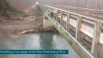
Scott Boettcher, a staff member for the Chehalis River Basin Flood Authority, was joined by West Consultants Senior Vice President David Curtis in a webinar Wednesday night where they broke down the OCB’s flood warning system and gages.
“Our objective (with) any flood warning system is to mitigate the risk, and we do that in two phases,” Curtis said. “First, we try to reduce the amount of time it takes to recognize there’s a serious event about to occur. With that information, then we try to increase the amount of time available to residents to respond to the flood threat.”
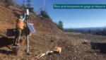
He further explained that flood warning systems have been in place for years, but after the 2007 and 2009 flooding events and with flooding becoming more frequent, the flood authority commissioned 10 new gages and sensors in 2010.
Eight of the sites measured rainfall and temperature and two additional sites measured stream levels, rainfall and temperature. Curtis said they were placed to fill gaps in the existing sensor system rather than replace it.
“An important part of the (new) system is it leveraged systems currently operated by other agencies rather than duplicating effort and building something brand new completely by the flood authority. As a result, today we have over 300 sensors reporting to the Chehalis flood warning system from 100 sites,” Curtis said.
Curtis said the public is welcome to view all of the data at https://chehalisriverflood.com/. Temperatures, rainfall and river forecasts can all be viewed along with a plethora of other information ranging from gage data maps to road condition reports.
“The forecasting features and high water alerts are also important to people who might have farm pads. In the 2007 and 2009 events, farmers suffered severely from the high water,” Curtis said.
He added the high water alerts would be key in helping farmers know when to start moving livestock and equipment onto their elevated farm pads to protect them. Anyone in the basin is welcome to sign up for the alerts.
Boettcher then spoke about how the OCB has worked to make a lot of the information more accessible using maps and other visuals to help residents get a better sense of when flooding might occur.
“Flood insurance is always an option for people, and I should say we have a new resource that we just finished yesterday. We’ve taken and translated into Spanish the process for signing up for the high water alerts,” Boettcher said.
Along with https://chehalisriverflood.com/, basin residents can also visit https://chehalisbasinstrategy.com/ for more information on flooding mitigation programs and assistance.
User feedback is welcome as Boettcher explained the OCB is always looking for ways to improve the flood warning system.
“This is an information system. It’s intended to give you information and that’s really your best first line of defense in times of floods,” Boettcher said.
LAND Steering Group Meeting: Diversions, Relocations and Levees
On Monday afternoon, the LAND Steering Group met on Zoom to discuss a number of possible concepts for non-dam flood mitigation and also voted to postpone an upcoming LAND public workshop that was to be held on Nov. 17 at the Great Wolf Lodge in Grand Mound.
No new date has been set for the public workshop, but the steering group hoped to hold it sometime in mid-January. An announcement will be made when a new date is chosen.
The reason for the postponement was that many of the group members felt that while they had preliminary concepts created and some modeling results, the data and concepts needed to be refined before being presented to the public for open discussion.
A total of five concepts were discussed at the steering group meeting still, all varying in costs from just over $256 million to almost $540 million but sharing many of the same flood prevention measures.
The first concept focused on floodplain restoration and the relocation or raising of structures within the floodplain. The second concept incorporated the first while also creating a 700-foot wide diversion near the Mellen Street Bridge and relocating the bridge.
The third concept included the first two while also adding levees along the north and south sides of the Skookumchuck River upstream of Interstate 5.
The fourth concept included only the first concept while also adding levees and floodwalls along the north side of the Chehalis River from Fort Borst Park to Galvin Road, along both sides of the Skookumchuck River, along the north bank of Salzer Creek, along the east side of I-5, along the north bank of the Newaukum River near Chehalis and all around the airport.
The fifth and final concept combined the first, second and fourth concepts.
If any concept is chosen, a variety of new infrastructure, with hefty price tags, would be needed.
That’s why the group decided to refine the concepts before workshopping them with the public.
“It’s a lot to take in,” said LAND Steering Group member Brian Stewart. “Trying to talk or speak for everyone on something like this is going to be tough. The options are gonna be key, letting folks kind of look at this because maybe we’re only talking about 10 or 20 structures and a little bit of money. Maybe we’re talking about a lot of money in some of these. Personally, I think defining the pros and cons and tradeoffs more explicitly so other folks at that meeting can look at it and feel like they understand what they’re looking at and also just not feel like they’re picking something based on money or based on structures and inundation.”


