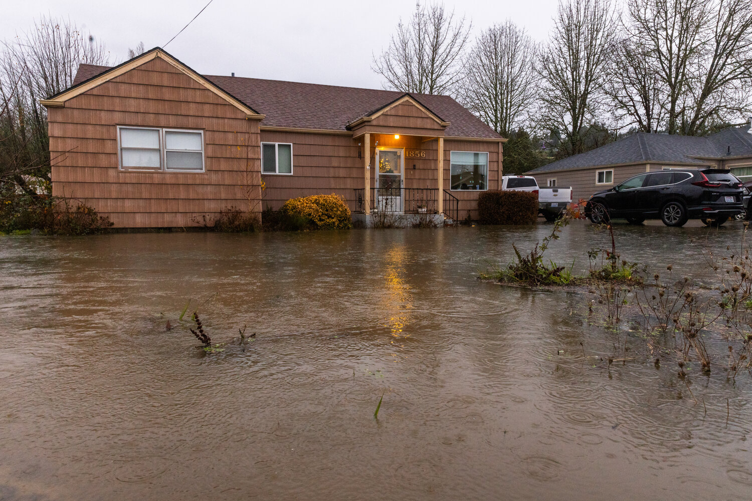


No corner of Lewis County was spared from the near-constant rainfall early this week.
The technical name for the now-dissipating storm is an “atmospheric river.”
On average, these concentrated streams of water vapor in the sky are equal to the average flow of water at the mouth of the Mississippi River, according to the National Weather Service. Larger atmospheric rivers can carry 15 times that much water, the weather service states.
And, after a recent dry spell, that rain hit Lewis County like hose water on hot bark dust on a hot summer day.
Flood warnings were issued for the Cowlitz River at Randle, the Newaukum River in Chehalis, and the Chehalis River above Doty and at Grand Mound early this week. Warnings for the Newaukum and Cowlitz were extended on Wednesday morning through at least Thursday afternoon.
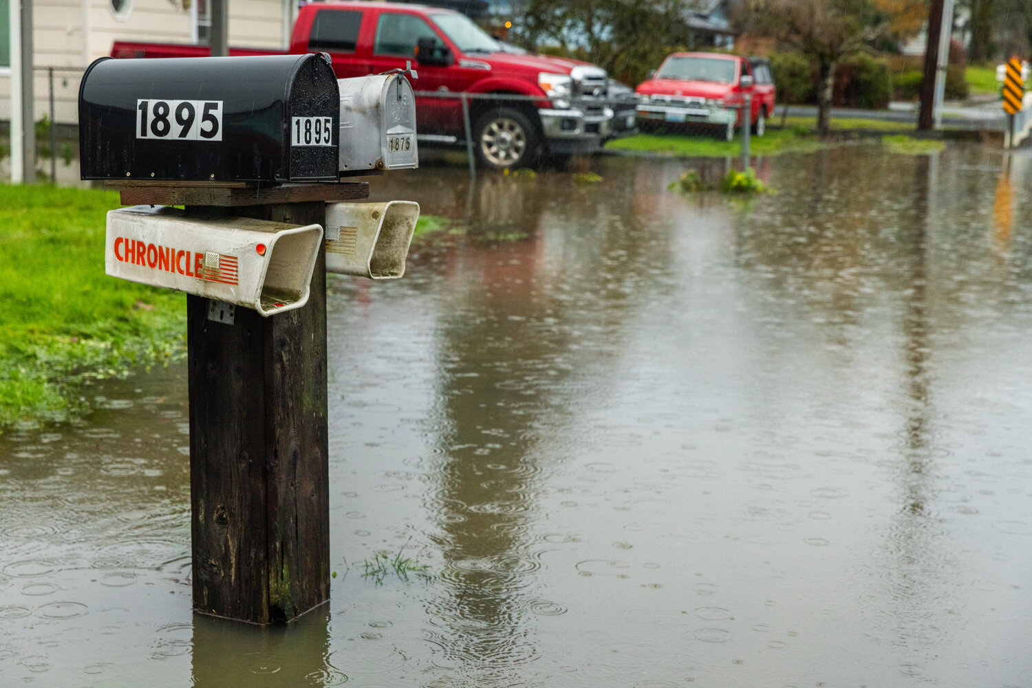
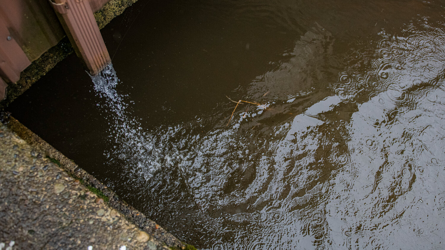
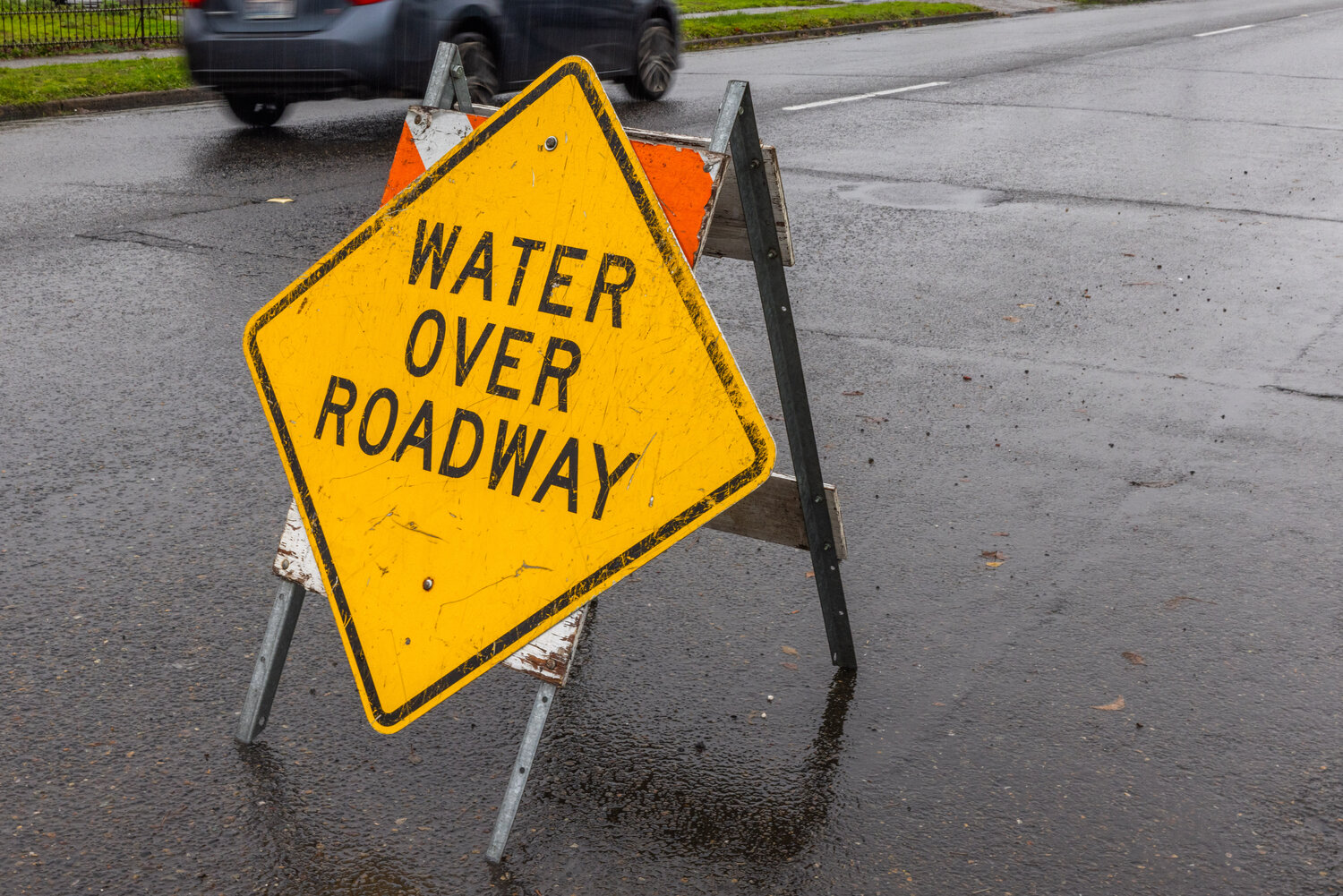
Though rising rivers and creeks is a concern, the Lewis County Division of Emergency Management’s biggest challenge this week came from surface flooding, said Deputy Director Ross McDowell.
“We got all the rain in three days. In those three days was not enough time to permeate that hard, hard dirt,” McDowell said on Wednesday. “A lot of our roadways are closed and it’s not because of the rivers, but it’s surface water.”
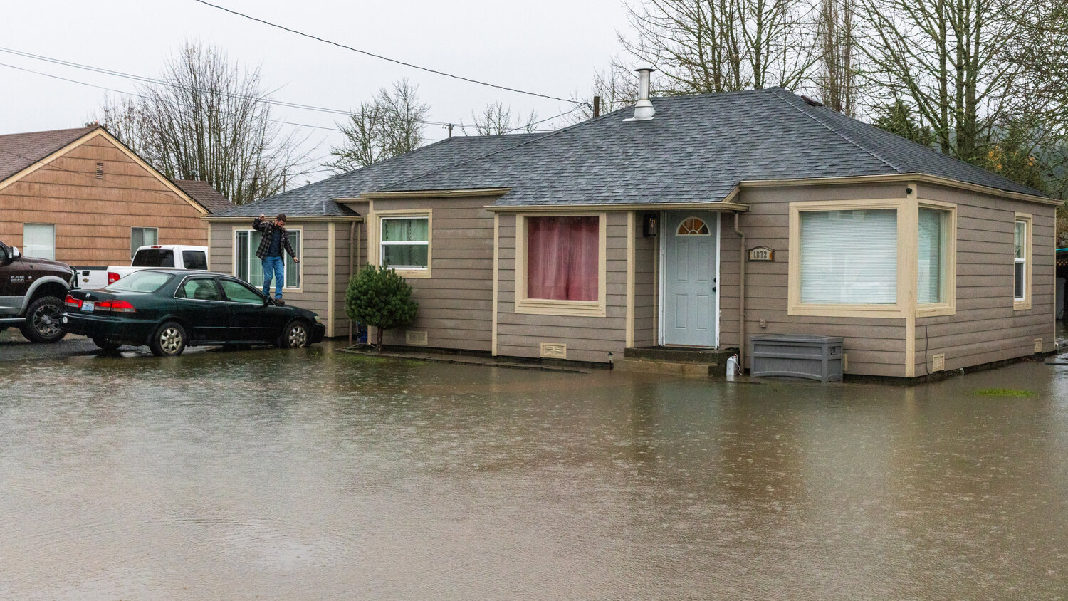
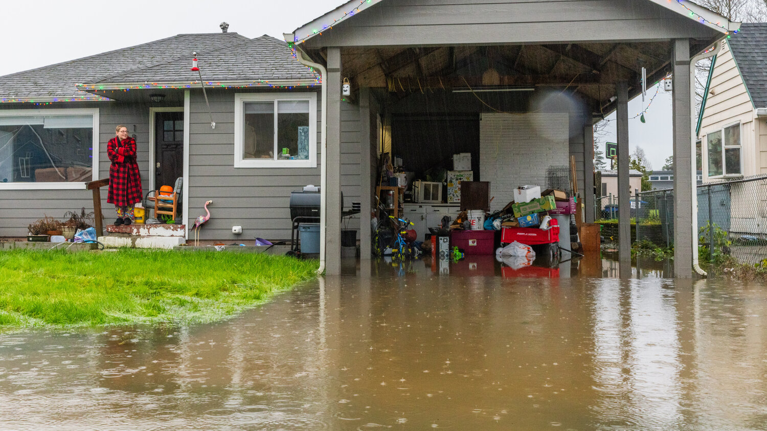
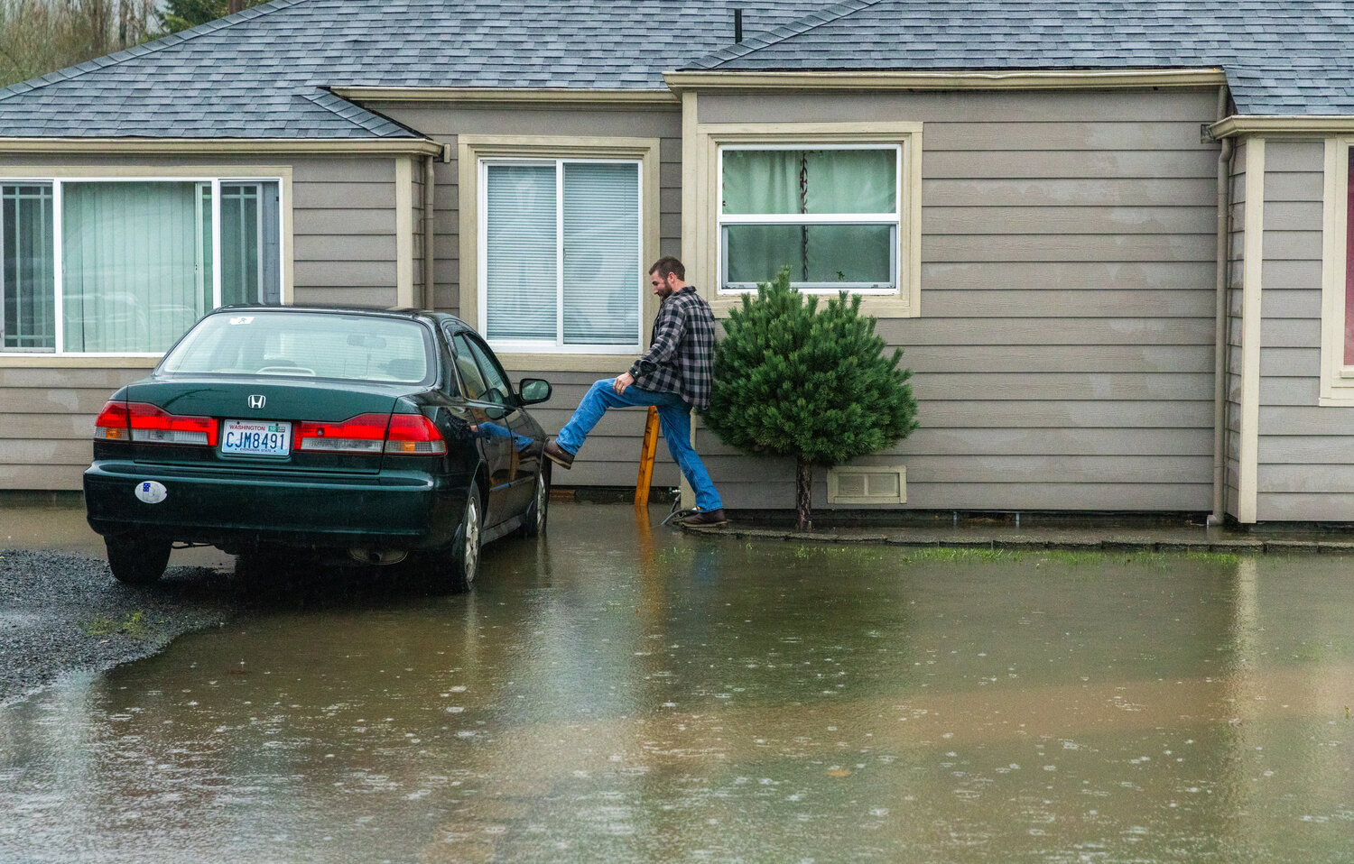
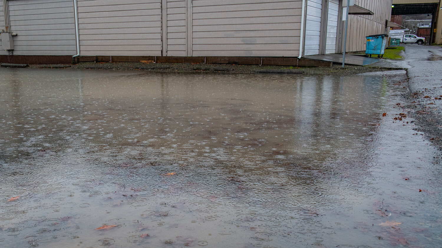
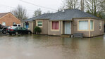
At Southwest Snively Avenue and Southwest 19th Street in Chehalis, garages and outbuildings flooded as houses were surrounded completely by water. A combination of the flooded creek running parallel to Snively and heavy rain accumulating in puddles combined into about 1 foot of water surrounding some houses, McDowell said.
The Chronicle asked McDowell, a Chehalis-based real estate agent and a former 29-year resident of that neighborhood, but none of them knew if that creek has an official name.
“We got a call from a lady on 19th Street. She was in a wheelchair and she said ‘there’s water coming into my outbuilding and it’s coming into my house,’” McDowell said.
As the rain began to let up on Wednesday, McDowell cautioned that another, less severe system was forecast for Saturday and Sunday. With rivers reaching bank level throughout Lewis County, his department plans to watch the weather pattern closely.
“It’s not going to help the water go down, that’s for sure,” McDowell said.
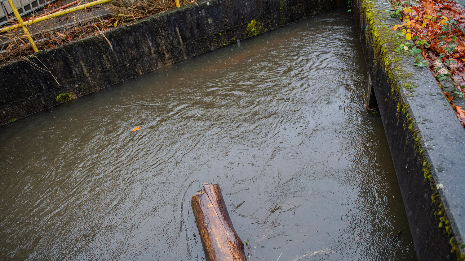
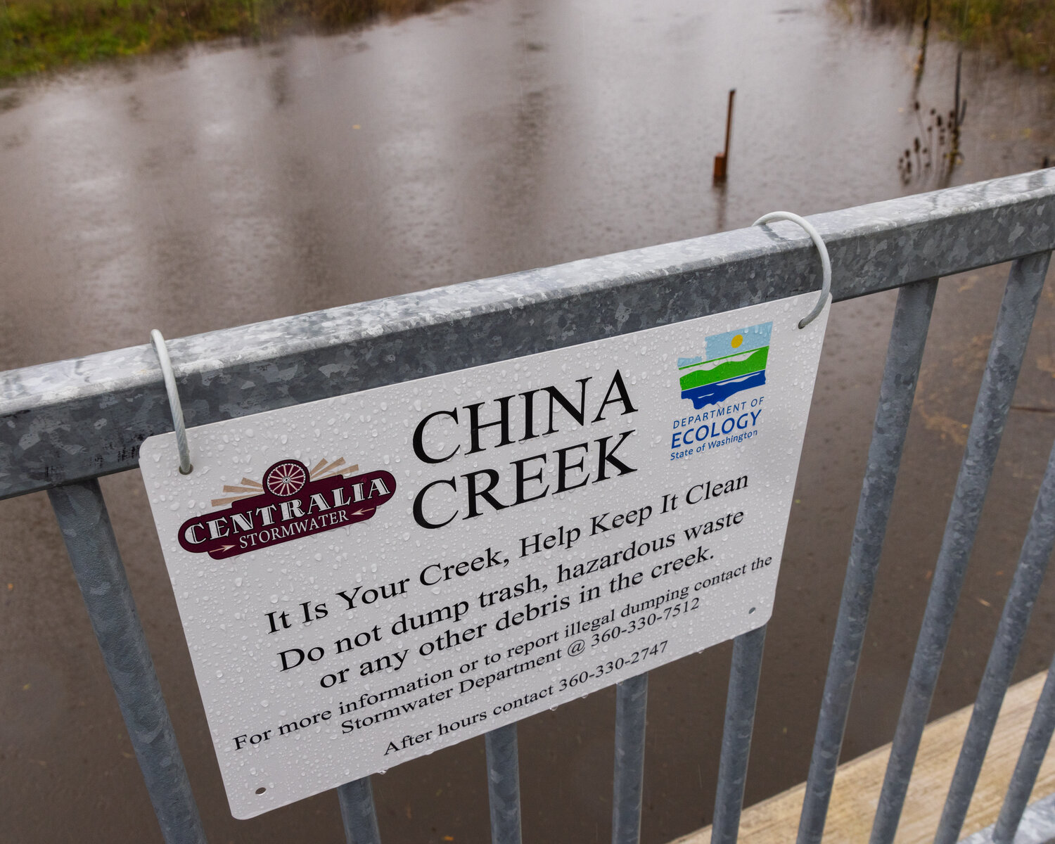
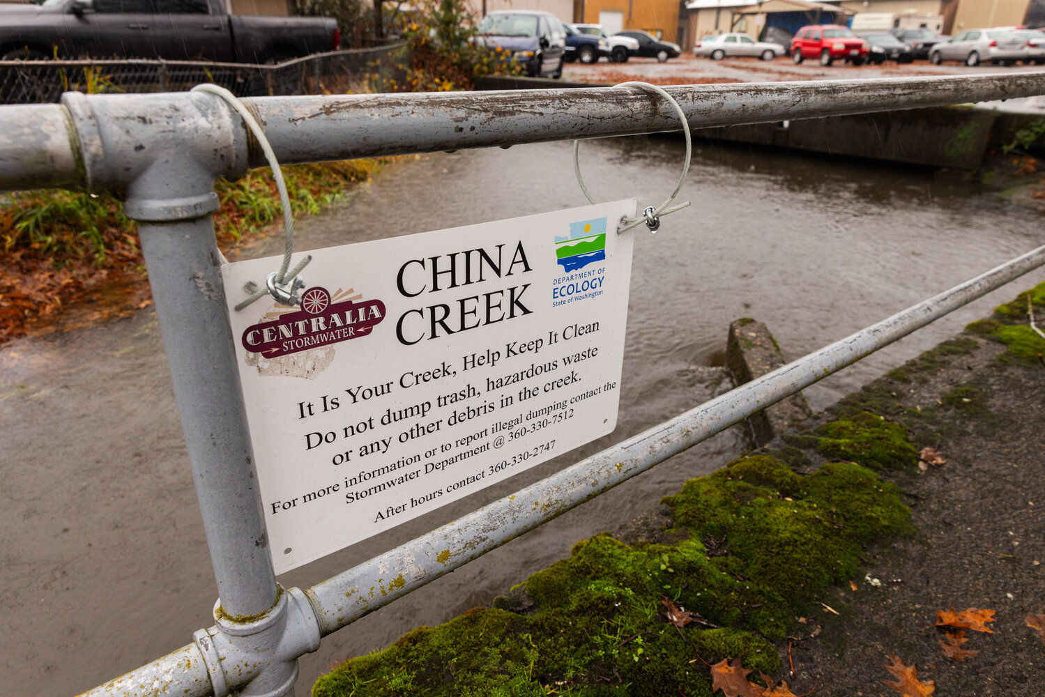
Surface water also inundated several streets in Centralia on Tuesday and Wednesday night, prompting a response from Centralia Public Works crews along China Creek through downtown.
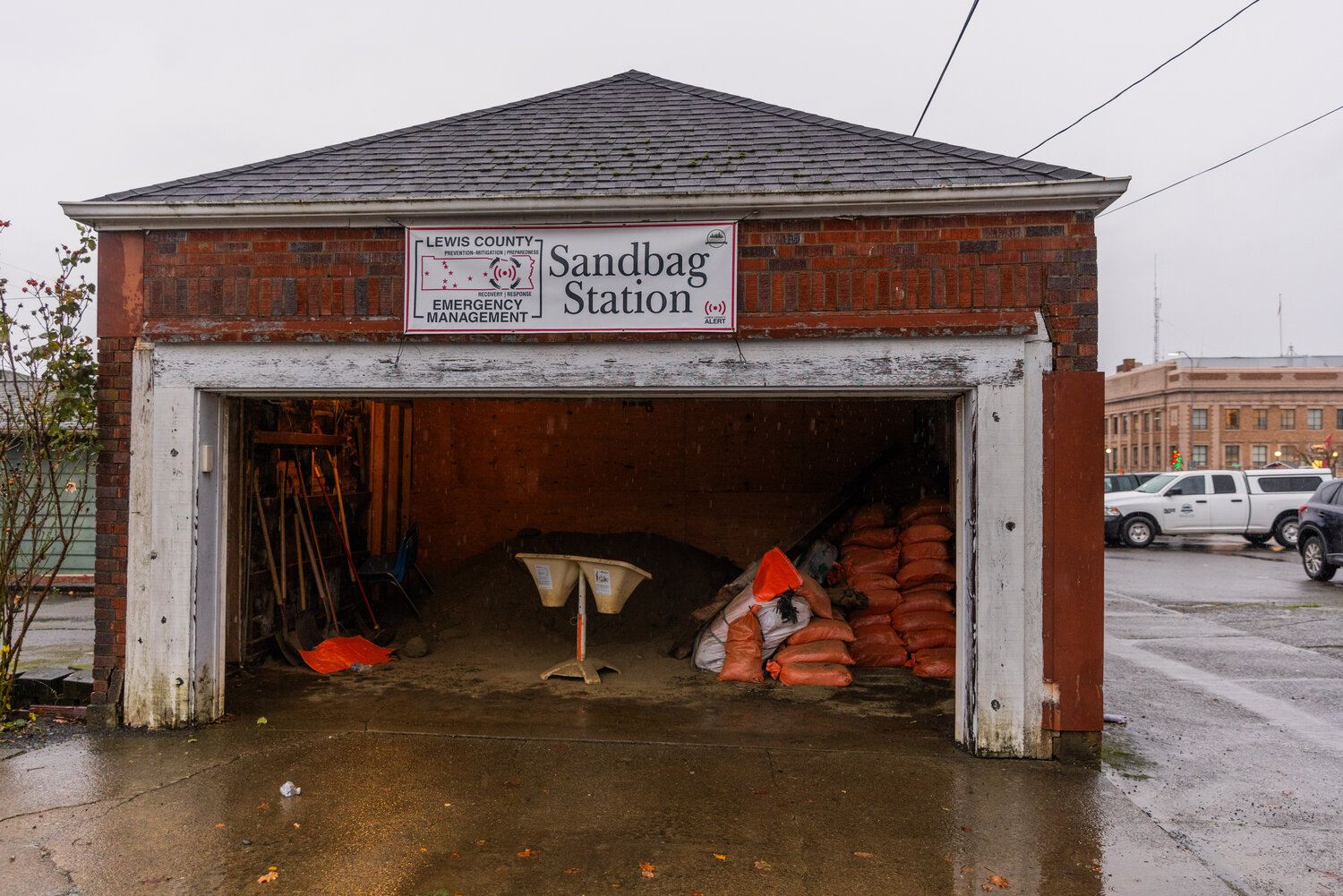
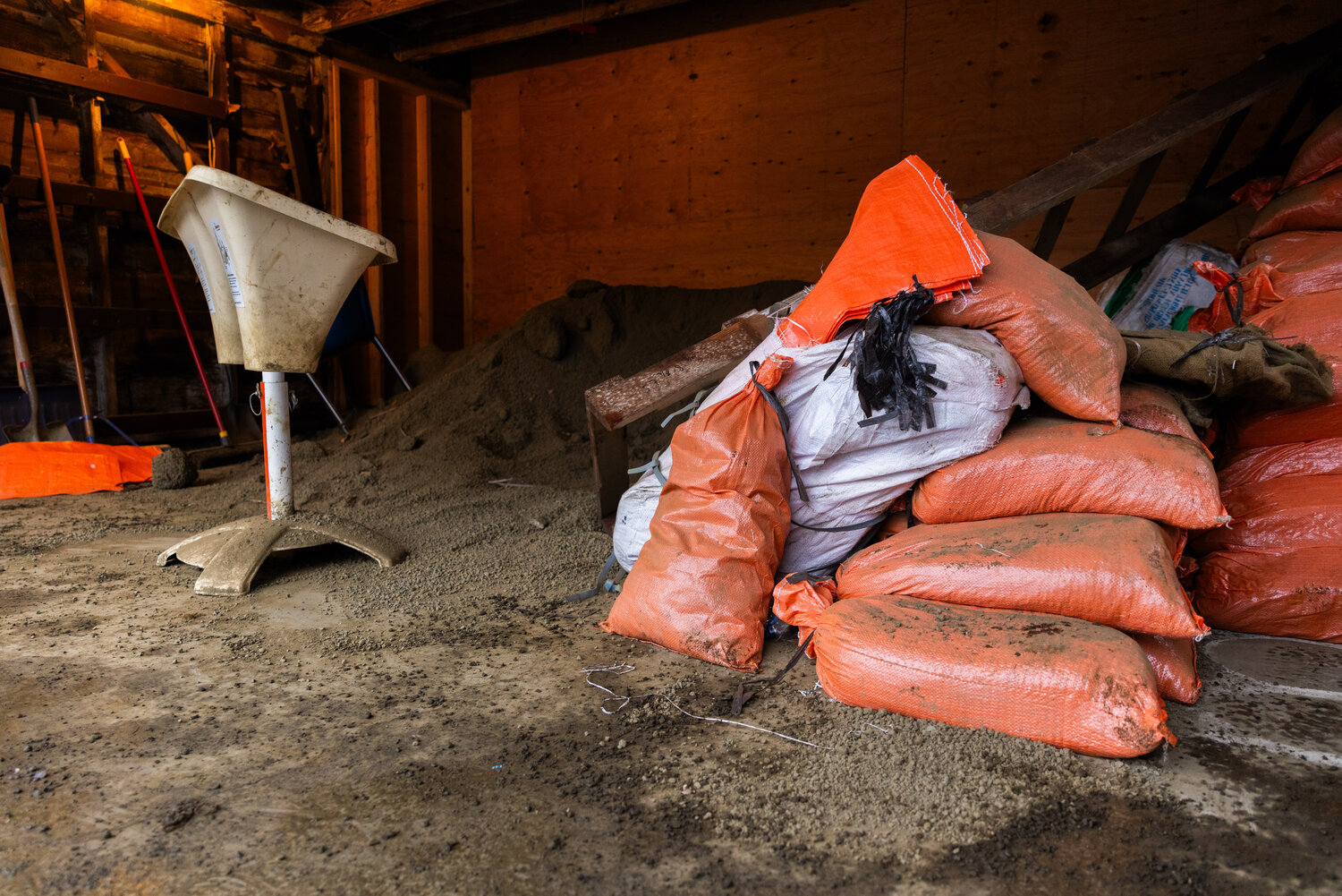
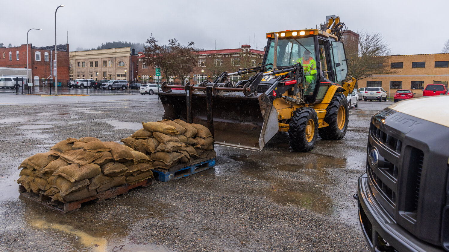
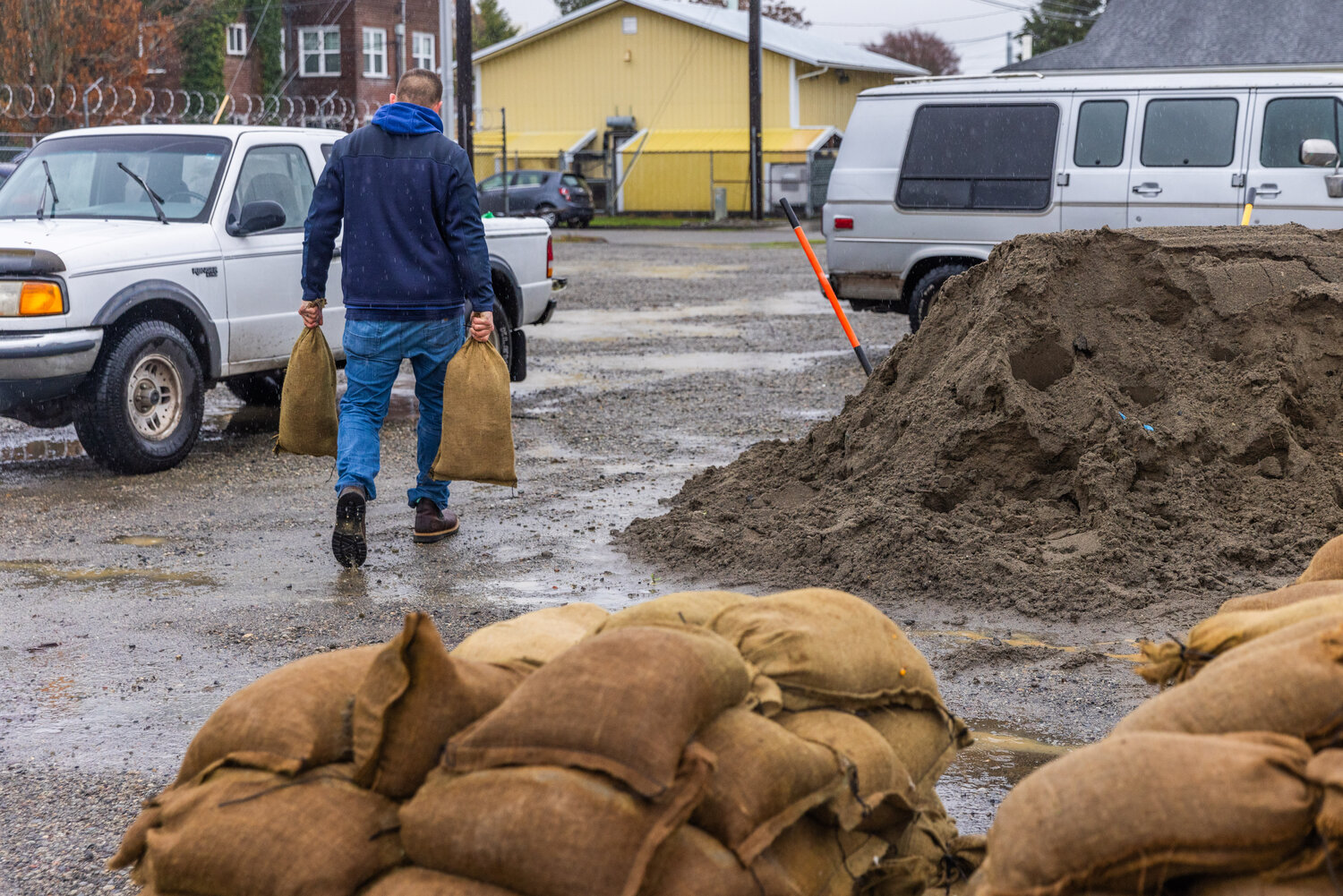
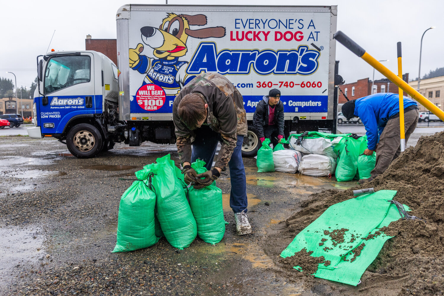
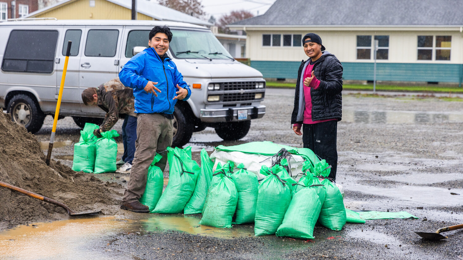
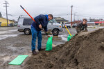
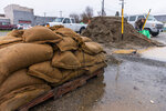
The city set up a sandbag station at the gravel parking lot on the corner of North Pearl and Maple streets as China Creek reached the “minor” flood stage on Tuesday morning. By 6 p.m., the creek crested just over its flood retention structure on North Gold Street. Elevation at China Creek fell throughout the morning Wednesday.
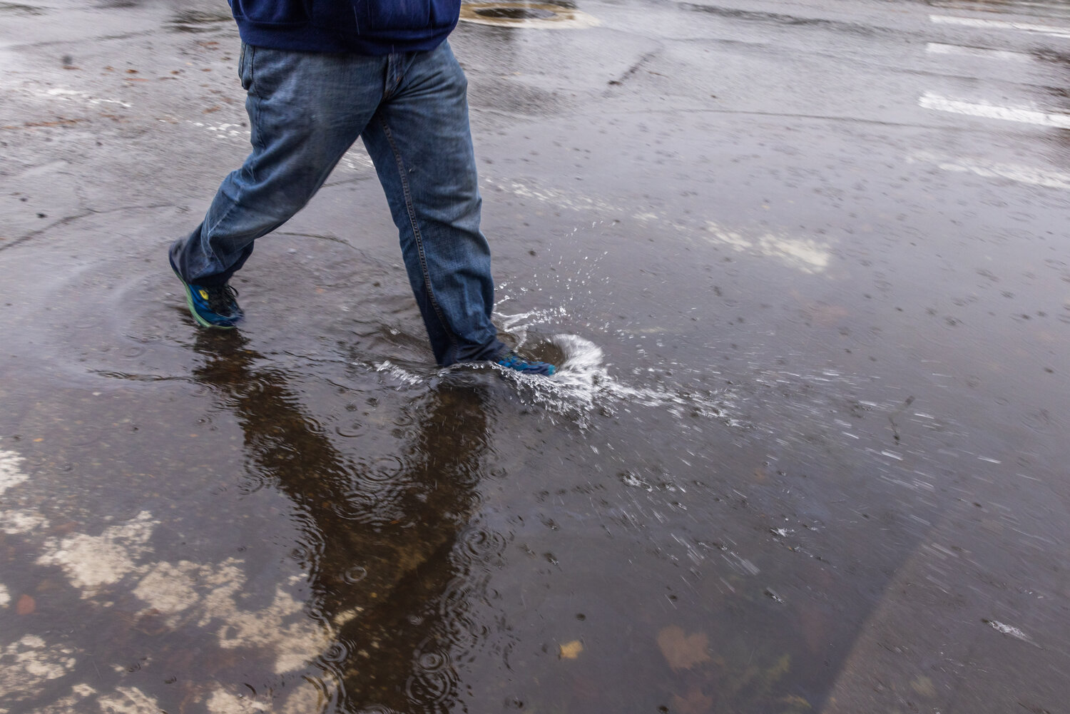
“One thing I did want to get out there is we’re really, really trying to push this, for people to not drive through flooded areas,” McDowell said.
By 5:30 a.m. Tuesday, Centralia Public Works crews were on the streets in raincoats setting up signs, pumps and barricades in the wettest parts of the Hub City, according to Director Kim Ashmore.
“Believe it or not, they’re also driving around and looking at storm drains,” Ashmore said. “Clearing leaves. … Keep things flowing.”
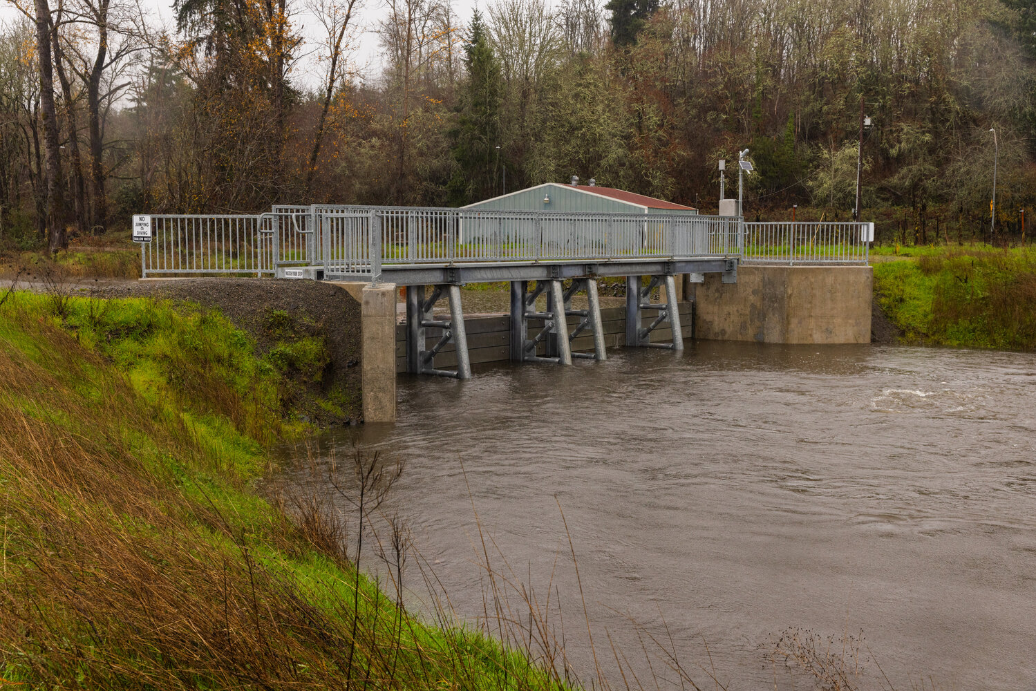
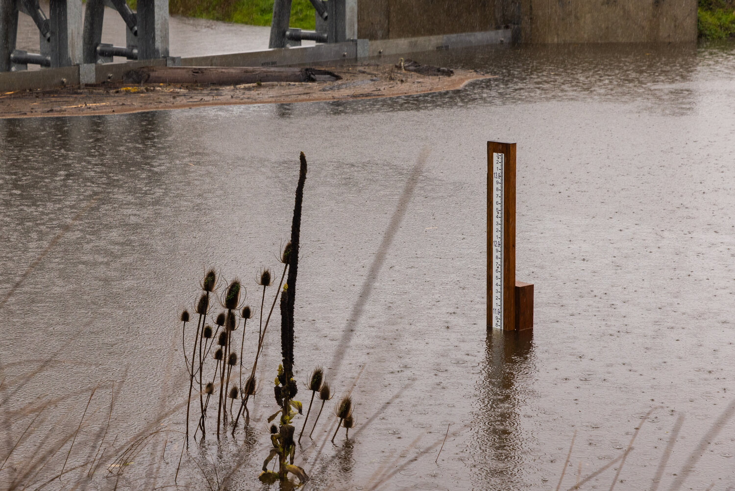
United State Geological Survey (USGS) river gauges — the agency uses the spelling “gages” — measure the elevation of the surface of the water, not the depth of water itself. Therefore, water levels are relevant only when compared to the height of different flood stages.
“We’re providing sandbags for people who are concerned about China Creek. … We’ve had a few phone calls today from people wanting to know if they need sandbags. ‘Is the creek gonna flood?’ ‘Is the river gonna flood?’” Ashmore said. “We’re just trying to be proactive.”
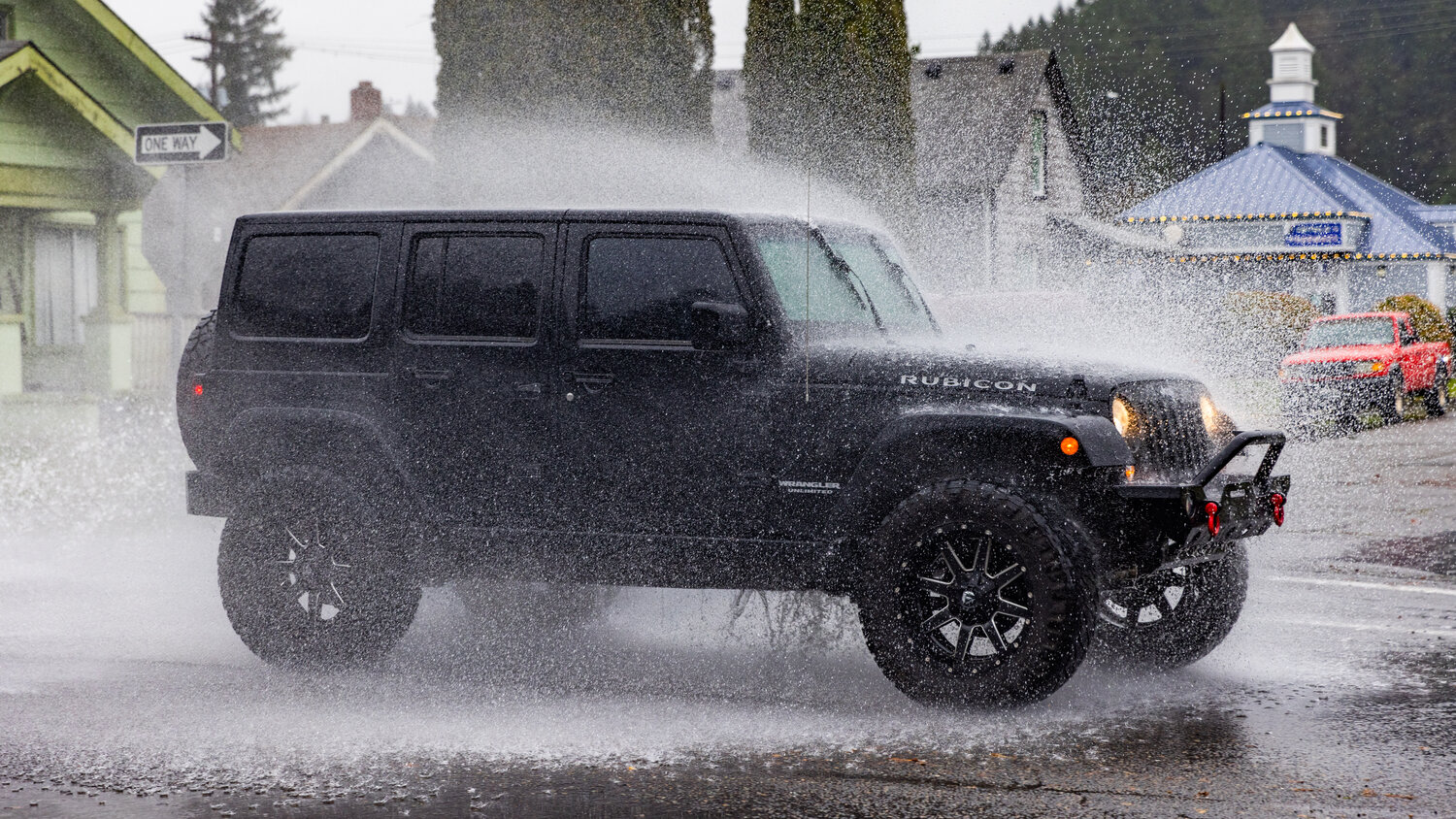
Though surface flooding is less likely to cause strong currents, noted McDowell, it is still unsafe to drive or otherwise travel through.
The weather service reports that most flood deaths occur when drivers attempt to navigate floodwaters where unknown hazards lie beneath the surface.
“You don’t realize what all is in that water,” McDowell said. “You don’t know what’s going to do to your car, you don’t know what that’s going to do to your legs. … You don’t want to bring anything home but a paycheck.”
Lewis County set up a sandbag station at 19 SW Cascade Ave., Chehalis, which is set to close at 5 p.m. on Friday.
For more information, head to these websites:
River conditions: http://rivers.lewiscountywa.gov/#/
Road conditions: https://roads.lewiscountywa.gov
Lewis County Alert: www.lewiscountywa.gov (click on the Lewis County Alert icon at the bottom right-hand side of the page)
River gauges: https://lewiscountywa.gov/emergency-management/2018-river-gage-information
Newaukum River
The Newaukum near Chehalis, as of Wednesday morning, crested and began falling in the “minor” flood stage.
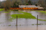
Although floodwaters inundated the low farmland arteries of Tune and Hamilton roads, Shorey Road and nearby homes were not impacted, McDowell said, “And that’s a good thing.”
After seeing the river crest below the previously forecasted “moderate” flood stage, emergency management is mostly concerned with long-term impacts from the Newaukum flooding, McDowell said.
As an especially “serpentine” body of water, its tendency to accumulate debris is worsened by major rain events. When pile-ups happen along the corners of the river, McDowell said, they can threaten the river banks’ structural integrity, change the path of the river, increase the speed of flowing water and threaten nearby infrastructure. In March 2021, the Lewis County Commissioners declared a state of emergency as the riverbank came within inches of Newaukum Valley Road, according to previous reporting by The Chronicle. That river bank stabilization project won Lewis County Public Works an award after preventing “a 10- to 20-minute increase on emergency responses in the valley,” said Director Josh Metcalf.
“The Newaukum is the one that we were really concerned about by the forecast because it was forecast to get almost to ‘major,’” McDowell said Wednesday. “And that didn’t happen. That was one of our main focuses.”
The county opened a sandbag station on Tuesday at the Napavine Fire Station, 115 E. Washington St., Napavine.
Cowlitz River
Midday on Monday, the surface of the Cowlitz River at Randle sat at 6 feet of elevation.
By 10 p.m. Tuesday, it had reached 20 feet.
The National Weather Service extended a Flood Warning for the Cowlitz at Randle until Thursday afternoon. At 10 a.m. Wednesday morning, the river in East Lewis County hit 21.31 feet, just inches from the 22-foot threshold for the “major” flooding category. Per the weather service’s Wednesday morning update, “the river is nearing its crest now and (is) expected to fall below flood stage (Thursday) morning and continue falling.”
The flooding prompted the Washington Department of Transportation to close U.S. Highway 12 between mileposts 115 and 116 at Chilcoat Avenue and Kehoe Road in Randle. State Route 131, which runs south from downtown Randle, was closed to traffic in both directions at 8:24 p.m. on Tuesday.
At this stage, according to Lewis County Emergency Management’s Ross McDowell, the biggest impact from Cowlitz River flooding is traffic. So far, residents and businesses have not reported structures taking on floodwaters, McDowell said.
“Where they’re at they’re at moderate flood, which means a lot of the fields are going to be completely filled with water,” McDowell said.
Crews from the Department of Transportation, Lewis County and the Randle Fire Department are on standby in the area, McDowell said.
With a break in the rain on Wednesday morning, he and other responders are optimistic that the flooding will improve from here on.
A sandbag station was enacted on Tuesday at the Kiona Public Works Shop, 8911 U.S. Highway 12, Randle and at the Toledo Fire Station, 150 N. Second St., Toledo.
Chehalis River
At and above Doty, including in Pe Ell, the Chehalis River reached “minor” flood stages on Tuesday. By Wednesday morning, the flow had dropped to normal elevation.
At the minor flood stage, floodwaters from the Chehalis and the South Fork Chehalis rivers “inundate many roads and some residential and commercial areas,” the weather service reports.
Residents should watch for floodwaters impacting Twin Oaks Road, Curtis Hill, Lake Creek, Moon Hill, Wildwood Roads and other parts of the Boistfort Valley, and Labri Road and Front Street near Doty.
Just before noon on Wednesday, the Chehalis River at Centralia hit the “action stage,” which is below “minor,” and began falling. Downstream, at Grand Mound, the river reached “minor” flooding and was falling at noon on Wednesday.
Skookumchuck River
The Skookumchuck River at Centralia is not forecast to hit flood stages this week. Near Bucoda, water levels fell just below the “action” stage on Wednesday at noon.
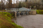
The Skookumchuck Reservoir, above TransAlta’s land dam, overflows at 477 feet. On Tuesday, the water level had reached 464.73. While the reservoir was not intended to provide flood control when first built, the reservoir does hold back high water from the Upper Skookumchuck River until the dam overflows. Because snowmelt from the mountains directly impacted the Newaukum and Cowlitz rivers, McDowell said, the Skookumchuck’s outlook may have been aided by higher elevation snowmelt being held back from by the dam.


