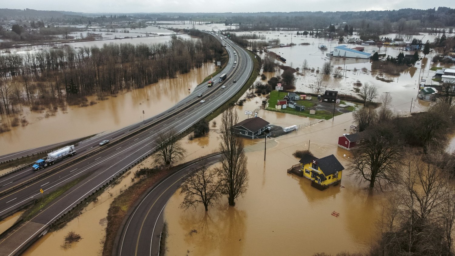
With the winter rainy season descending upon the Chehalis River Basin, residents are once again preparing for the possible flooding that will accompany it.
The Office of the Chehalis Basin isn’t just preparing for this year’s possible flooding events, but is looking ahead using University of Washington climate change models to see what flooding might look like in the state’s second largest river basin by the end of the century.
They presented their findings in a public webinar on Wednesday night.
Nat Kale, principal planner for the Office of the Chehalis Basin, presented first and walked those who were watching through the various data and models he had been studying.
There were two types of flooding the modeling looked at. The first was major flooding events, defined as the flow of water in the Chehalis River near Grand Mound having a rate of flow between 38,800 cubic feet per second (cfs) and 75,099 cfs. Examples of major floods in the past include the flooding events of 1996, 2009 and most recently early this year.
Any flood in which the flow rate exceeds 75,100 cfs is in the level of catastrophic flooding, which happened most recently in 2007.
“Keep in mind, a cubic foot (of water) is just under 8 gallons. When we look at major floods, the type of floods we’re talking about are floods where we get about 40,000 cfs going past Grand Mound in the Chehalis River. That’s about 300,000 gallons per second. That’s a lot of water,” Kale said.
For a flooding event like the catastrophic 2007 disaster, an average of 560,000 gallons of water per second flow through the Chehalis River by Grand Mound.
“We know that flooding at this scale is very dangerous and very damaging and we know that it will almost certainly happen again,” Kale said.
He added that current climate change models are predicting longer, dryer summers combined with shorter, more intense rainy winters.
“That’s going to mean more floods and worse floods,” Kale added.
Partnering with the University of Washington’s Climate Impact Group, the office was able to provide predictive modeling for the Chehalis River Basin. Currently, based on the flooding from the past, the region expects 14 major flooding events every 100 years.
“Somewhere around 2050, with climate change effects, we expect that frequency to double, or even more than double, to somewhere in the range of 29 to 45 major floods every 100 years. In the late century, somewhere around 2080, we expect those numbers to go even higher, maybe even up to roughly a one-in-two chance that in any given year we might see major flooding,” Kale said.
The rate of catastrophic flooding is expected to rise as well. And due to climate change, Kale explained, researchers expect to see greater flooding intensity on top of them occurring more frequently.
Thurston County Stormwater Utility Hydrogeologist Kevin Hansen concurred with Kale’s predictions.
“For the 2040s and 2080s, and the nearest basin in this analysis was in Nisqually here, in both cases we’re looking at 21% to 25% more peak streamflows by 2080. This is gonna hit us harder and faster going forward for the foreseeable future,” Hansen said.
From Lewis County’s perspective, Hansen said more than likely all stormwater culverts will need to be upgraded to larger ones to accommodate for the more intense flooding, one of many expensive fixes the county may need to pay to adjust for how the climate continues to change.
Another possible solution Hansen stated was being considered are new ways of logging.
Logging would still be allowed but would be less frequent to allow trees to grow older, he said. This would allow for older forests, which are able to store more water, he said.
Hansen said a reduction in logging would help decrease flooding during the winter, but the water stored by the trees would last until summer to help keep stream and river levels high enough during the longer summers. Older forests have lower transpiration rates, another way in which they retain more water as compared to young forests, he said.
Cool winter rain water storage is important for the longer summers being predicted as well; if that cooler water isn’t retained, then temperatures in rivers and lakes will keep increasing as well, which is dangerous for salmon, Hansen said. From what Hansen has seen, the temperatures are already rising.
“Almost every surface water monitoring station in our county shows increasing maximum summer temperatures,” Hansen said.
Clearcutting as a method of logging should be eliminated to avoid creating massive rain runoff areas, he said. Hansen stated the method should be replaced with strip-cutting or selective logging.
Kale added there are already other potential solutions that the Office of the Chehalis Basin is considering, including a possible dam near Pe Ell and non-dam alternatives, such as improving levees and the Chehalis-Centralia Airport pump station.
As for what residents of the Chehalis River Basin can do right now to protect themselves from flooding, Kale advised flood-proofing properties and installing farm pads, both of which the office assists with already. If someone desires relocation, that is also an option.
Kale strongly advised residents to purchase flood insurance, as even if a flood hits and FEMA declares an emergency there’s no guarantee everyone who needs funds will get them, or get the amount they need.
Chehalis Basin residents are no strangers to flooding, but according to the Office of the Chehalis Basin, they need to prepare to face floods more frequently.
Another webinar on preparing for floods and learning about the flood warning system will be held by the office at 6 p.m. Nov. 2 and the Lewis County Flood Meeting will be held in-person the next day at 1 p.m. at the Jester Auto Museum.
Learn more at https://chehalisbasinstrategy.com/about/.


