






Editor’s Note: This story is part of "Headwaters to Harbor," a project by The Chronicle to document the Chehalis River from Pe Ell to Grays Harbor while highlighting people and issues connected to the river along the way. Our coverage is compiled at www.chronline.com/Chehalis-River.
The Chehalis River gives.
Salmon and steelhead of the basin have been integral to the Chehalis and Quinault Tribes since time immemorial. The river valley is filled with fertile soil, lush with green. Walk down the Willapa Hills trail or visit Lintott-Alexander Park for a peek of the joy the river gives to families and youth in the summer.
The Chehalis River takes away.
Countless times, I’ve watched the Chehalis River pour over its banks and into the adjacent floodplain.
In 2007, I trudged through feet of muck inside rooms where I’d attended sleepovers and dinners, as my friends coped with the loss of irreplaceable possessions including photo albums, pets and livestock. Last January, I experienced major flooding for the first time as a reporter, spending the night at The Chronicle as roads were closed and waterways went wild.
The word “privilege” doesn’t seem to fully summarize the blessing of my life in Lewis County outside the floodplain, where I am treated to the river’s gifts without being personally harmed by its wrath.
This week has amplified my understanding of water’s highs and lows. On Saturday, I exited the water with both ego and body bruised. On Monday, I cried at the beauty of a mallard duck taking off just in front of me — yes, I really am that soft.
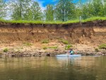
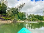
In the early afternoon, Chronicle photographer Jared Wenzelburger, columnist Brian Mittge and I shoved off at Lintott-Alexander Park.
After our misadventure on Saturday — which you can read about at https://www.Chronline.com/Chehalis-River/ — Chronicle Editor-in-Chief Eric Schwartz encouraged us to take a smoother section for our reentry. I’m feeling sorry about the missed section between Rainbow Falls and the Newaukum confluence, but may end up remedying that with a day trip paddle down the line.
Because he was the first reporter to do such a journey for the paper, I trusted Schwartz’s wisdom.
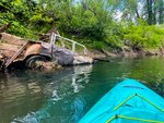
The first major landmark we reached was the state Route 6 bridge. I drive over it at least twice a day, nearly every day, and never knew it was partially built from wood until I saw it from below on Monday.
We passed the Chehalis confluence with Salzer Creek, which I also drive over on Interstate 5 most days. Then China Creek, which runs under the building where I work. Then, the Skookumchuck River, and we ended at Fort Borst Park.
As prevalent as these waterways are in my life, I regularly ignore them, as one ignores a living room couch or a picture on a bedside table.
From the river, I saw my everyday life from an entirely new perspective.
This stretch was not particularly difficult. The river nearly folds in on itself with meanders through the Twin Cities, so it would likely be faster to walk, but the current barely pulls at all.
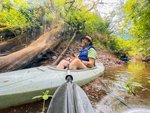
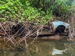
With the calm of the waters, we were able take our time, exploring creeks and log jams. Mittge educated me on trees, while I identified birds for him.
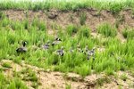
For anyone who is a novice kayaker (like myself) I’d highly recommend this stretch of the river. You’ll be treated to many raptor sightings, including osprey, bald eagles and red-tailed hawks. We also saw Canada goslings ducking down in the grass, thinking themselves hidden from three scary kayakers, which was pretty hilarious.
In summary, Wenzelburger and I are re-energized for this adventure. After losing our camping gear, we implemented a day-trip system. Logistically, this is more challenging, but it has upgraded this journey to “glamping” status in terms of food and sleeping arrangements.
Continue to follow us along the river on Twitter @Chronline and Facebook @theCentraliaChronicle.