The Goat Rocks Fire near Packwood, one of many in the Gifford Pinchot National Forest and throughout Washington burning into late October, hit 6,013 acres in size as of late Tuesday.
All areas north and northeast of Butter Creek are at a level 2 “be set” evacuation notice. This includes the Upper and Lower Timberline, Goat Rocks and Riverdance neighborhoods, and parts of High Valley. The fire expanded by several hundred acres over the weekend due to dry, windy conditions, which prompted the precautionary evacuation warnings. Packwood proper is not under evacuation status at this time.
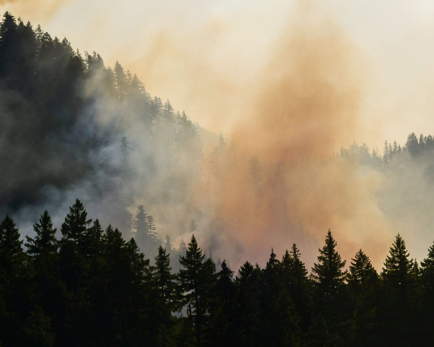
By Saturday night, flames from the forest fire were visible from the downtown area. The East Lewis County town is laden with thick smoke and all around Washington, several air quality alerts are in place. On Wednesday, The Seattle Times reported Seattle was experiencing some of the worst air quality in the world.
Wednesday was expected to be the last day of warm, fire-friendly weather, according to a news release from staff working on the Goat Rocks Fire. On Thursday, an onshore flow was set to bring cooler, more humid air into the region as a series of weather systems were forecast to bring rain and cooler temperatures starting Friday.
There are over 200 people working on the fire in east county, which was started by lightening in early August. There are several helicopters and fire engines in use and crews are patrolling neighborhoods several times per day.
One helicopter was able to drop water on the fire for a short period in the afternoon on Tuesday despite heavy smoke making flying difficult.
According to a news release, as the helicopter was returning to its base, a drone was spotted near the fire. Flying drones near wildfires is a violation of federal law.
“(Drone) incursions are very dangerous for aircraft working on the fire. Pilots may not see an (unmanned aerial system) in time to avoid a collision, which may damage an aircraft and possibly cause a crash. A UAS too close to a fire requires a shut-down of ALL aerial operations,” the release stated.
One Packwood resident told The Chronicle Sunday she felt “just so thankful for the firefighters.” She mentioned their consistent, friendly and cooperative presence in the community, which has been dealing with significant effects of the fire and its smoke since the blaze first engulfed hundreds of acres in early September.
Meanwhile, firefighters on the Kalama Fire south of Mount St. Helens continue to take advantage of minimal fire activity and are making progress on suppression, according to a news release from the U.S. Forest Service. The size of that fire remains at approximately 495 acres with containment at 37%. When aircraft at the Goat Rocks Fire were grounded during heavy smoke over the weekend, those teams were assisting with Kalama Fire efforts.
To get the most up to date information on evacuations throughout Lewis County, sign up for Lewis County Alerts at https://bit.ly/LewisCountyAlerts.
For more information on the Goat Rocks Fire, call 360-370-4168 between 8 a.m. and 7 p.m. or email 2022.GoatRocks@firenet.gov.


