
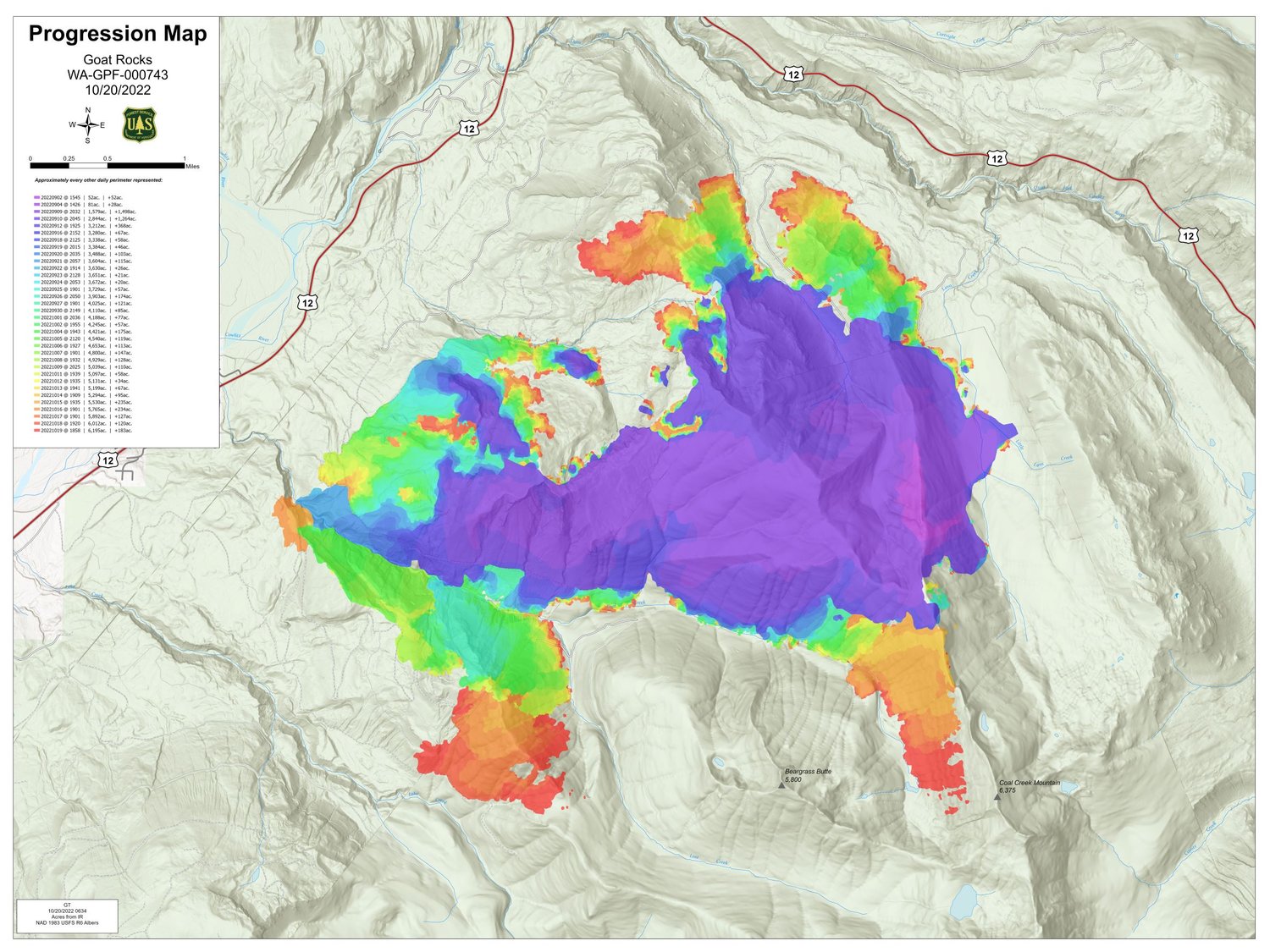

Crews battling the Goat Rocks Fire northeast of Packwood were able to improve containment of the blaze on Wednesday even as the fire grew to 6,196 acres in size, according to the latest update from the incident management team.
The fire, which was sparked by lightning in early August and began to grow rapidly Sept. 9, is now 4 percent contained as 223 people, five aircraft, 13 engines, three water tenders and one dozer are dedicated to battling it.
“The Goat Rocks Fire area continued to be impacted by smoke for much of the day with the Coal Creek and Lake Creek drainages seeing some of the densest smoke impacts,” according to the Thursday morning report from incident management. “Containment increased to 4% after extensive work along the ridge between the Coal Creek and Lake Creek drainages. Poor visibility continues to limit air operations over much of the fire area. A large Type 1 helicopter was able to drop water on the fire for a short period in the afternoon in the Lake Creek drainage.”
Heavy equipment was moved from the 46 road system to Forest Roads 1266 and 41 to start woody debris removal in that corridor, according to the update.
According to the U.S. Forest Service, fire activity has diminished over the northern section of the fire footprint over the past few days. Resources are patrolling the Forest Road 46 system, cooling fire by the roads. Engines are patrolling around the structures and testing pumps and hoses.
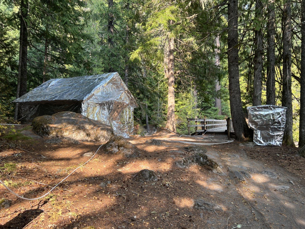
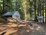
“Many of the firefighting resources have been moved to Division A, on the southwest side of the fire, to help increase contingency lines in the Lake Creek drainage.” according to the report. “Crews continue to engage the fire near the Three Peaks trail system where it is safe to do so with both water and handline. Due to steep terrain and heavy fuel loading, the fire is expected to continue to smolder in the thick duff layers, burning roots and large logs. Structures near Packwood Lake in the Lake Creek drainage have been prepared with fire resistant shielding and fuels have been removed to reduce the risk to the structures should fire move into that area.”
Thursday will be a weather transition day, according to the Forest Service.
“The first half of the day will continue to see the smoke inversion linger,” according to the update. “The inversion is expected to lift mid-day. The approaching weather system may bring erratic winds, with winds out of the southwest up to 25 mph on the ridge tops and winds of 4-8 mph with gusts up to 12 on the lower slopes. A series of storms will enter the area starting Friday bringing much needed precipitation to the fire area.”
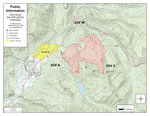
All areas north of Butter Creek remain at level two (be set) evacuation status. That includes Upper and Lower Timberline, Goat Rocks, Riverdance and parts of High Valley.
“This is precautionary due to Goat Rocks Fire behavior,” the Forest Service wrote. “Packwood proper is not under evacuation status at this time.”
For more information on the Goat Rocks Fire, visit https://inciweb.nwcg.gov/incident/8415/ or visit the Gifford Pinchot National Forest Facebook page at https://www.facebook.com/GiffordPinchot/.


