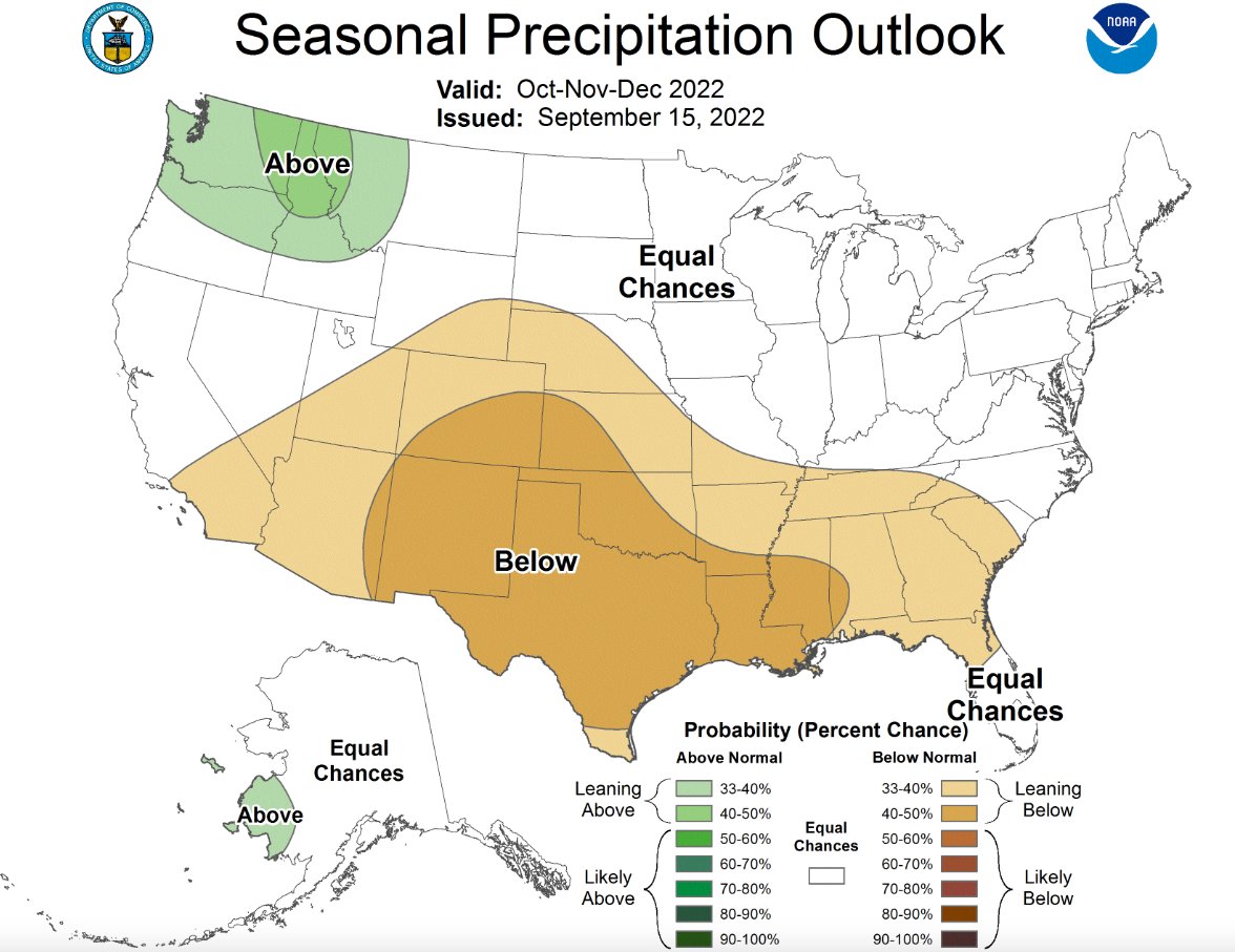
The Chehalis River Basin Flood Authority held a meeting Thursday morning to discuss a number of topics, including a National Oceanic and Atmospheric Administration (NOAA) forecast map that shows chances for above-average rainfall in the Pacific Northwest over the next few months.
David Curtis, warning systems technical consultant for WEST Consultants, explained what the forecast might mean for residents living in the basin.
“We’re still in a lingering La Niña for the third year in a row,” he said. “You all remember the heavy rain we got last year. Washington in particular got several episodes of heavy rain starting in the end of 2021 in the Chehalis Basin and right at the beginning of 2022. For the Chehalis Basin, it rained almost every single day from Oct. 1 to mid-January, so there’s a chance we might see something similar this year.”
While the forecast could be wrong, Curtis still urged residents who live in the flood basin to prepare for heavy rains.
Aside from the precipitation forecast, a number of different projects were discussed during the meeting as well, including upgrading the hydrometeorological monitoring equipment on the Chehalis River from Grand Mound to Grays Harbor in order to provide improved flood monitoring.
Current equipment doesn’t take into account the changing of the tides, which affect sensors as far inland as Porter.
“The current methodology that the National Weather Service River Forecast Center uses in that part of the river does not handle water trying to go downstream and trying to go upstream at the same time. So you have a flood that’s trying to come downstream that’s fighting against an incoming tide,” Curtis said.
Curtis added that he hoped to have the National Weather Service use the modeling it currently employs on the Columbia River on the Chehalis River.
China Creek in Centralia is getting a new water flow rate gage as soon as the equipment that was ordered arrives, and it will include a rating curve.
“We’ll be able to connect the dots between how deep the water is on this side of the structure. We can actually see and how much water is actually going through the structure coming out on the other side,” Curtis said.
One other issue Curtis brought to the flood authority’s attention was the climate change flooding risk facing the Grays Harbor area right now.
“Grays Harbor area, from a climate change and sea level rise perspective, is kind of a billion-dollar disaster waiting to happen. They’re going to be more impacted by sea level rise, by king tides and by severe storms that move in,” Curtis said.
Curtis recommended asking state legislators and the Office of the Chehalis Basin for guidance as to how to address that issue. The next Chehalis River Basin Flood Authority meeting will be held on Nov. 17 starting at 10 a.m. on Zoom.


