
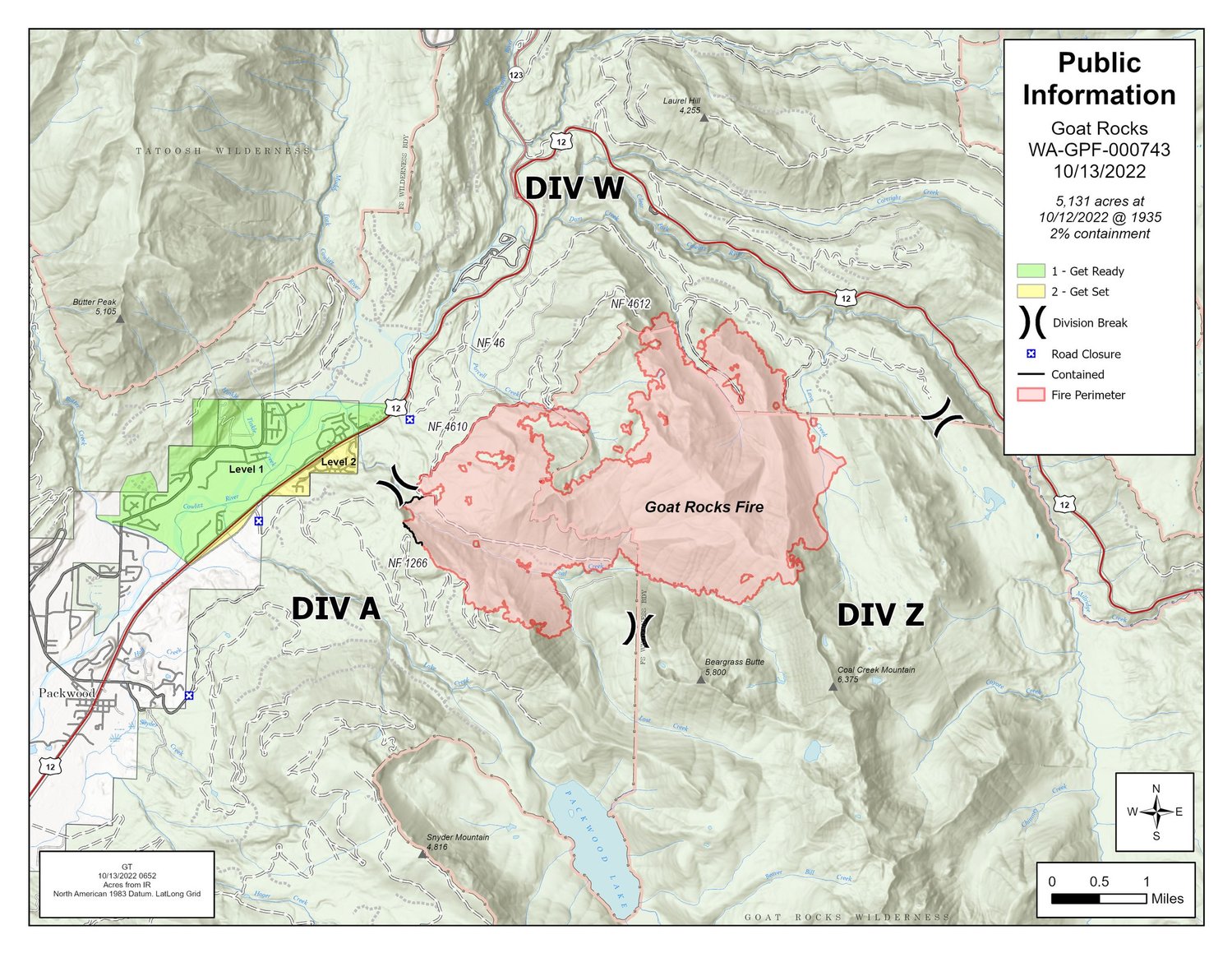
As the Goat Rocks Fire surpasses 5,000 acres in size, crews are successfully holding all control lines, according to a Thursday update from the U.S. Forest Service.
Burning in the Gifford Pinchot National Forest about a mile and a half northeast of Packwood, the fire was sparked in early August by lightning. It grew rapidly in early September, but no structures have been damaged and there have been no injuries or deaths.
“Fire activity remains light,” the Forest Service reported. “The fire is backing and flanking in most areas; some single-tree torching was observed yesterday. The western fingers of the fire continue to close in on one another, slowly consuming flammable vegetation.”
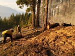
According to the latest update, crews are successfully holding all control lines. Firefighters are patrolling the communities closest to the fire and testing the hoses and pumps.
“The Smith River Hotshots are leveraging an area where fuels and terrain allow for safe control of the fire’s edge in the Coal Creek drainage,” the Forest Service wrote. “They are hard at work with hand tools and chain saws as they secure additional line directly adjacent to the fire. Air operations are still assisting to limit fire spread from the Coal Creek drainage.”
Hazardous fuels removal continues along Forest Road 1266, Forest Road 46, Forest Road 041 and the Three Peaks Trail system.
Temperatures were expected to be higher Thursday, with a high of 78 degrees. Humidity will be lower, hovering at 23%. Easterly, terrain-driven wind speeds will average 6 mph with gusts up to 13 mph.
The Packwood Fire Department will be hosting a Firewise USA information session at 6 p.m. Friday. The Goat Rocks Fire Incident Management Organization will provide a brief update on the fire at the event.
According to the Forest Service, the fire has burned 5,131 acres and is 2 percent contained. There are 200 people fighting the fire. There are three crews, six aircraft, five engines, four water tenders and one bulldozer being used to battle the blaze.
Evacuation levels remain the same, with areas northeast of Butter Creek, including the Goat Rocks and Lower Timberline areas, are still in level one (be ready) while the Upper Timberline remains at evacuation level two (be set).


