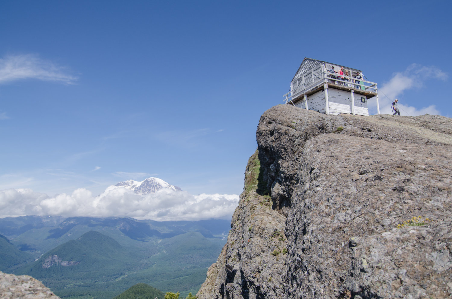
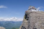
On a clear day, breathtaking views of Mount Rainier can be had at the High Rock Fire Lookout tower.
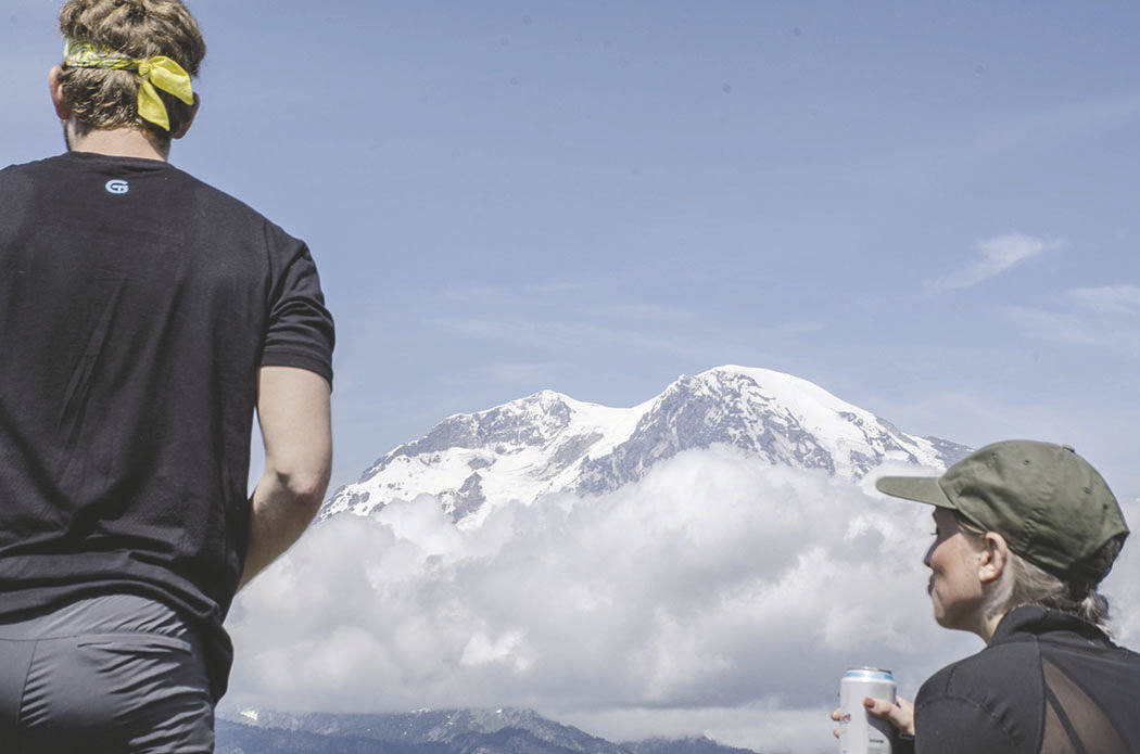
Hikers take a moment to reflect on the beauty of Mount Rainier during a break in the clouds Saturday, June 22.
While the glacial till does provide for a good grip going up to the lookout, be cautious of the inline.
While narrow at some points, the trail leading up to the High Rock lookout provides exquisite views of “The Mountain” and the valleys which surround it.
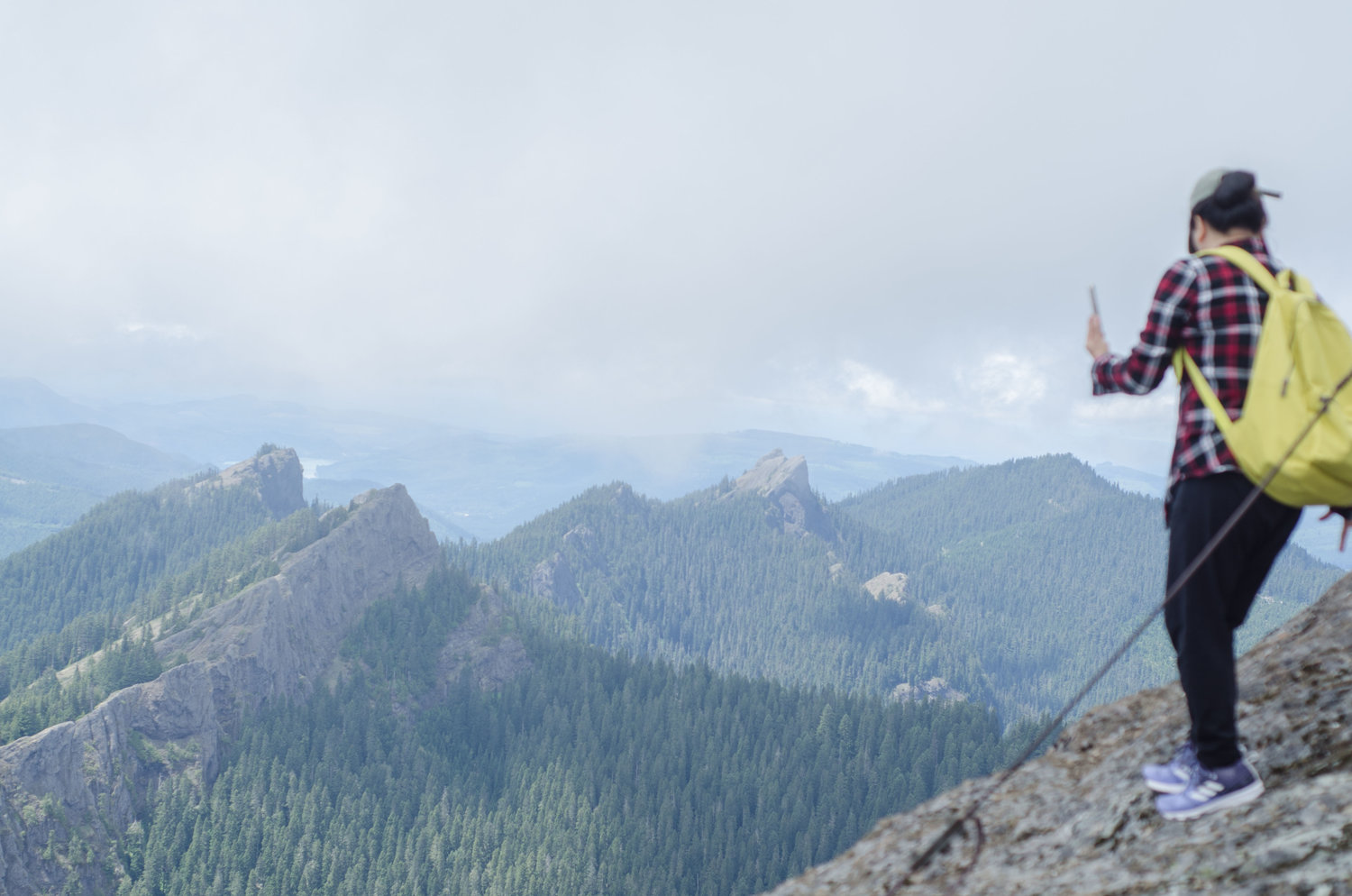
Jagged pillars reach high above the valleys carved out by Mount Rainier’s glaciers. The trail up to the High Rock Fire Lookout follows 1.6 miles along Sawtooth Ridge.


(Editor’s Note: The reporter traveled to High Rock Lookout from Yelm. For directions from Lewis County, see the sidebar to this story)
Mountain, mountain in the sky, what trail is most worthy of a one and a half hour drive?
If you’re an avid hiker of the southern Cascades, your list of answers is probably long and exhaustive; there are countless “viewtiful” hiking spots in the 236,000-acre national park. But no place better gets the hearts pumping and the glutes burning quite like the High Rock Lookout trail.
With expansive views of Mount Rainier, the Nisqually River and surrounding jagged pillars of Sawtooth Ridge, the dramatic and steep 1.6-mile hike up to the High Rock fire lookout is well worth the drive and effort you’ll put in on the trail and on the road. And despite its steep incline, it’s also a great location to bring family and friends for a weekend getaway.
We decided to make the excursion out there Saturday, June 22, with hopes that the cloudy weather would part and we’d get a somewhat decent view of Rainier in the afternoon, as is sometimes typical with Puget Sound weather. This was my first time driving out this far east on state Route 706 (I tend to frequent Morton Pass as my preferred route over), but I was excited to see the rolling hills and Nisqually Valley transform into towering mountains. And I must admit that the drive out there also helped me add some activities to my summer bucket list.
Before our exchange onto state Route 706, I was mystified by the beauty of Alder Lake’s ravishing emerald tinge. It was a welcome distraction from the monotony that comes with a half-day long excursion from Yelm. The quaint railroad charm of Elbe was also a welcome sight to behold (a note to myself that I must stop in town one day and experience the locomotive-themed businesses).
As we made the turn onto Forest Road 52, and subsequently a bridge across the Nisqually River, county roads soon transformed into gravelly forest service roads, and before we knew it, we were at the trailhead atop Towhead Gap — a modest 4,320 feet above sea level.
Eager for the hike, we barreled out of the car, snapped a few photos of the clouds as they began burning off from the nearby hills and hit the trailhead.
Despite the information it offers, the trailhead is low in resources, and it needs to be noted that there are no restrooms within close proximity to this trailhead.
As you peruse before the trek, hikers can learn about the High Rock fire lookout restoration project, planned Forest Service repairs and other restoration projects.
The High Rock tower was constructed in 1929, according to Park Service documents, and was manned until 2005. It is among only a handful of fire lookouts that still remain to this day.
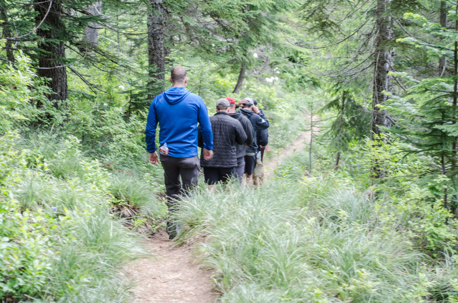
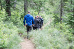
Our heads filled with a healthy dose of knowledge, we hit the trail. Starting out the first half-mile, the trail is fairly narrow with a meager incline. Pines and dirt cover the glacial till that makes up a good majority of the ridge. On dry days, tennis shoes should be adequate for the 1,365-foot incline.
As the trees become denser, you tend to forget that you’re hiking up a narrow ridge thousands of feet above two narrow valleys. And as the incline steepens, you’re aided by the walking-step tree roots provided by the towering trees.
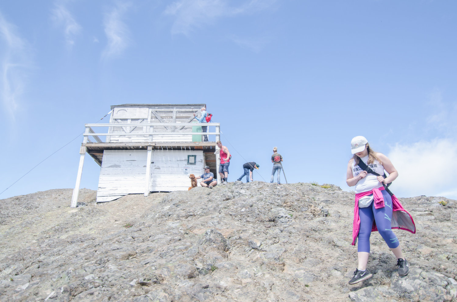
Being a fairly popular trail (there were somewhere close to two dozen cars parked alongside the parking lot), I would suggest getting used to the frequent sounds of passersby. I also noted that there was no shortage of litter left along the trail; along my journey, I found a coffee cup, a couple beer cans and a baseball hat. With that being said, here’s a reminder: pack it in, pack it out — especially for a 3-mile round-trip hike.
Once you finish out three-fourths of the first mile, you’ll start noticing the steepening incline of the trail. Take your time and note the multiple benches parked along the trail. Around a mile in, you’ll also take note of your first glimpse of Mount Rainier, as well as an overlook of Cora Lake.
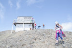
Just another half-mile of steep inclines, and a couple switchbacks, and you’re facing the exposed rock that leads up to the fire lookout. If you’re vertigo-prone or lacking proper hydration, I would suggest not perusing too close to the cliff’s edge — one misstep can lead to a 500-foot drop.
Wonderful views of Mount Rainier can be taken in by walking up from the fire lookout and onto the tippy top of High Rock. As the clouds meandered on by, I found myself gazing endlessly at the ever-shifting shapes and angles of “The Mountain.” The clouds never revealed Rainier fully, which was tantalizing enough. But grab some water, eat a snack and enjoy the expansive views. It’s too bad this lookout isn’t manned anymore, because if it was I’d be the first one in line to apply for that job.
•••
Eric Rosane is a reporter with Nisqually Valley News and a local hiking enthusiast. For story ideas on hikes off the beaten path, contact him at erosane@yelmonline.com.


