


Damage assessments reported to Lewis County Emergency Management so far show that at least 120 individual homes and structures have been damaged from historic flooding that inundated the Chehalis River Basin earlier this month.
Ross McDowell, deputy director of Lewis County Emergency Management, said estimated structural and personal losses have so far surpassed $2 million, with an expectation that figure will continue to slowly rise.
He said officials believe they’ve tallied the worst of the damage, though more reports continue to be submitted every day.
“I believe there could be more people out there who have had a loss on their houses who we have not heard from. Five to 10 come in a day, so we’re hoping to get the last of the curve,” McDowell told The Chronicle this week.
Homeowners have until the end of the month to report their damage to Emergency Management and file an individual damage assessment. More information on that can be found by contacting the department at 360-740-2600.
The county is hoping to receive a FEMA disaster declaration from President Joe Biden, though cumulative damage sustained from the flood must meet a certain threshold.
McDowell said officials are still working with about 60 individuals who cannot return to their homes yet due to flooding and are currently displaced. Lewis County is currently renting out about 18 hotels for these individuals, and much of the effort is being funded through donations, which can be made to United Way of Lewis County at www.lewiscountyuw.com.
Cleanup efforts — prominent in the days and weeks following the rise of local rivers from warm rain and lowland snow — have largely concluded.
Compared to floods of recent memory, this latest event has caused minimal amounts of damage.
J. Vander Stoep, a member of the Chehalis Basin Board, said a state commissioned study showed following the devastating 2007 flood — which closed I-5 for multiple days — there was roughly $930 million in damage.
Reflecting on the 2022 Flood
Officials have reached the general consensus that, when it comes to the flood of 2022 — on par in some ways with the devastating floods of 2007 and 1996 — the Chehalis Basin was lucky.
Peak flow on the main stem of the Chehalis River this year hit a high of 34,600 cubic feet per second — a relatively smaller number compared to the 49,000 cubic feet seen during the 1996 flood.
Vander Stoep said the difference between the ‘96 and ‘22 floods is roughly 9.6 billion gallons of water flowing through the Chehalis main stem every day.
“You still have a big flood, you still have damage, but you don’t have anywhere near as close the damage had the main stem been full,” Vander Stoep told The Chronicle this week.
There was more than enough water to cause the type of devastation seen in 1996 and in 2007, but because the Chehalis River was lower than it was during previous major flooding events, it was able to take on water from the overflowing Newuakum and Skookumchuck rivers and further drain out the Chehalis Basin.
Peak flow measured on the Skookumchuck near Bucoda and the Newaukum near Chehalis was roughly the same in 1996, 2007 and 2022, but the peak flow measured on the Chehalis River near Grand Mound in 2022 was just 44.6 cubic feet of water per second (CFS), compared to 79.1 in 2007 and 74.8 in 1999, according to data from the Chehalis Basin Flood Authority.
“That’s really important because you can visualize this water flowing down from above, it's flowing through our communities, and then it goes all the way on down through Grand Mound and on down out towards the harbor. If that system is all filled up and that CFS is up super high, like in the ‘96 or 2007 event, then water is going to back up in the Twin Cities, it's not going to evacuate out. So what you’re seeing here is you didn’t have the devastation you had in ‘96 and 2007 is a function of water being able to evacuate out in a metered way down the Chehalis, the Chehalis was low enough that it could take that water,” said Scott Boettcher of the Chehalis River Basin Flood Authority at Monday’s Chehalis City Council meeting.
Renewed Discussion Surrounding Flood Dam
Vander Stoep said he believes this flood — among the worst seen in more than a decade — has reinvigorated discussion surrounding a flood retention dam along the Chehalis River that would be located near the town of Pe Ell.
The dam would prevent “catastrophic” flooding along the middle stem of the Chehalis River. Similar 100-year floods, such as the one in 1996, would be reduced to a flood the size of the 2022 flood, perhaps smaller.
As the dam undergoes state and federal environmental reviews, concerns of its impact to fish and aquatic species populations have been raised, though members of the Chehalis River Basin Flood Control Zone District have committed that mitigation efforts would reduce the impact to nearly zero.
A Local Action Non-Dam Alternative (LAND) Committee was commissioned this last year to look at non-dam alternatives to prevent catastrophic flooding in the Chehalis Basin as the dam studies continue on. Though still in its infancy, that group has begun meeting and will begin finalizing recommendations to the Chehalis Basin Board and the Office of Chehalis Basin this coming summer.
Pro-dam members of the Flood Control Zone District at a meeting earlier this month voiced skepticism of the LAND process and the intent of its members.
“One thing that I see is there are some people on the committee that are going to be mightily tempted to just pursue fish habitat policies and no people policies in the valleys. And that’s because they quite possibly don’t see a valley being full without pulling people out of the valley,” said Dan Maughan, LAND Committee member, at a Flood Control Zone District meeting.
“That’s, in my book, a non-starter, and it’s going to be interesting to see just how far they push their thought process there,” he continued.
Erik Martin, manager of the Flood Control Zone District, said he would like to see the LAND Committee measure their alternatives up side by side, functionally, to the dam and levee projects.
“Compare ‘em side-by-side. How does it stack up with damage? How does it stack up with flood levels? How does it stack up with flows?” Martin said, adding later: “If they can do that, and they can line those numbers up side by side, then I think the public and the board can make a real choice about what alternatives are out there. If they want to come back with something that conflates all that or confuses that, it’s going to be hard to compare the two.”
Alternative Flood Storage Solutions
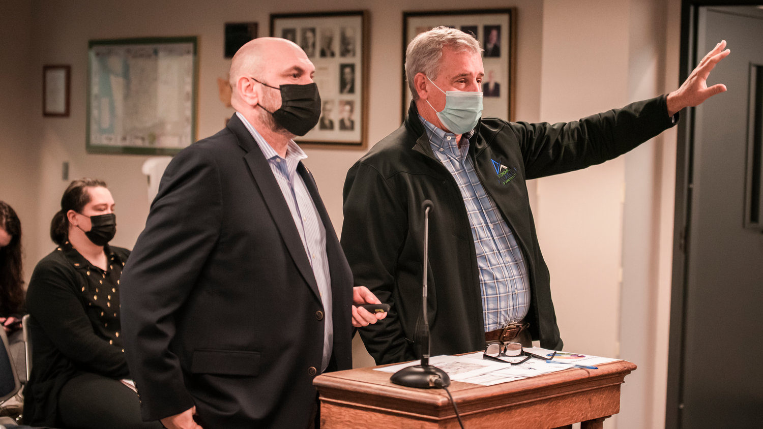
The City of Chehalis is considering the possibility of creating a flood storage facility along the Chehalis River near the Chehalis wastewater treatment plant, but preliminary designs from engineering consulting firm Skillings, Inc., show that it may not be possible to have one flood storage facility that reduces the negative impact of flooding during both major and minor flood events.
“Because of the geometry of the channel and the sinuosity of the channels that we have here and the constraints of the community that’s encroached … we only have so many places that we can put the water,” said Skillings Vice President Patrick Skillings, who presented alongside Skillings Design Engineer Anthony Guerrero at a Chehalis City Council meeting on Monday.
Skillings and Guerrero focused their presentation on two designs: the initial design Skillings came up with in 2019, which is predicted to reduce flooding by just under 1 foot both upstream and downstream of the project site during a major flood but could increase flood levels downstream by up to 0.2 feet during a smaller flood event; and the most-recent design, which would reduce flooding both upstream and downstream of the project site during minor flood events but would have no effect on downstream flooding during a major flood event.
The primary reason why the company hasn’t been able to develop a design that reduces the negative impacts of both a major and a minor flood, Skillings said, is because there are limited spaces outside the natural floodplain to store water.
“Storing water in the floodplain, that becomes the floodway which is where the current is moving in the flooded area, (which) gets problematic because we’re pretty constrained in here,” he said.
The best option in the long run, Skillings said, would be to move people out of the floodplain and allow the river to overflow its banks during minor flooding events.
“When we talk about flooding it’s always ‘flooding is bad,’ but really in a 2-year event in a natural system, you need flooding to maintain those wetlands and to actually protect the stream channel because that’s when you get those flows coming down, as it can get out of its bank and create a wider cross section, your water slows down and it doesn’t destroy the channel,” he said.
The tricky task going forward is developing a flood storage solution that can maintain wetlands and improve habitat yet not negatively impact people and infrastructure, he said.
Whatever that solution is, Mayor Tony Ketchum was adamant it could not increase flooding downstream of Chehalis.
“If we impact anyone downstream, no matter what we do, we’re not going to get a project approved by anybody,” he said.
Skillings was tasked with refining its designs and coming back to the city council at a later date.
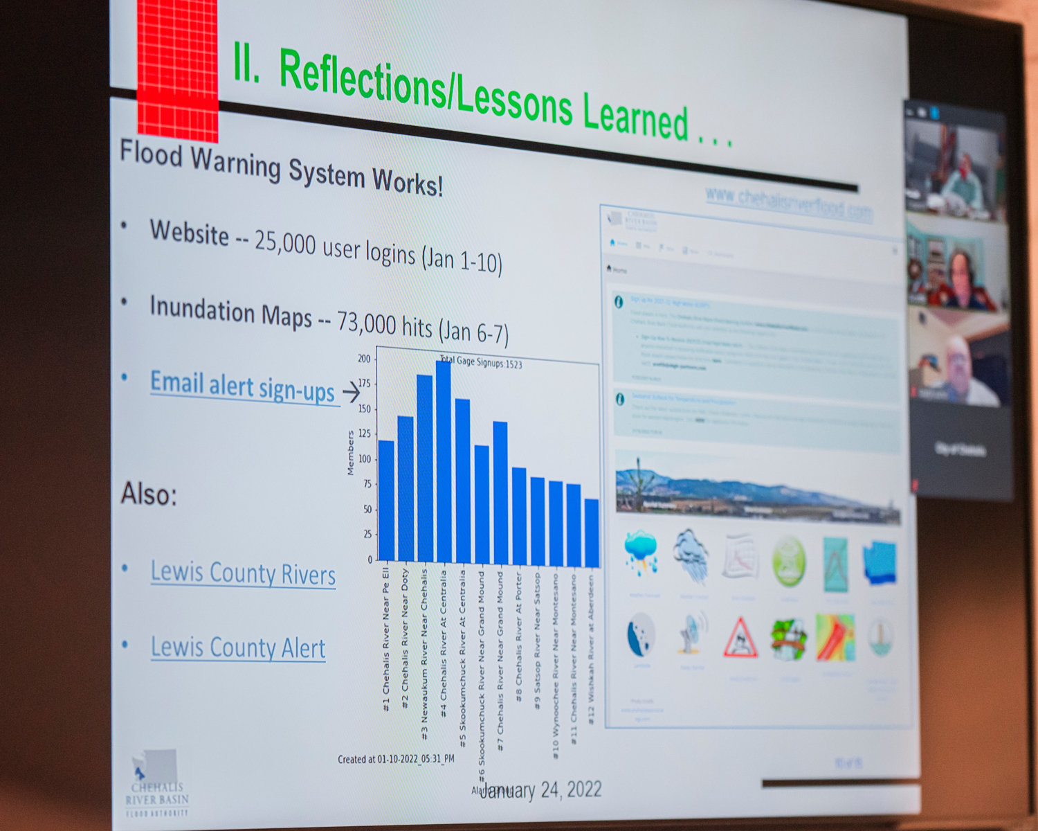
New Resources Mitigate Damage — And Loss of Life
Social media and the quick spread of information was a prominent factor in mitigating flood damage, said Edna Fund of the Chehalis River Basin Flood Authority and an Office of Chehalis Basin voting member, who presented to the Chehalis City Council alongside Boettcher on Monday.
“When we had the flood in 2007 and the one in 2009, one of my friends said, ‘When I look at your webpage and when you’re stopping posting about casseroles, I know we’re having a flood,’ so we’re beyond that now, it's pretty amazing how we can reach people,” said Fund.
The week of the flood, the Flood Authority had 25,000 unique logins to its website for flood information. During the peak of the flood on Jan. 6 and Jan. 7, the Flood Authority tracked 72,000 hits to the flood inundation maps on its website.
The majority of those came from posts made by The Chronicle and the Washington Emergency Management Division that were shared on social media, Boettcher said.
“Social media really works, I mean we have traditional ways of doing things and the social media route and the sharing of information … really is the superior way and it reaches the largest number of people,” he said.
The Flood Authority’s gauge alert system, which sends automated alerts when river levels gauge one to two feet below flood stage, was pushing 15,000 unique signups by late January, said Boettcher.
“Some of those people are front-desk people at hotels or nursing homes, hospitals, who in turn get a message and carry it on further into their own networks, so we feel that the flood warning system is occupying an important niche here in that it's giving people the opportunity to have early information.”
The alarm is purposefully set a few feet below flood stage, Boettcher said, “and that gives people the time they need so they can proactively respond to a impending threat as opposed to waiting until we’re at crisis and then people have to reactively respond to that, leaving them little time.”


