.JPG)

.JPG)
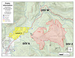

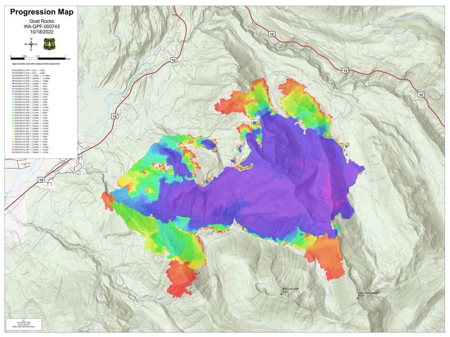
All areas north of Butter Creek, including Upper and Lower Timberline, Goat Rocks, Riverdance and parts of High Valley, remained at level two (be set) evacuation status Tuesday as a precaution due to concerning behavior from the Goat Rocks Fire, according to an update from the U.S. Forest Service.
Packwood proper was not under evacuation status as of Tuesday morning.
A smoke inversion lingered over the Goat Rocks Fire for most of Monday, restricting aerial operations but keeping temperatures down and relative humidity up at lower elevations, according to incident management.
Above the inversion, however, temperatures were warmer and relative humidity dropped into the 20% to 30% range. These conditions allowed for active fire growth, including on steep slopes below Three Peaks toward Lake Creek. To the north, fire continued to burn in the Dam Creek drainage to Forest Road 46, where engine crews kept it south of the road.
The fire continued to creep around in the Coal Creek drainage Monday, but did not move closer to structures near U.S. Highway 12. Crews and other resources worked to get new containment lines around this part of the fire.
A hotshot crew planned Tuesday to scout in the Lake Creek drainage, where burning debris rolling down steep slopes and igniting fuels is spreading the fire. Helicopters plan to drop water on this area to slow fire spread if conditions allow, according to a Tuesday update from the incident management team.
Some of these slopes are covered by stands of younger conifer trees, where water dropped by helicopters has a better chance of getting past the trees canopies and reaching the fuels on the ground, according to the forest service.
Since they were unable to fly on the Goat Rocks Fire on Monday due to the smoke inversion, helicopters assisted the Kalama Fire and other fires on the Gifford Pinchot National Forest, according to the forest service.
In a Tuesday morning update, incident management said they expected weather similar to Monday’s to continue Tuesday, with slightly lower relative humidity. The fire was expected to be more active at higher elevations due to warmer and drier conditions above the inversion. Temperatures and winds are forecasted to be moderate. Warm, dry weather is expected the next few days before a cold front is predicted to bring showers late this week, according to the forest service.
On Tuesday, crews planned to reinforce containment lines and cool the fire’s edge in the lower part of Coal Creek, with engines patrolling neighborhoods to the west, according to the forest service.
Crews were expected to complete removal of woody debris along Forest Road 46 on the north edge of the fire Tuesday. Engine crews were in place to cool the fire Tuesday if it reaches Forest Road 46.
To monitor changes to evacuation statuses, visit https://bit.ly/LewisCountyAlerts or https://bit.ly/LewisCountyEMFB.


