

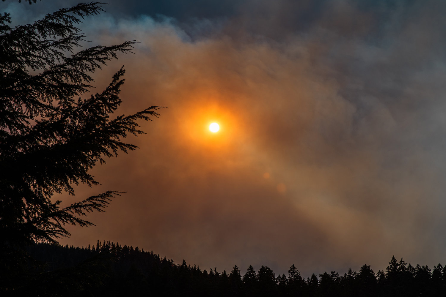


Existing wildfires in the Cascades grew and new blazes were sparked during a weekend marked by a Red Flag Warning brought by unseasonably warm temperatures, gusty winds and very low relative humidity.
According to a Clark Regional Emergency Services Agency statement, there are now 10 large fires burning in Western Washington from the Canadian border all the way down to the Columbia River, five of which started Sunday.
Some of the more dangerous fires included the Nakia Creek Fire near Camas, the Loch Katrine fire east of Seattle, the 8 Road Fire near Elbe and the Bolt Creek Fire near Skykomish, according to reporting by The Seattle Times.
About 2,900 homes are under level three (leave now) evacuation orders with an additional 4,000 homes and businesses under less severe evacuation notices as of Sunday night after the Nakia Creek Fire grew from 156 acres to 1,565 acres.
Additionally, the Loch Katrine Fire expanded to more than 2,000 acres and the 8 Road Fire was at an estimated 150 acres on Sunday.
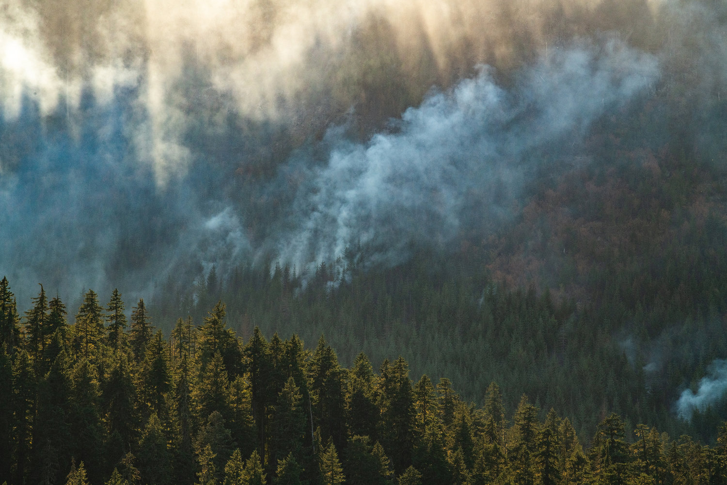
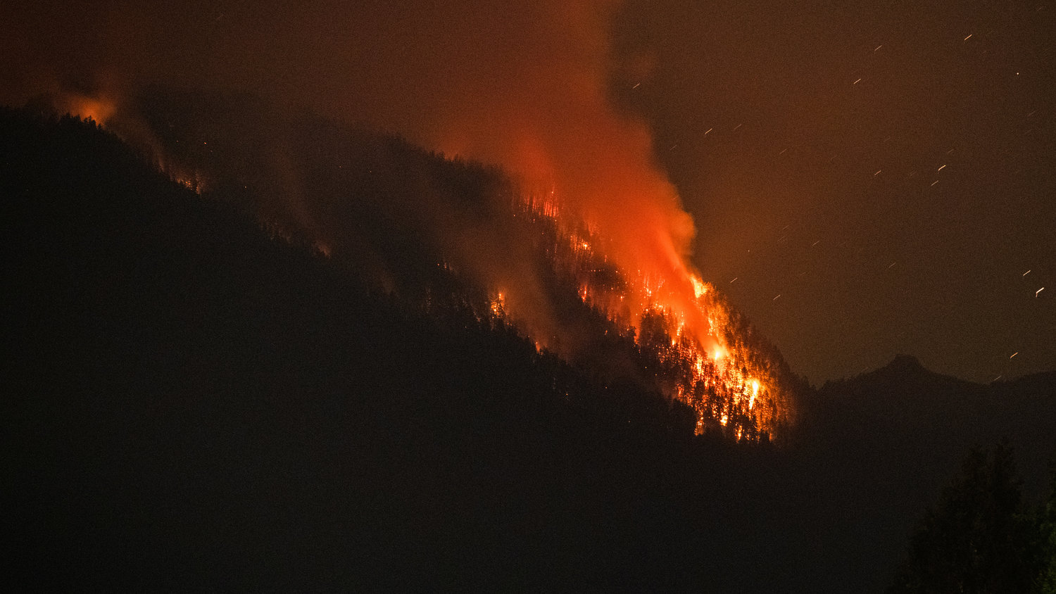
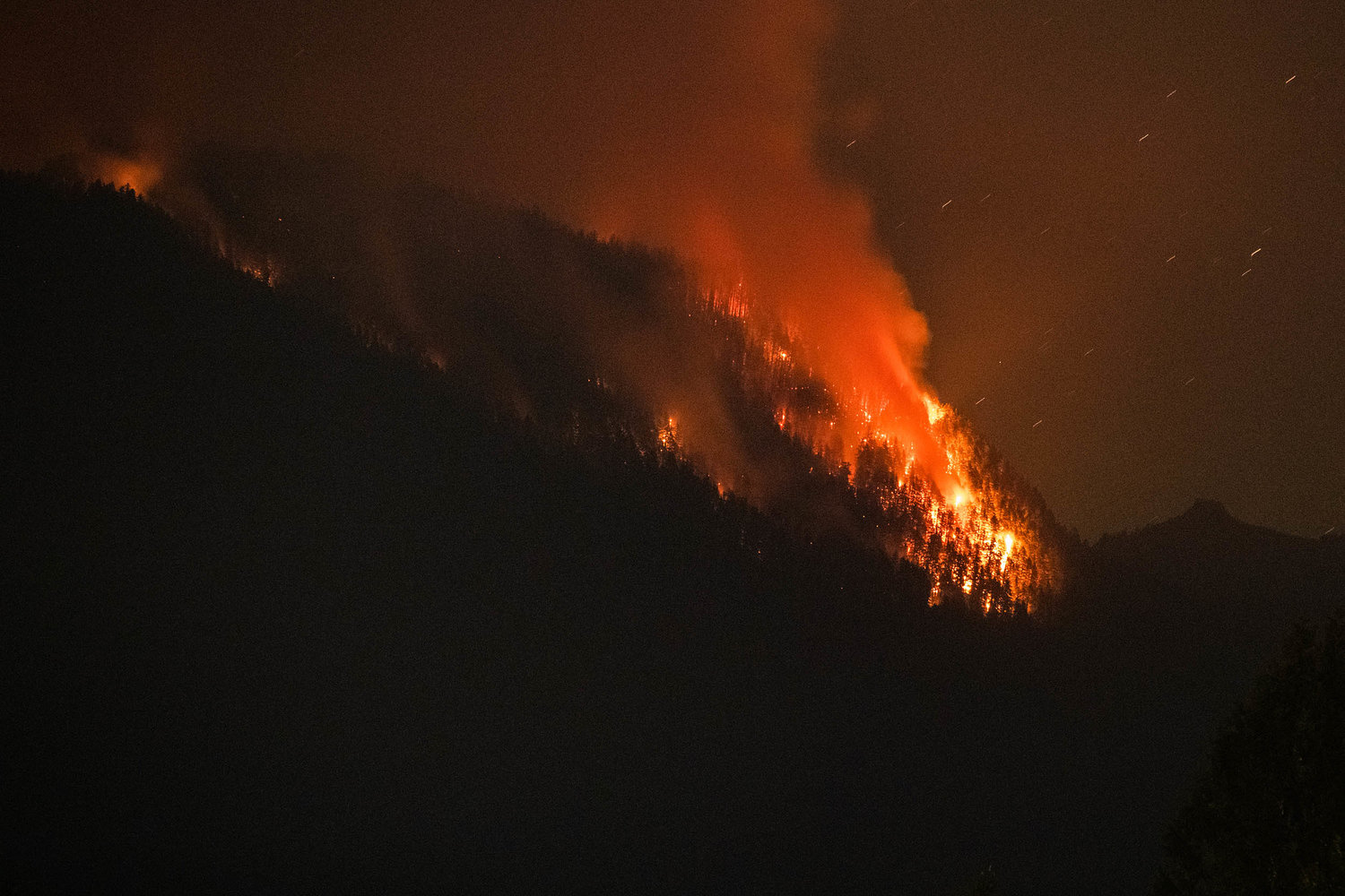
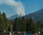
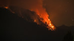
As for Lewis County, the Goat Rocks Fire saw a lot of active burning on Sunday as well. Areas north of Butter Creek are now at evacuation level two (be set). Goat Rocks, River Dance, parts of the High Valley and both Upper and Lower Timberline areas are included.
Packwood proper was not under evacuation status as of Monday afternoon.
Lewis County Emergency Management Deputy Director Ross McDowell explained the move to change the evacuation levels all to “be set” was precautionary due to the unseasonably dry conditions persisting in the area.
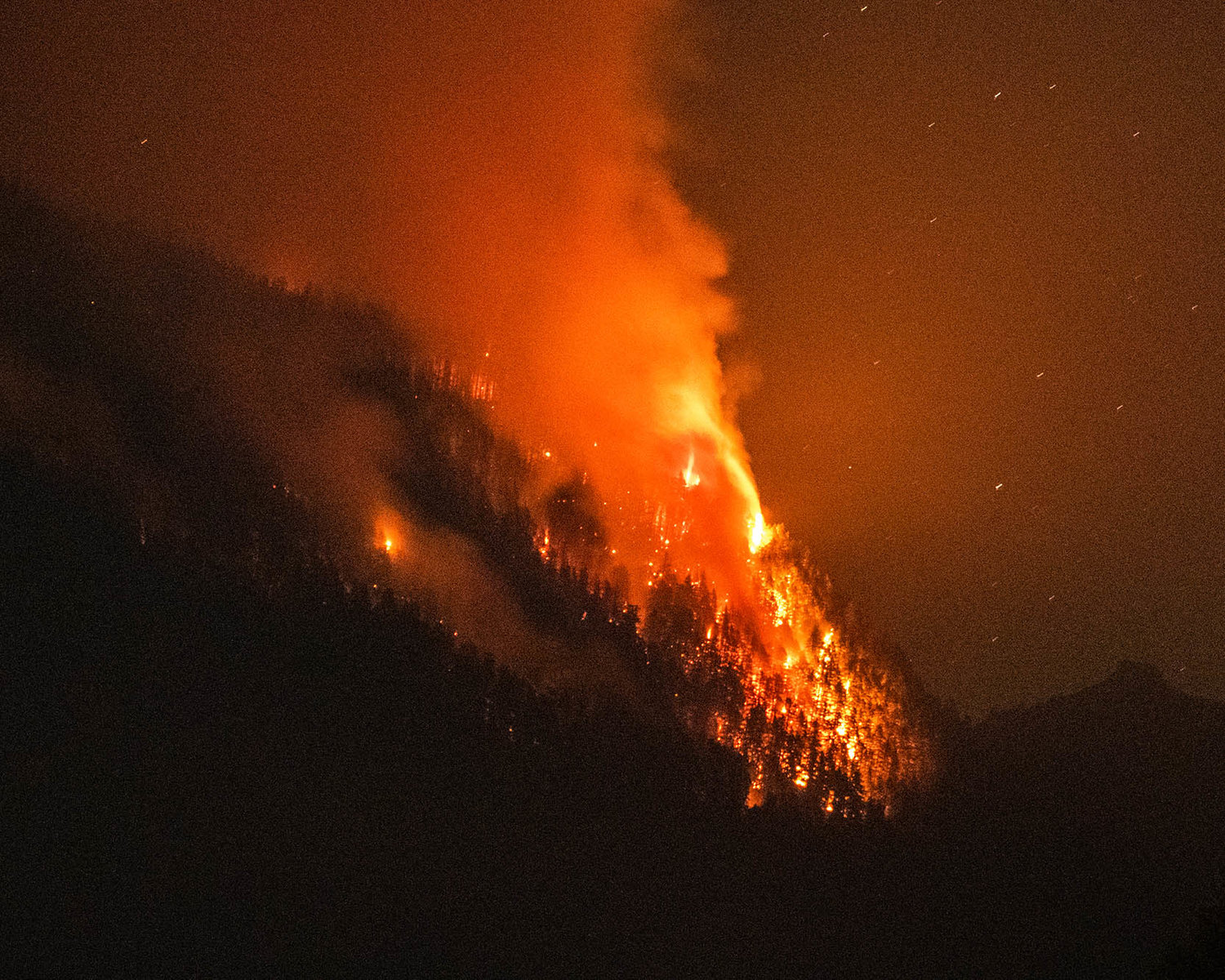
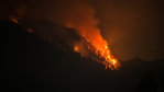
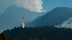
The fire was expected to burn actively again on Monday. At last report, the blaze had burned 5,765 acres. It was sparked by lightning in early August but didn’t spread significantly until early September.
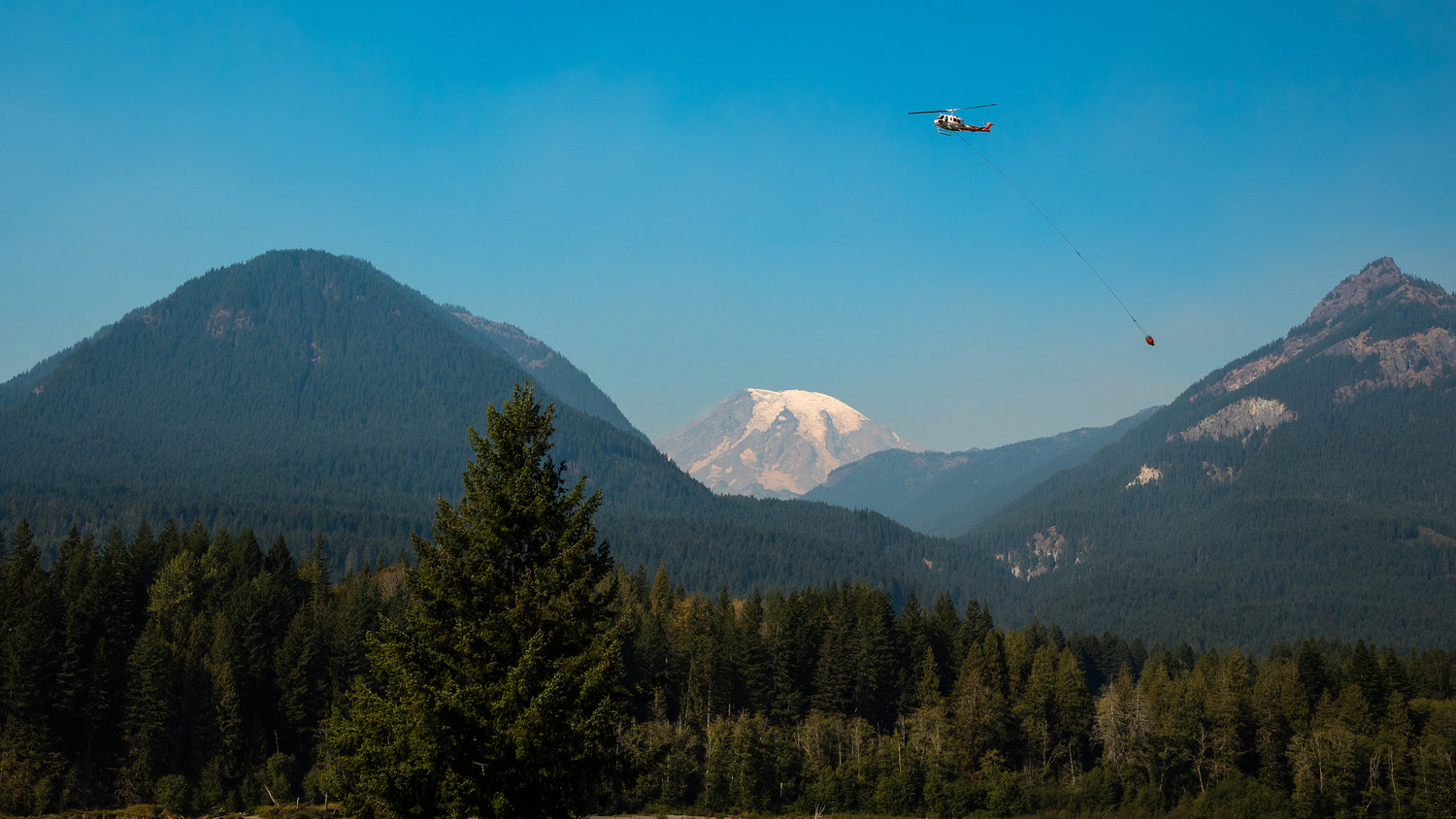
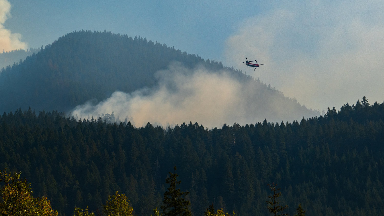
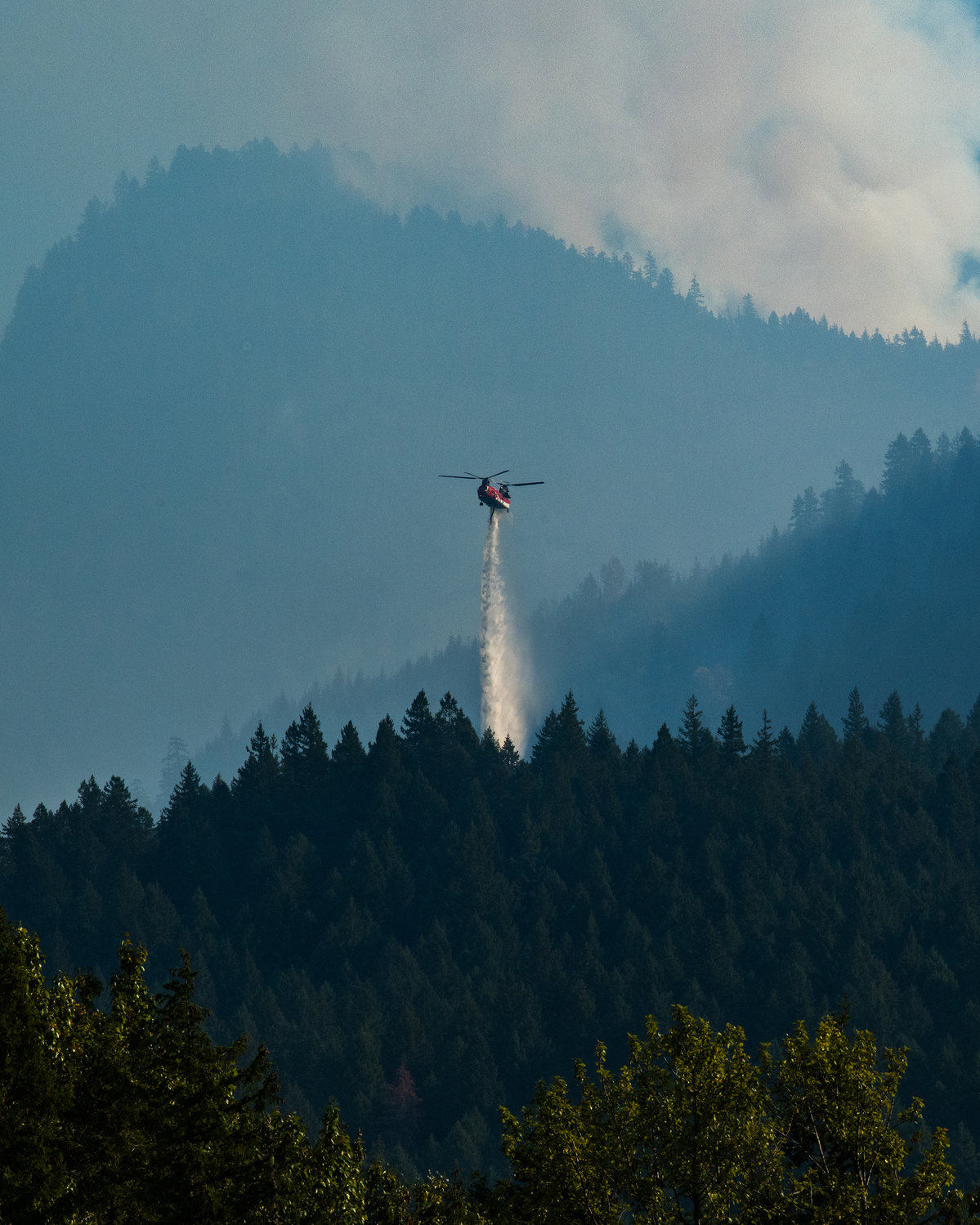
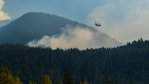
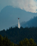
There are 162 people, five aircraft, nine engines, four water tenders and one dozer currently being utilized in the fight against the fire. Containment was estimated at 2 percent as of Monday morning.
“Right now, the fire is in an area where there’s a ridge that it can run that would lead it directly to that area (north of Butter Creek). We want to make sure everybody is ready,” McDowell said.
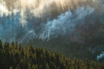
Firefighting crews are still patrolling neighborhoods in the area and are focusing their efforts on preventing the fire from spreading further west in the Coal Creek drainage. Helicopter crews will be performing water drops as needed to slow the fire’s spread.
Additionally, the crews have almost completed removing wood debris along Forest Road 46 as engine crews prepare to fight the fire as it reaches the forest road. Debris removal is expected to be completed on Monday or Tuesday.
While a cold front is predicted to roll in later this week and bring rain, dryer conditions are expected to remain for now with humidity predicted to drop to 25% Monday afternoon. McDowell added that heavy rain is what crews really need to start beating the fire back.
“We don’t just need one or two days (of rain), we need quite some time of rain, even to the point where maybe we’re looking at possibly some of the snow,” McDowell told The Chronicle.
The sooner the rain starts, the better for crews fighting the fire still, but according to the forecasts, rain isn’t expected to start until the cold front hits, which is expected to occur on Friday.
McDowell cautioned that while rain is needed to help end the fire season, the flooding risk will return with the rainfall and residents must remain vigilant.
“We want to have people remember what happened last year (with flooding). We really don’t want to have a repeat of that, so there are a few things you can do to help yourself to keep some of your property from floating away,” McDowell said.
He urged residents to pay attention to weather conditions.
“Rain is a double edged sword. It’s great for (fire crews) out there because it’s gonna put a stop to the fires, but then what’s it gonna do here on the west end, we’ll start in with the flooding,” McDowell added.
Closures due to the fire can be viewed online at https://bit.ly/GoatRocksFireClosureMap.
Updates on the Goat Rocks Fire can be viewed online at https://inciweb.nwcg.gov/incident/8415.


