The Goat Rocks Fire northeast of Packwood has seen recent growth along Coal Creek. On Friday morning, the blaze was reportedly one half mile away from the Upper Timberline neighborhood.
After about two weeks of more than 200 firefighters working the project, fire protection lines are around 85% complete in the neighborhood and the process of moving fuel from nearby structures is finished. Despite the fire now reaching 3,632 acres, these efforts should ensure the highest priority of the crews — human safety.
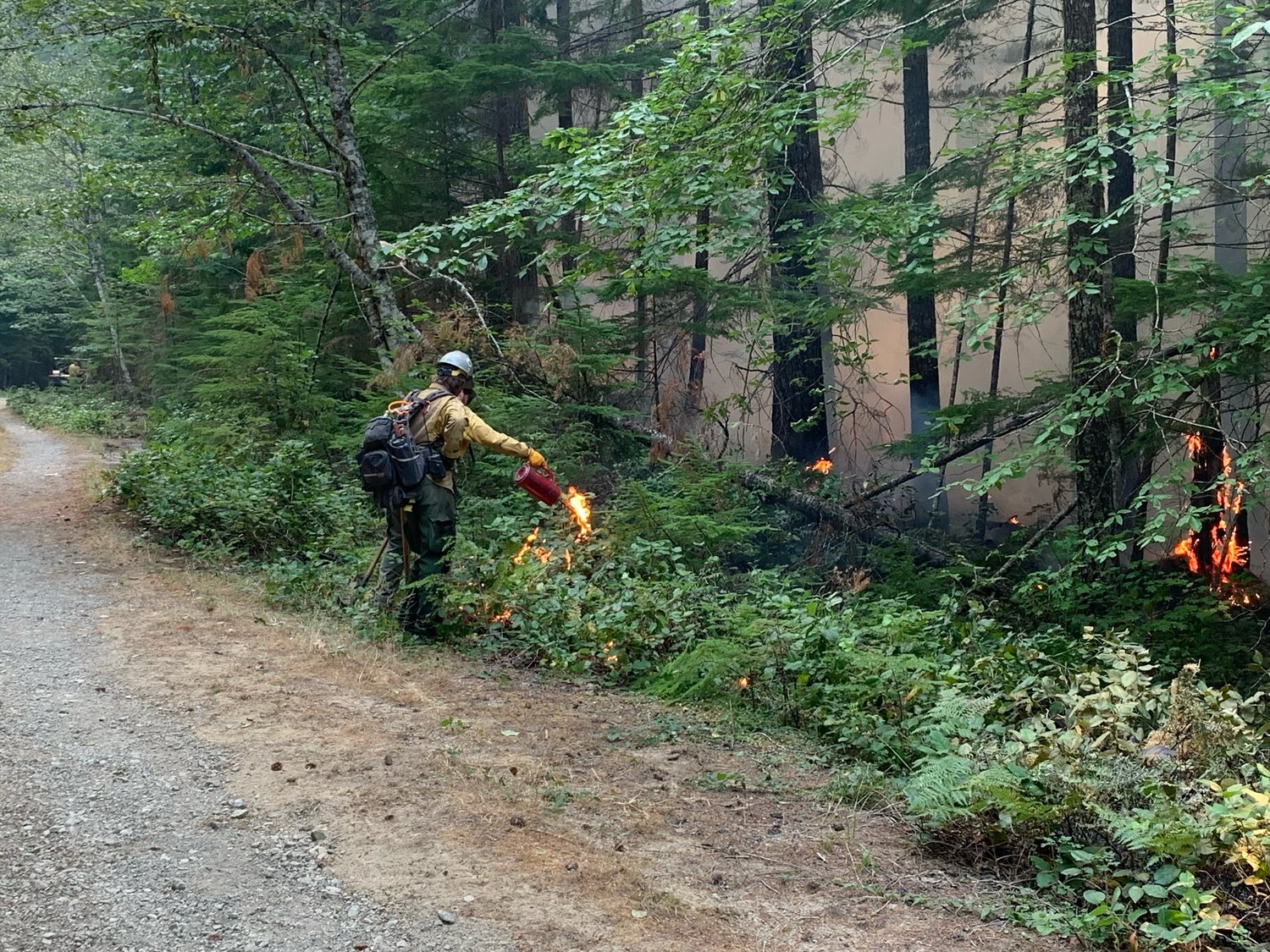
Burning operations on the non-civilized end of the fire are taking place. According to a spokesperson with the Gifford Pinchot National Forest, firefighters are still looking to several weeks out for the blaze to be fully extinguished. It is 0% contained.
A daily news release from the Forest Service stated: “The percent of containment on a fire is one measure of progress, but not the only one. Completion of firefighting objectives is another measure of progress. These objectives include construction of control lines and protecting highly valued resources such as the Packwood community, sensitive tribal resources and historic structures at Packwood Lake.”
Neighborhoods northeast of Butter Creek and in Lower Timberline and Goat Rocks are still at evacuation level one, “be ready.” The Upper Timberline area remains at level two, “be set.”
According to James Donahey with the Cowlitz Valley Ranger District, some stands in the forest fire’s track contain trees that are over 600 years old.
Through oral history, record-keeping and determining the age of the majority of the trees, Forest Service staff have determined the area hasn’t burned since the 1400s.
“Back in the day, they would say, ‘OK, all these trees are approximately the same height, similar composition on a similar kind of slope feature. We're going to call that a stand,’” Donahey said. “They would then go out and measure the trees in that stand, core some, determine the age of those trees. And you can kind of piece together a very visual representation of that fire history based on the ages of the trees within those stands.”
To receive alerts from Lewis County in the case of an emergency, people can sign up at
https://lewiscountywa.gov/departments/emergency-management/lewis-county-alert/.
For information on current road and trail closures, visit https://www.fs.usda.gov/Internet/FSE_DOCUMENTS/fseprd1060181.pdf


