
Mount Rainier seems as ready for the coming fall weather as the rest of us. In the last week, the mountain donned a powdery-fresh layer of snow.
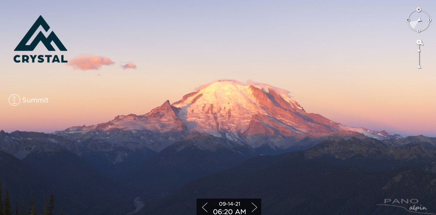
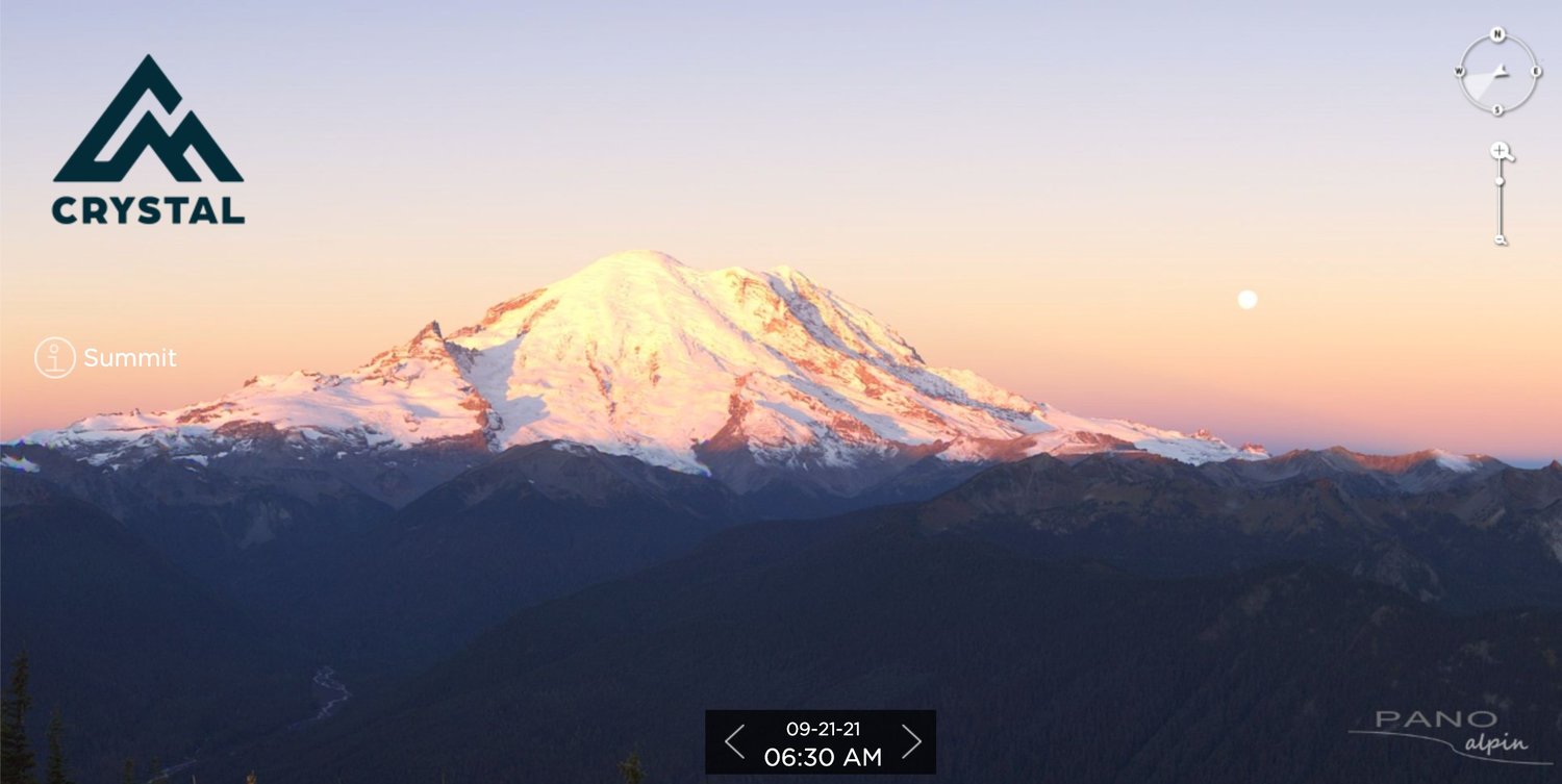
Photos posted to Twitter on Tuesday by the National Weather Service in Seattle showed webcam photos of Mount Rainier captured a week apart from Crystal Mountain Resort.
In the first image from Sept. 14, Mount Rainier's slopes appear rocky and naked after a summer of little precipitation.
The image captured Tuesday morning shows Mount Rainier looking more itself with snow fully capping its summit and only spots of rock peeking through its blanketed slopes.
Crystal Mountain Resort on Twitter complimented Mount Rainer's "nice new dress."
Mount Rainier has weekend storms to thank for its fresh powder. The storms dumped rain on Tacoma and Seattle, but Weather Service forecaster Kirby Cook said the systems brought accumulations of snow to the higher elevations of Mount Rainier.
"As we transition from the summer into the fall — today's the last day of summer — we start to see more storm systems and cooler temperatures, and that's why we start to see accumulations," Cook said.
A snow level observation made on Sunday found snow accumulation on Mount Rainier about 6,500 feet above sea level, Cook said.
Cook said more precipitation expected Wednesday afternoon and into the evening could bring more snow accumulations to the mountain at about 8,500 feet above sea level.


