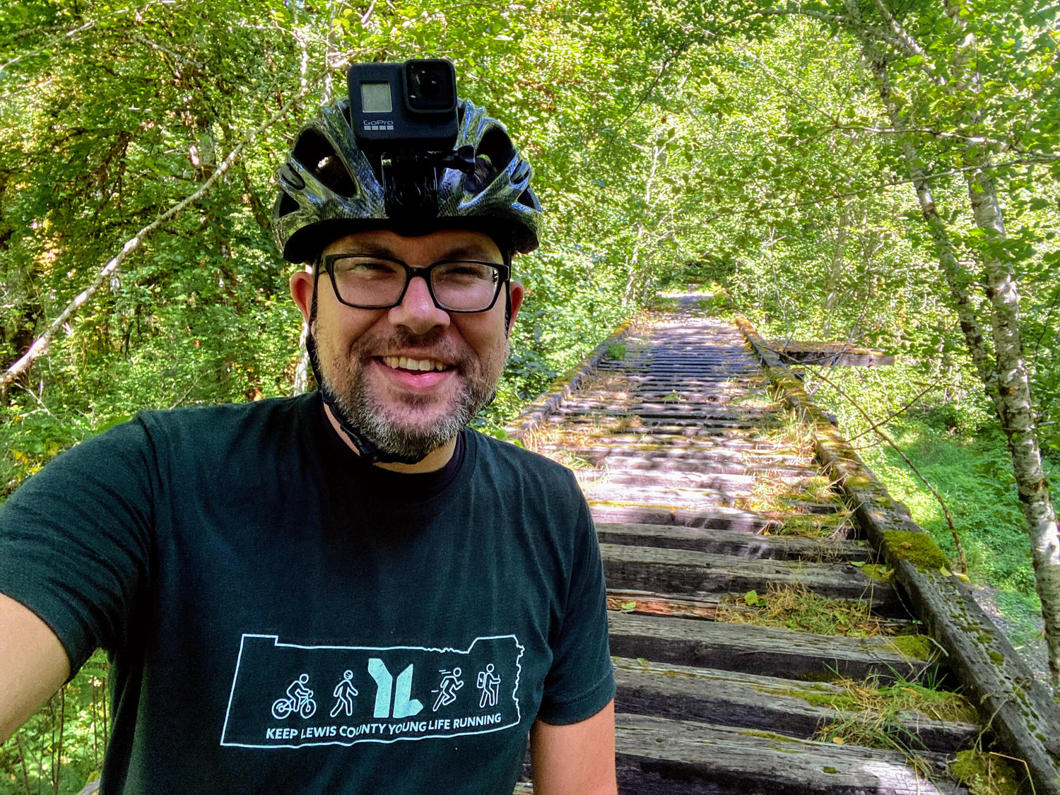
Chris Brewer smiles in front of one of the bridges at mile 32 on the trail in the Pluvius Hills. This bridge is one of two within a half-mile that State Parks is seeking grant funding to restore for non-motorized use.
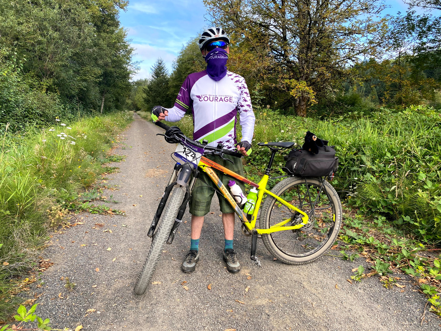
Jon Gust poses for a photo with his Norco bicycle just west of the Ceres Hill trailhead on the Willapa Hills Trail in west Lewis County. Gust invited Brewer on the ride to help commemorate what would have been the weekend of the Mary Bridge Children's Courage organized ride.
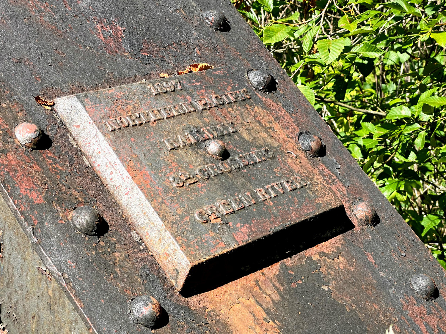
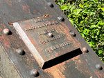
A plaque showing the date of construction of a bridge is shown just west of Lebam on the Willapa Hills Trail, which once served as a railroad line linking Chehalis to South Bend.
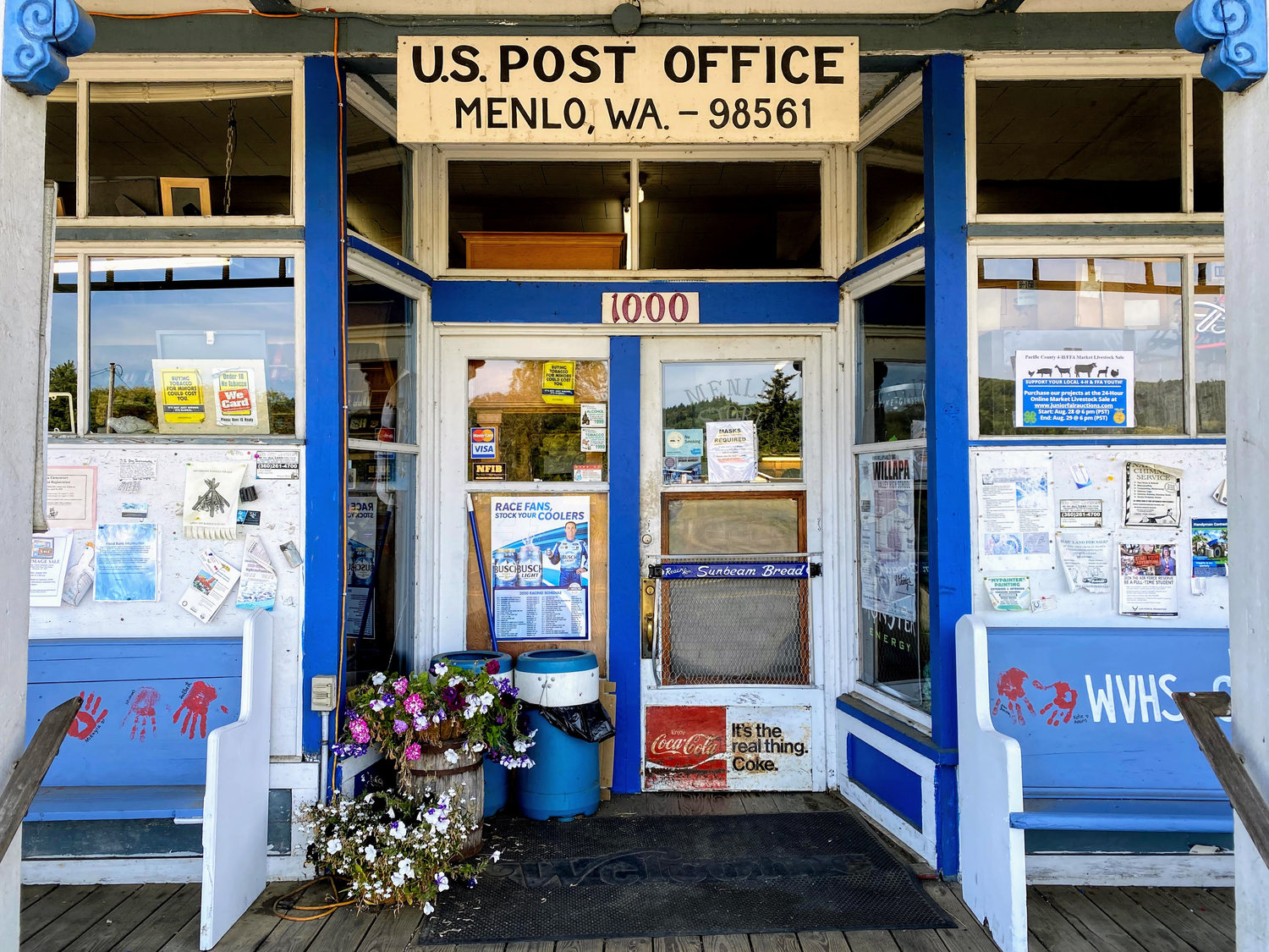
The Menlo Store in in the rural outpost of Menlo, where Chris Brewer and Jon Gust refueled for a final push to Raymond.

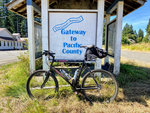
Chris Brewer's bike, a 1990s model Specialized Rockhopper, rests on a Pacific County welcome kiosk at Lebam, nearly 40 miles into the journey.
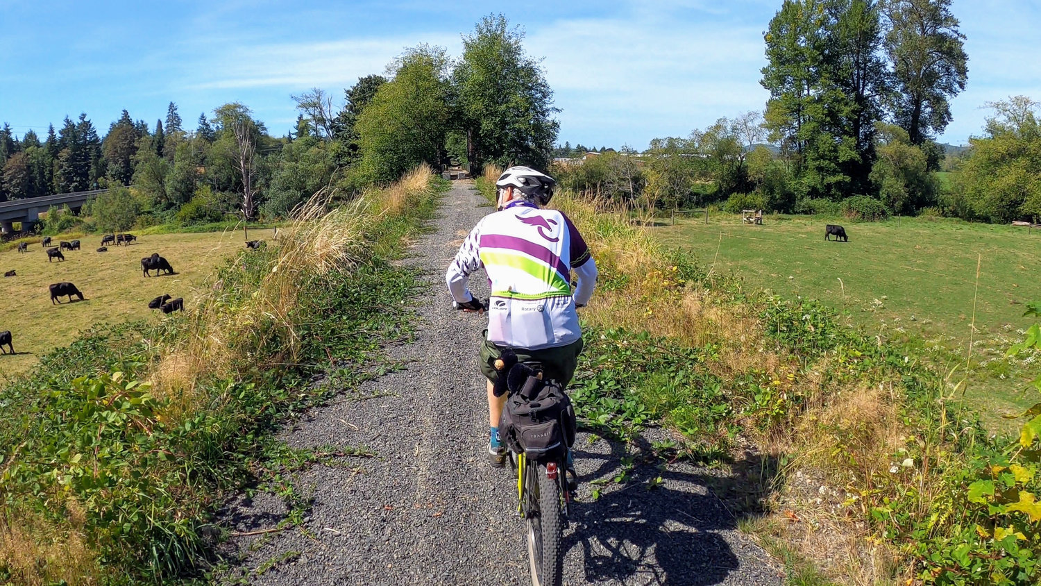
Jon Gust looks over fields as he rides toward a bridge spanning the Willapa River near Menlo.


As an avid cyclist and president of Lewis County Community Trails, Chris Brewer had biked large sections of the Willapa Hills Trail countless times over the years — just never the complete route. So when board member Jon Gust sent him a text out of the blue last week asking if he’d be down to tackle the entire trail in one trip, he jumped at the chance.
“He said, ‘Hey, this weekend is what would have been the Mary Bridge Children’s Courage Ride. In place of the event, I’m going to ride from Chehalis to South Bend on the trail. Do you want to join?’” Brewer said. “I said, ‘Hey, let’s see how far we get and see what can be done.’”
The Willapa Hills Trail began as a railway line for the Northern Pacific Railway in the late 1800s, connecting South Bend to Chehalis, and even further on to Lake Superior. It was eventually abandoned in 1990 and was acquired by the Washington State Parks and Recreation Commission in 1993 to create a trail.
There were entire sections of the 757-acre trail that Brewer had never seen in person. He had only ridden his bike west of Pluvius once and, in fact, he hadn’t even rode his mountain bike in over a year.
But Brewer and Gust, who have both ridden much further than the 56-mile distance the trail encompasses, are no novices. Gust has traversed the entire trail four or five times in the past and has experience riding in cycling tours, while Brewer has completed the Seattle-to-Portland bike ride twice in a single day. But road biking and gravel biking are two entirely different experiences.
The trail is a cinch for the first five and a half miles, paved all the way from Chehalis to Adna. It turns more wild and rugged the further west it goes until pavement restarts near Raymond.
“You had to pay way more attention to your surroundings, you had to be very in tune with the trail, know your equipment and know your capabilities the entire way,” Brewer said. “I had never felt as jarred as I did after a ride like this. It was a cool and unique experience.”
The duo departed from just south of downtown Chehalis at 8:30 a.m., reaching the trailhead at 8:45 a.m. The morning temperatures were near-perfect as they started out at 11-12 mph clip — a brisk pace on a mountain bike with thick tires, Brewer said.
It was smooth riding on asphalt for the first 5.5 miles until they hit finely-crushed gravel past Adna. There, they followed the Chehalis River to Rainbow Falls State Park, which was loaded with campers.
They opted to take a detour at mile 12.5, using Meskill and Leudinghaus roads, which run parallel to state Route 6, to avoid a repetitive four-mile straight stretch. There they encountered sustained winds of 10 miles per hour, reentering the trail at Stevens Road in Doty.
The two arrived in Pe Ell at 11:15, stopping for a quick snack at The Tin Snug — Gust, a frank with cream cheese and sauerkraut, while Brewer put down two large waffles.
They hit High Bridge over a low-watered section of the Chehalis River at mile 23. Pushing on, the pair took in lush views of the forested hills as the Chehalis River meandered off and a series of creeks appeared that would eventually turn into the Willapa River.
Climbing 450 feet in elevation, the two reached Pluvius Hill Summit past mile 29, where an old railroad turntable once existed at the now-decommissioned Pluvius Station.
“You go west of Pe Ell and I think that’s the most scenic area on the entire trail, from about miles 23 to 33,” Brewer said. “You get up into the hills there, the far reaches and fringes of the coastal range, and when the trail ducks away and you realize you’re in some really remote area that not many people get a good opportunity to see, it’s really something special. It’s stuff like that that kind of keeps you going along the trail.”
Soon they arrived at two dilapidated and unpassable bridges, which are the original trestles, about 40-50 feet above Fern Creek at Mile 32, roughly three miles east of Frances. They represent the final gap left between the far west and far eastern portions.
“To see the bridges there and see their construction is to see their history and wonder what everything was like back in the 1890s and 1900s,” Brewer said.
It forced the two to leave the trail and bike less than a half mile up state Route 6 until picking the trail back up and pushing toward mile 35 and Frances, where they arrived at 1:30 p.m.
Frances to Lebam was the last semi-OK stretch, but past Lebam was a bit treacherous. At Mile 42, Brewer hit a large rock head-on that was camouflaged by cut grass lying over the trail, causing his hands to shake free of the handlebars and sending him tumbling head first onto the ground. No cuts or bruises, just some soreness.
That prompted a stop at the Menlo Store to charge back up with some Gatorade. Next was a stop at Wilie Keil’s grave to pay homage to the 19-year-old would-be settler who passed away on the trip from Missouri to Washington in 1855 and was carried to and buried near Menlo.
From there, the trail was a hazardous singletrack, which caused Brewer and Gust to plod along Route 6 for a bit until reentering the trail near Heckard Road, about four miles east of Raymond. Before long they had hit the paved portion and glided into the rural logging outpost around 5 p.m.
Gust headed to the Raymond Elks Lodge in the downtown area while Brewer continued on to South Bend, passing the Port of Willapa Harbor before arriving at the location of the old terminus in South Bend. Brewer made his way back to the Elks Lodge in Raymond to join back up with Gust before a friend picked the two up and brought them back to Chehalis.
The total ride time was six hours and two seconds at an average speed of 10.4 miles per hour, a little slower than the two predicted.
It was a rewarding experience for Brewer and Gust, who experienced the Willapa Hills in a way few get the chance to; seeing farmers working in bucolic pastures that otherwise a person would be blowing past in their vehicle without truly appreciating.
They encountered a bevy of people between Chehalis and Adna, by far the most well-maintained and popular section of the trail, and saw about four-to-five people between Adna and Rainbow Falls. They ran into not a single person from Pe Ell to Raymond — a 29-mile stretch. Brewer estimates they came across less than 50 people total on the trail.
Lewis County Community Trails received a large grant from TransAlta in 2010 to invest in trail projects and has used a lot of that money for grant-match to help state parks with their funding requests to complete the trail further westward.
The Washington State Parks and Recreation Commission completed work in 2018 to improve four miles of the pathway west of Pe Ell, creating 27 miles of traversable trail from Chehalis to Pluvius.
The Washington State Parks Department, which oversees the trail, has put in a grant application to the Washington State Resource and Conservation Office for $1.2 million to renovate the former railroad trestles. This project would make the trail continuous for nearly 40 miles, between Chehalis and Lebam.
“I think we’re kind of in the last days of seeing the trail as wild as it is,” Brewer said. “I think the state parks have a reality good, aggressive schedule to get this done and I hope the grants will get funded.”
Brewer offered some tips for anyone wanting to complete the full trip: have good biking experience, don’t do it as a novice, bring a mountain bike and, better yet, use one that has a suspension for the rocky portions of the trail. He hopes to make the full trip there and back next summer.
“It really gave me a great appreciation for having it functionally complete in Lewis County,” Brewer said. “Being able to ride that in my own backyard is a special experience.”


