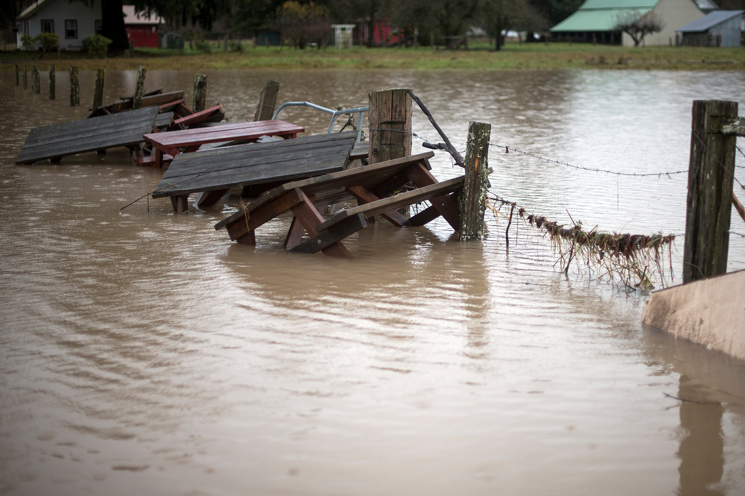
Picnic tables from the Maple Grove Resort in Randle are stacked up against a fence while floating in floodwaters from the Cowlitz River in this December 2015 file photo.
Fresh off the heels of the season’s first real wind and rain storms earlier this week, officials are urging residents in Western Washington to brace for another offshore onslaught to arrive this weekend.
A smattering of snow was expected to fall in the mountains, particularly the North Cascades, overnight Friday before the warmer offshore flow was set to arrive Saturday morning. That weather system is expected to cause at least minor flooding on area rivers as well as in urban areas due to clogged storm drains. Flood advisories have been issued for all of Lewis, Thurston, Cowlitz and Pacific counties. The advisories will be in effect from Saturday afternoon through Sunday afternoon.
“All rivers are at risk of minor to moderate flooding, but the emphasis right now is where we have the heavier precipitation and that’s rivers flowing off the central and south Washington Cascades,” said Kirby Cook, science officer for the National Weather Service in Seattle, in an advisory briefing on Friday.
High winds are expected to hit the coast as well as the north interior of Western Washington with average speeds of 25-30 miles per hour and gusts of up to 45 miles per hour. In other areas, the wind is expected to further complicate drainage issues by backing up storm drains with falling leaves and branches.
“The winds will pick up. It will be a little breezy, a little gusty this weekend, but we’re not looking at speeds as strong as they were on Wednesday,” said Ni Cushmeer, senior meteorologist with the National Weather Service in Seattle. “If the rains are intense enough, it could lead to urban flooding as well, and that’s why we’re asking people to help with clearing storm drains.”
Cushmeer said that extensive rainfall this week has already pushed the Nooksack and Skokomish rivers to the brink of flooding. She noted that other area rivers are not far behind.
“This looks like it’s going to be more rain than the other system, so the odds of rivers flooding have increased,” said Cushmeer. “The main thing this weekend is the heavy rain could lead to, definitely rises on the rivers, and could cause some rivers to flood.”
The Cowlitz River near Randle and Packwood is one area of particular concern. Forecasts are calling for 7 inches of rain near Paradise at Mount Rainier from Saturday through Sunday, and Randle is expected to get about 4 inches of rain in that same time frame. River projections indicate that the Cowlitz River will be within 3 inches of major flood stage in East Lewis County by mid-morning Sunday.
“In Lewis County, we are definitely expecting the greatest amount of precipitation to fall in the Cascades,” said Cushmeer. She noted that between 4 to 6 inches are projected to fall in most areas of East Lewis County from 5 a.m. on Saturday through 5 p.m. on Sunday.
“And then in the lower elevations we're expecting lower amounts of up to three inches of rain,” Cushmeer said.
Cushmeer said that most lowland areas are expected to receive between 1.5 and 3 inches of rain from 5 a.m. Saturday until 5 p.m. Sunday with Chehalis slated to get 2.13 inches of precipitation and Olympia anticipated to receive 2.66 inches of rain.
The Newaukum River is expected to stop rising about 1 foot short of flood stage on Sunday, and precipitation is forecast to begin letting up by mid-day Sunday with better weather conditions projected into next week.
“Next week is looking fairly benign,” said Cook in the advisory conference. “We may still have some river flooding into Monday but after that we have a drying trend.”


