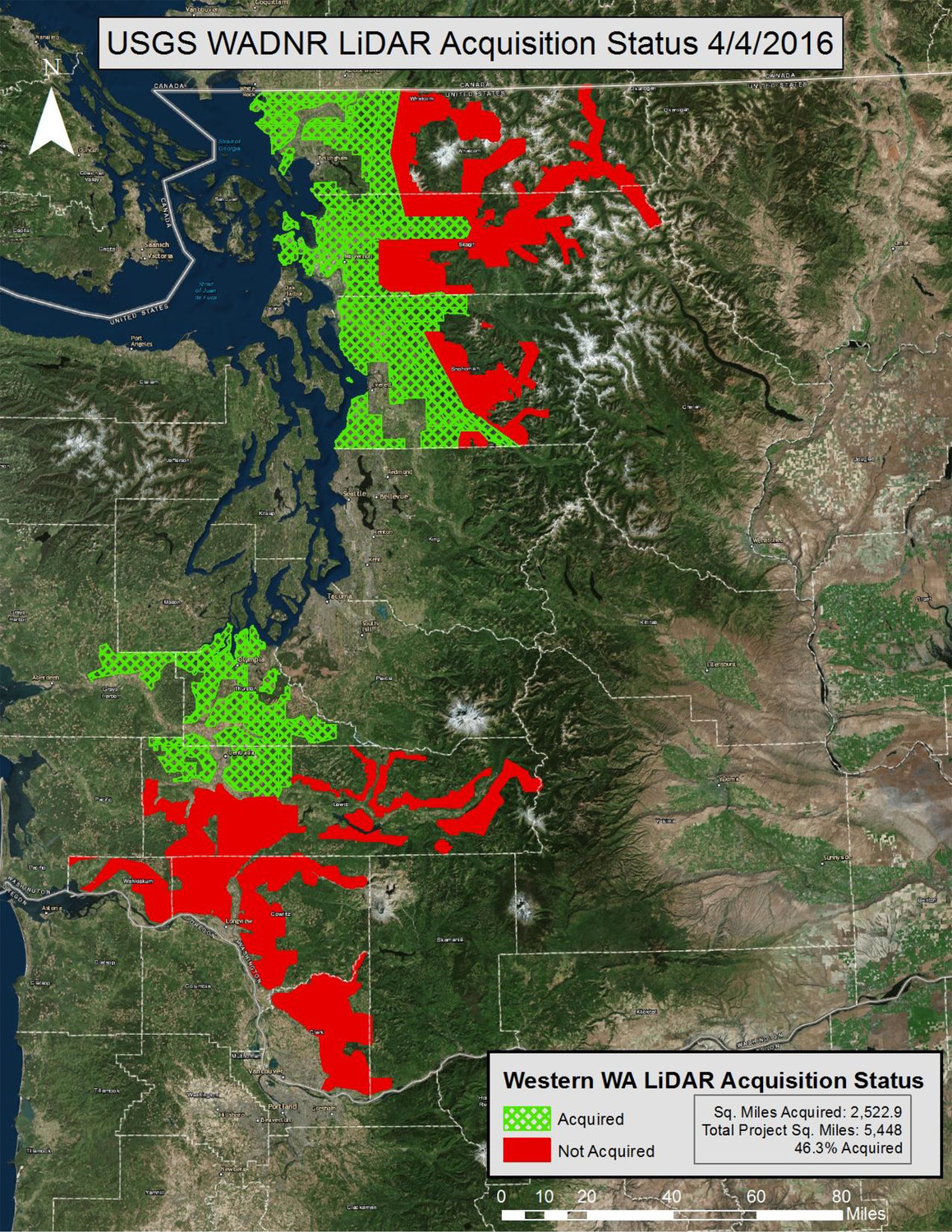
This map from April 4 shows areas where the Washington State Department of Natural Resources has acquired LiDAR, Light Detection And Ranging, data and areas where the agency plans to use LiDAR technology to map the geology.
The Washington Geological Survey, a division of Washington State Department of Natural Resources, map published standardized methods to map landslide hazards in the state using lidar.
The new protocol was created to ensure the different agencies that map landslides do so with consistent data that is easily catalogued, a press release from DNR said.
“Our mission is to be the go-to source for information about Washington’s unique geology. To do that, we need to be using consistent, accurate data,” state geologist Dave Norman said in a press release. “We developed these mapping standards to make sure geologists doing this important work are all singing from the same sheet of music.”
The Legislature in 2015 mandated and funded DNR to collect, analyze and distribute lidar maps of geological hazards. Geologists are currently using the new protocols to inventory landslides in Pierce County and are currently using them to map landslides in the Columbia River Gorge.
Lidar, which refers to light detection and ranging, uses lasers mounted on aircraft to measure the topography by measuring reflected light. It allows mappers and scientists to see the topography of landforms without interference from ground cover, human development or forest canopies.
Collected information will be publicly available at lidarportal.dnr.wa.gov.


