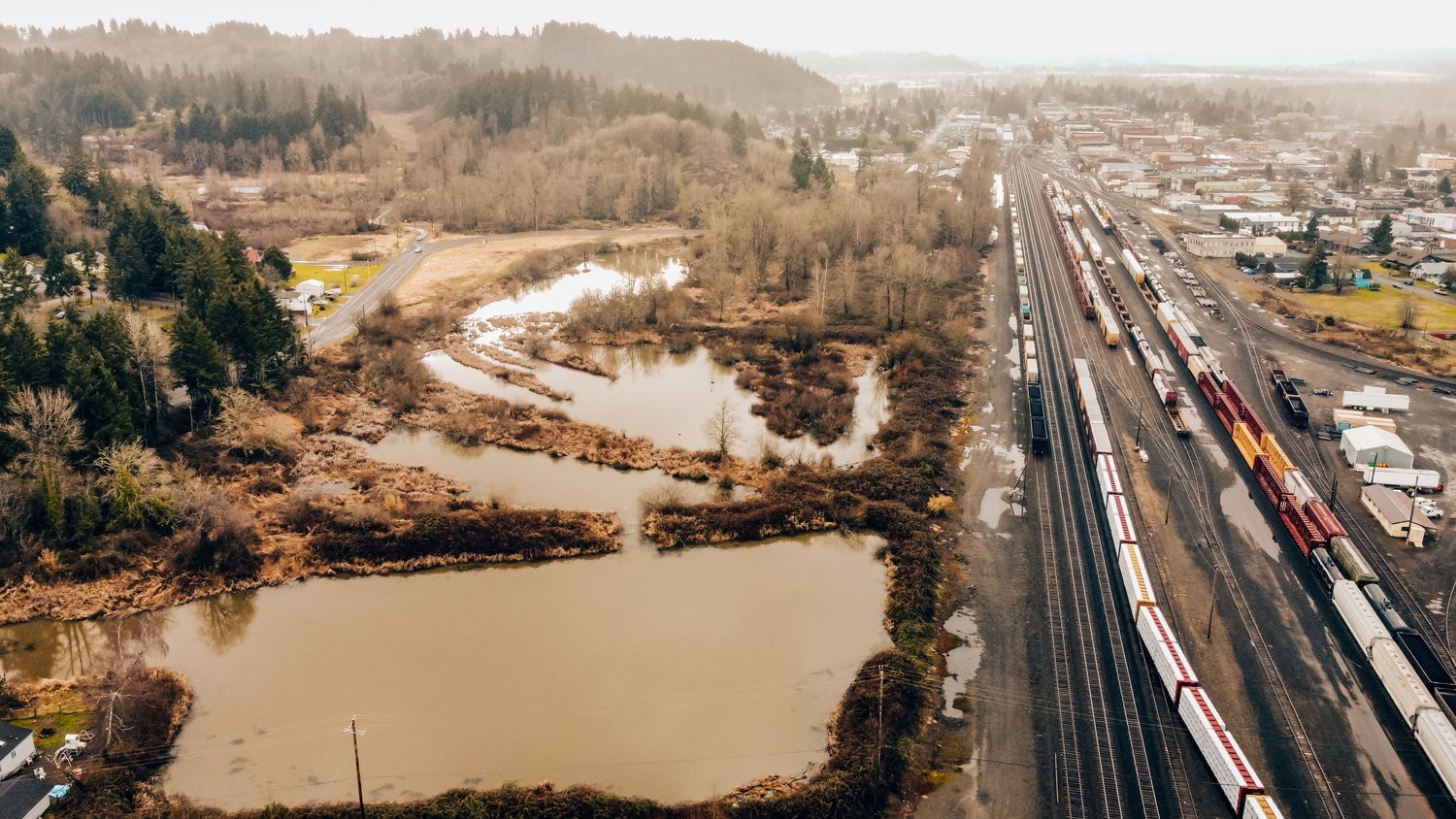
China Creek empties forms through the Agnew ponds in Centralia.

A 72-project plan to mitigate water loss from the state’s second-largest watershed has been finalized by the Chehalis Basin Partnership.
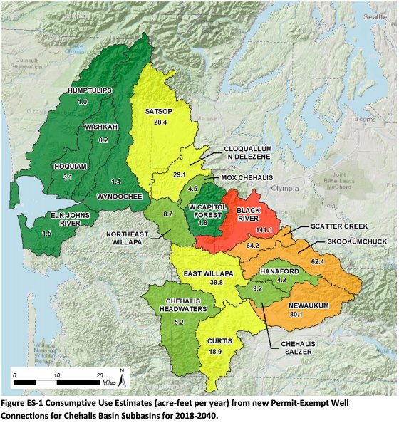
The aim is to offset groundwater lost through private, rural wells — 4,555 of which are expected to pop up in the next 20 years.
Directed by the state Legislature, the Chehalis Basin Partnership has been working on their updated watershed management plan for two years. Last week, it was adopted by the Department of Ecology ahead of the deadline. While some projects are straightforward water right acquisitions or habitat restoration, others aim to physically redirect water into aquifers. The issue of private wells siphoning off water “is something that has historically not been addressed in Washington state,” according to the Chehalis Basin Partnership.
“This kind of water-focused approach that the Legislature asked us to do is new,” said Kirsten Harma, the partnership’s watershed coordinator. “People didn’t have a bunch of projects in the queue about how we’re going to get water back in streams, so those are the most important type of projects, and also the ones with the most work ahead.”
In 2016, a state supreme court case — known as the “Hirst decision” — limited local governments’ abilities to approve rural development before taking into account water availability. Two years later, the Legislature passed a “fix” to that decision, allowing projects to continue while directing local groups to address water loss.
Now that Ecology has adopted the Chehalis Basin Partnership’s years-long plan — as well as plans for the Okanogan and Little Spokane watersheds — the question of funding remains. While competitive grant programs are available, the projects will need major funding from the Legislature.
The 4,555 wells projected to be drilled in the Chehalis Basin in the next two decades will likely lead to an annual loss of 505 acre-feet of water due to evaporation. An acre-foot of water is enough water to cover an acre of land 1-foot deep.
“While this impact may be considered small relative to the fact that the Chehalis Basin is 1,664,000 acres (2,600 square miles), the impact is more serious in smaller creeks, especially in the summer months when water use is high but streamflow is low,” reads a Chehalis Basin press release.
According to the release, the most development is expected to occur near the Black, Skookumchuck and Newaukum River as well as Scatter Creek — areas where already-threatened fish populations could be impacted by decreasing water levels.
Projects span across Thurston, Grays Harbor, Lewis and Mason counties. Major projects in Lewis County include Centralia’s ongoing China Creek flood and habitat mitigation project as well as Chehalis’s plan to transfer its water intake from the north fork of the Newaukum to the mainstream of the Chehalis River, hopefully keeping more water in the Newaukum to sustain fish migration.
Other projects include groundwater recharging, which is a strategy to shift winter runoff into the ground, which is then naturally released to bolster streamflows.


