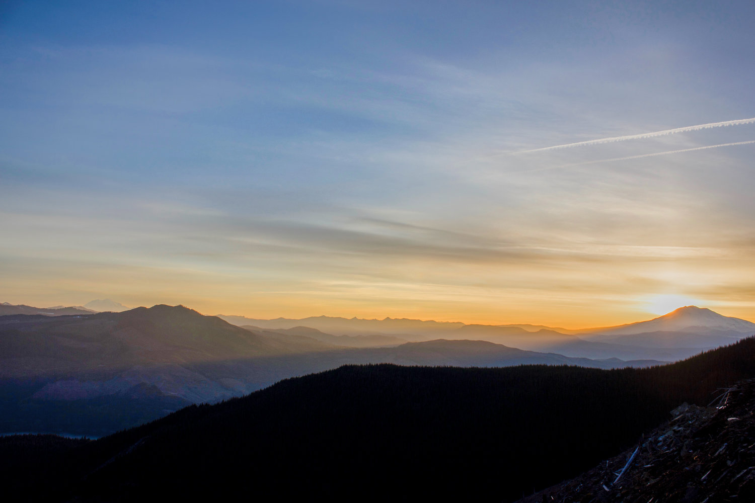
The dawning equinox sun illuminates the Gifford Pinchot National Forest.
An old wood bridge twists as it decays in the wet rainforest.
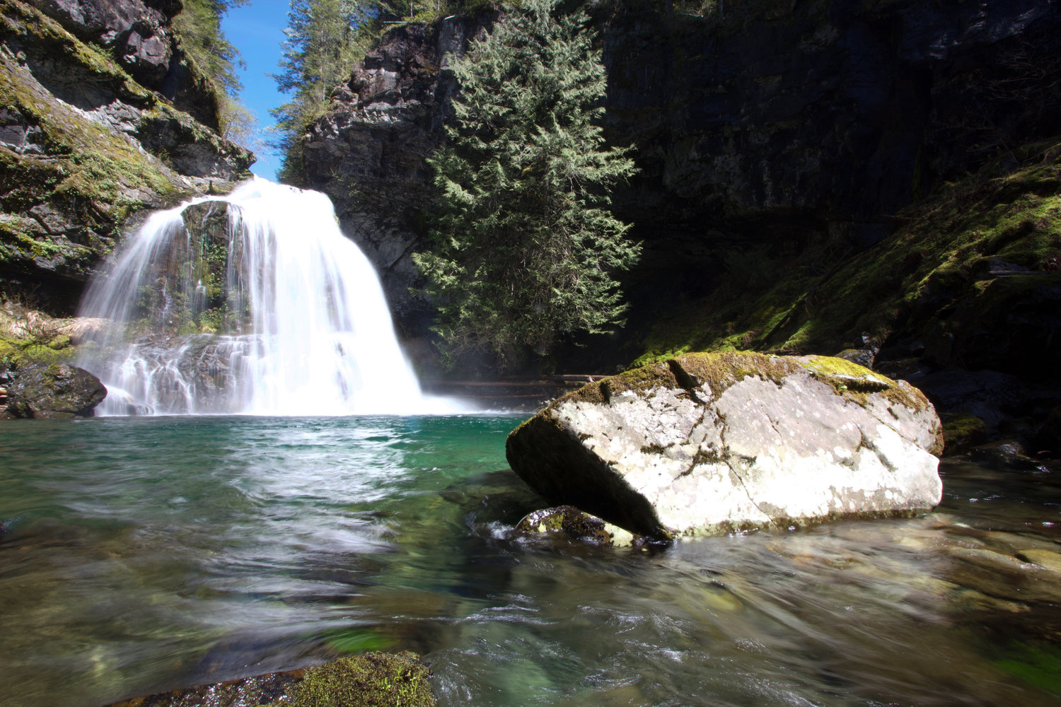
Black Hole waterfall.
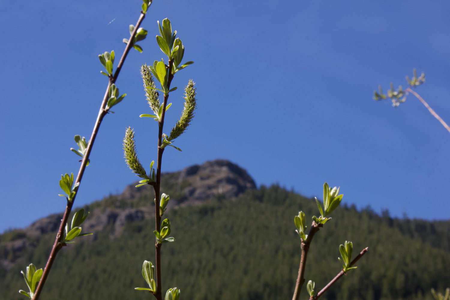
Peekaboo views of Mitchell Peak begin as the trail climbs out of the North Siouxon Creek valley.


A light breeze drifts across the landing in the golden evening light. The wind drifts off to the west, where Mitchell Peak’s bulky, jumbled summit dominates the scene. At my feet, the landing edge falls off into a clear-cut slope, dropping 700 feet down to the gentle saddle connecting the landing with Mitchell. A thousand yards away, the bumps and pockets of Mitchell’s grey rock are a detailed red in the approaching twilight. A constant, subdued roar from either side of the saddle is the sound of spring snow-melt.
The roar is two creeks flowing full, clear, and cold; pulsing over rocks and small falls of opposing watersheds. Just north of the saddle, one nameless creek begins a short run to the southeast corner of Swift Reservoir. Opposite, a tributary of North Siouxon Creek begins a thousand foot drop as it flows south along Mitchell’s eastern flank. My eye traces the course of that tributary to its confluence with the North Siouxon, where it enters a prominent valley that turns southwest towards Clark County. The valley disappears into that of Siouxon Creek proper, where the two creeks join and, just a bit further, empty themselves into the Lewis River near Yale Dam. I am at the end of an 11-mile, eight-hour hike up that valley to this landing. Mount St. Helens, Mount Rainier and Mount Adams lie in a wide panorama to my right. I relax, lean with both hands on my walking stick, and breath in the warm air. It is a scene I have seen many times before. It is spring in the North Siouxon, and I am happy to return once more.
Earlier that day
I stand on the dappled colors of river rock along North Siouxon Creek. An hour into the hike I take a short break to check out the fording site for the old trail. A minute’s search fails to locate the trail on the south side of the creek, where it should climb the ridge that divides Siouxon Creek from the tributary I am following. This crossing is one of only three places on the trail where a hiker can clearly see the North Siouxon. I stand on the rocks, munch a snack, and look up and down stream at the ripple-to-run-to-ripple pattern of the flow here. My pack and staff rest on a log farther inland. The pack’s bright blue fabric contrasts sharply with the flashing silver of the creek, the grey of the rocks, and green all around. A vine maple pushes a few of its branches out into the warming sun. A close look at the tips reveal needle points of green, the beginnings of the seasonal budding.
Resuming the walk, I approach the first of several log crossings. The wide, old log slopes up across a small creek. A good 10 feet over the rushing water and rocks, a narrow footpath of bare wood and carefully placed roofing shingles separate the parallel lines of salal that run up either side. Past the log, the salal flows up ridge slopes as the trail climbs steeply above the North Siouxon. I walk a mile on, and watch the transition begin.
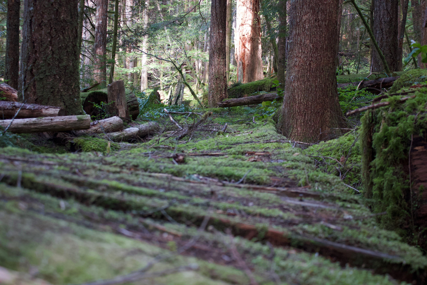
Another minor crossing, and the forest darkens. The trail descends sharply and swings left. The scattered moss found here and there earlier in the walk rises to prominence. It is wet and shady here. A spongy, emerald layer of moss coats any horizontal surface. The trail shrinks to a narrow strip of brown slowly succumbing to the green carpet pressing in from either side. The morning sun filters through the canopy from the south, creating a gold-yellow backlight behind long strings of moss drooping down from tangled patches of vine maple. I gingerly cross two decaying footbridges. Both bridges consist of two parallel logs held together by a row of planks. Both are coated in the green moss, and twist as they rot away. The rainforest goes on and on, punctuated by rock-strewn creek beds, where tangles of downed trees and open sky, testify to the power of periodic flooding.
By early afternoon, I am descending a spur trail down to the creek. The constant, gentle rumble of water along the main trail grows to the familiar roar of a waterfall as I drop through short switchbacks. I take a few short steps past the trees at the last corner and pop out into the small punch-bowl of Black Hole Falls. Frothy white water spurts out of the pitcher-spout opening in the lava wall where the North Siouxon makes its leap down to an emerald-blue pool below. The Black Hole sits encased by trees and mountain ridges in the distance, much like the scenes at Kalama Falls and Upper Falls. I balance on a pair of slick boulders at the pool edge, absorbing the constant roar, the breeze of mist, and the endless flow of glass-clear creeks churning past rocks as the North Siouxon resumes its regular route downstream. Here in this deep pocket, the high afternoon sun sits just above trees sprouting bravely along the bowl’s right hand cliff. The chance for an ideal photo of the falls is already gone now that the bright-white afternoon sun replaced the golden light of morning. Another break, some photos and a snack, and I return to the main trail.
The moss reaches its apogee just past the last crossing before the climb. Mounting a spur, the trail moves through a forest of cedar, with inviting, lawn-like patches of thick green moss beds interspersed throughout. Ferns and salal gradually appear as the trail moves through switchbacks. Minutes pass. I have climbed 500 feet higher, the air is just a bit drier, and ferns and salal complete their conquest of the forest floor.
In time, the trail crests onto an old road bed. The gentle climb continues as the footpath winds around scrubby alders and small washouts. The trees and creeklets are slowly erasing the road. Mitchell Peak, and her unnamed sister to the east, pop in and out of view through the thinning forest.
The trail drops slightly at the head of the valley. I scramble down the 8-foot drop to the creek. This nameless tributary jostles and bubbles over the flood scrabble of small boulders as it charges clear and swift to join the Siouxon. Climbing back up to the trail, I squat and rest a minute, taking in the first good view of the North Siouxon Valley. The valley runs straight to the southwest, its steep, forest-swathed walls draw my eye to Mt. Tum Tum and the expanse of Clark County in the distance.
The trail is warm. Yellow afternoon sun blankets the red-orange stone all around. The path follows another decaying road along the southern flank of the unnamed sister, climbing clockwise around the sister towards Mitchell. Baby fir trees sprout up through the red rock of the old road. The road has changed in the 10 years since I first found it. A distinct footpath winds around trees and large rocks, organizing the rocky, two track of yesterday. The creek cuts are deeper now, forming large, sloughing Vs in the old road. Boulders lie here and there, parts of the mountain falling down. Fir and Alder choke the pathway down to loose tunnels in places. Entropy is overwhelming man’s tidy order.
Snow lingers wherever it can as I climb the last stretch of road to the landing. The snow is losing its fight against the warmth, sun and lengthening days brought by the vernal equinox. Shaded north slopes and flat, open spaces along roads and trails where the snow piles deep, seem to be popular retreats for the scattered patches of white. I manage to salvage some water from one of the more promising rivulets trickling out of a snow bank behind camp. The trickle produces a quart or so before disappearing as the evening cools. Resigned to a dry camp, I drink most of the quart, and prepare for morning coffee by filling the remainder of the bottle with icy snow that I hope will melt slowly inside my bivy sack overnight.
Looking around the scene, I notice a large snowfield covering a slope above the landing. A flock of five ravens circle and sport around it. They seem to take turns, two or three perched quietly on the snowfield’s upper-right edge while one or two summersault down in bursts. Each summersault ends at the field’s lower edge, followed by a quick takeoff and gliding circuit above the scene. The subsequent flights consistently end in a pouncing landing upon a perched friend, producing a short squawk, a shuffling of positions, and another round of the show. Looking through my 200-millimeter lens, I watch the corvids continuing these cycles for long minutes. Eventually I grow bored, wishing for a longer lens capable of capturing these birds at play.
I lie in the bivy and stare up at the usual constellations. It is probably past midnight, and I am tempted to take a shot of the dipper over the crater rim. Better judgement prevails as I recall attempting night shots from the far end of Siouxon Ridge in the past. Light pollution from Seattle, Portland, and Clark County dominated the star shots then. Looking at Mitchell silhouetted by the lights of the county, I resolve to wait for morning.
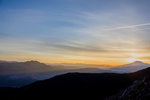
Dawn colors slowly shift on a bank of clouds over the distant peaks of the Dark Divide. Over minutes, deep purples shift to reds as faint blue-grey shafts appear in the northern valleys. The sun runs behind Mt. Adams, delaying dawn on the landing. The entire eastern half of Mount St. Helens brightens as the newborn day awakens. The spring sun’s sloping azimuth runs along Adam’s northern flank. I expectantly watch the nearby rock summit, but never see the cleansing approach of the dawn shadow, the instant arrival of the sun. Instead, we merely experience a gradual brightening; the summit, the landing, the valley, and I simply become aware that the day has begun.
Accepting the anticlimax, I sit in my chair and sip tepid coffee as the stove canister wheezes its last gas. The morning is here, and I am ready to move. A few minutes on, and it is an hour past the dawning as I take my first steps past the snowbank with staff in hand and camera stowed and gear packed. The simplicity of this system confirms itself as I slowly step down the road. My house is on my back, my staff strikes a rhythm, my focus on the moment. Minimalism frees the mind. Forests on the far side of the Swift take on their familiar green in the gathering sun. The water around Devil’s Point begins to shimmer in the increasing light. My return to the austerity of my army past comes with a pleasant sense of confirmation. A poncho, a bivy, and a pair of boots. Eschewing the pursuit of comfort sharpens focus onto the external. Once again I am fully aware of the land.
I sit on the rock, as I have dozens of times before. Looking out east towards the landing; the mountains, trees, and valley brighten in the warming morning light. I wonder at the things we ponder, when we choose to face them. The minor issues that needle our lives, the major ones that vex us, that we are tempted to ignore. I release my mind, and it slips automatically into my my role in the tribe. I wonder at the vexing things: teleology and theodicy, the direction of causation, of being or becoming, of the nature of the panda’s thumb. As always, answers prove themselves coy. There is no arrival point. I slip into that space anyway, allowing the disparate directions of those competing ideas find their balance in my mind. The sun climbs as the process runs its course. The psyche tares to the new center, the hermeneutical spiral has spun once again.
An hour on, and I stand on the spur. Two miles behind me the trail leads back to the old Mitchell Peak trail head. Once a small, bustling lot, the old trailhead saw the high use that comes with being listed in hiking guidebooks. A land use dispute, a gate, and a closed road intervened. Today Mitchell Peak has become backcountry. I stand at the corner of the trail, looking at the gradually disappearing footpath. Morning sun filters through the trees shadowing the beargrass encroaching the trail’s dirt. A random scattering of deadfall branches clutters the path, as they have since I joined the trail at the saddle. The Mitchell trail is dying, and I feel the melancholy that always arises in accepting the reality of the life-cycle of all things.
I dawdle in indecision on the spur. Facing south, I feel a surge of excitement at the prospect of exploration. The fir and beargrass covered spur slopes gently away, dropping eighteen hundred feet back down to the North Siouxon. A new place, and curiosity beckons. I face west, imagining the ridge-walk between Mitchell Peak and Sugarloaf, the two high places that own me as much as any land, anywhere. The draw west is strong, a sense of rightness and belonging, of responsibility and stability, unfaded through many years, nights, storms, runs, climbs, rambles and sunrises experienced on those peaks. The minutes slip by until the dawdling ends in a step south, a decision to stick to plan, to learn a new part of the Land.
The map is true, and the spur is just pleasantly steep. The sun floats silently on my left as I follow the crest of the spur down and south. Occasional tangles of budding vine maple and rhododendron break the uniform forest of beargrass and fir. Ferns and salal begin making their appearance a thousand feet down. I find my way around an abrupt rock wall. The sound of water drifts over from the draw to the west. Another five hundred feet and the salal is thick, hiding small undulations in the ground. I chose my steps wisely. A final steeper pitch and I am at fifteen hundred feet, back in the cool, wet, mossy valley. Stepping onto the trail, I turn west and begin the walk home.


