Davis Creek Road Washout
Lower Hopkins Creek (Randle, WA)
Standing at the base of Galena Falls.
Washout Falls (near Lewis-Skamania County line)
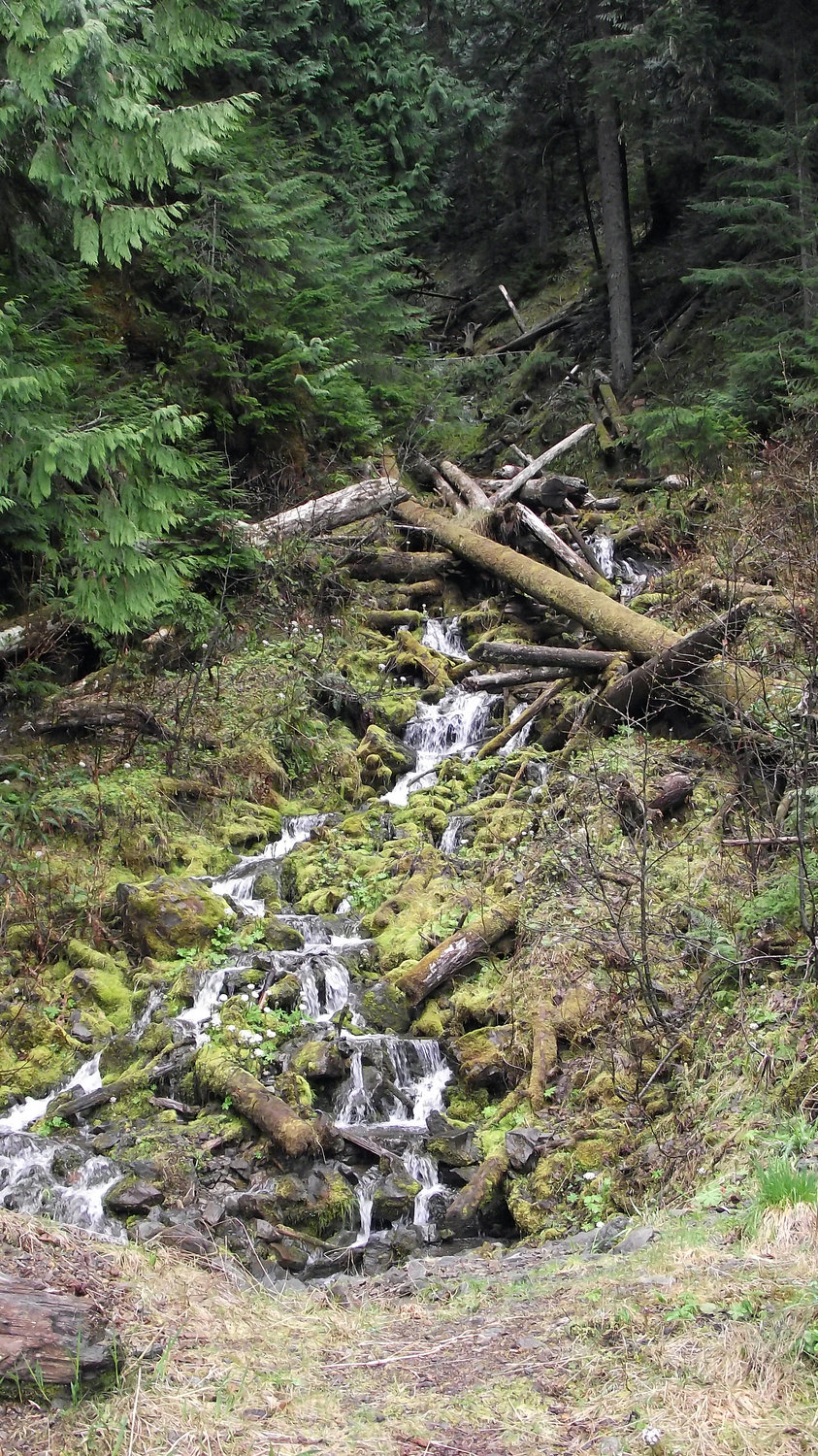
Camp Creek Falls (Cispus)

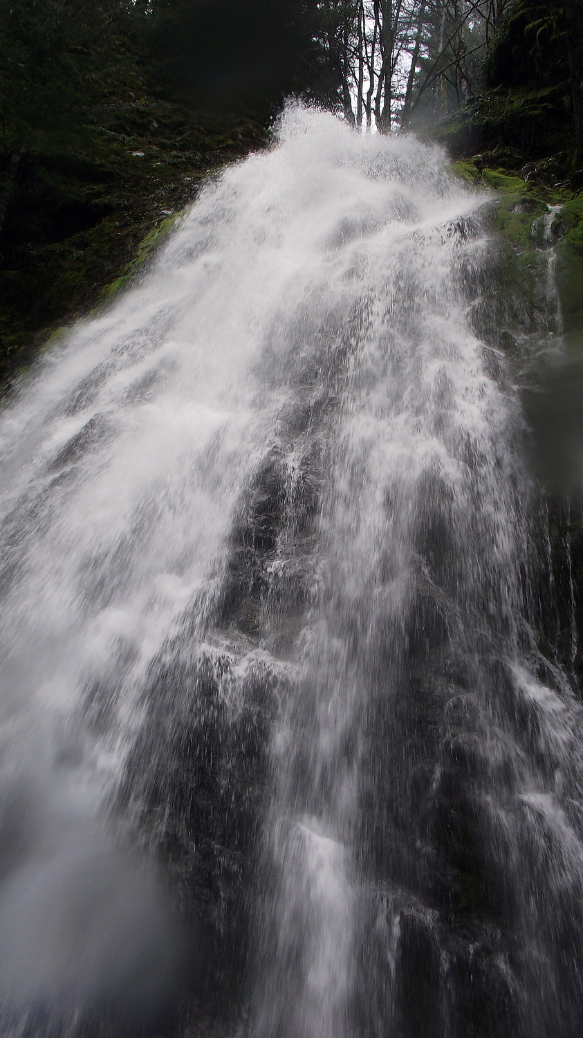
Cathedral Falls
The view from behind Cathedral Falls.
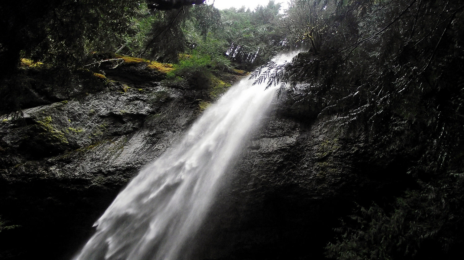
Cathedral Falls (above Lake Scanewa, near Glenoma)

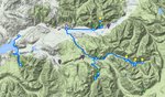
Check out the interactive map here: https://www.google.com/maps/d/edit?mid=zTz-uwtFLC5M.kbhzFMpR9vzU
Cat Creek Campground

Slick Rock Falls (Cispus)
Twin Creek Falls
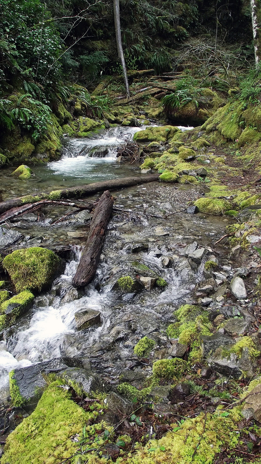
Galena Creek
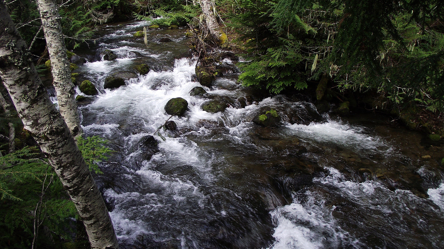
A creek at the Cathedral Falls trailhead, above Lake Scanewa, outside of Glenoma.


As a kid who grew up in the ‘90s, I remember singing “don’t go chasing waterfalls,” when the chart-topping song “Waterfalls” by TLC played on the radio.
But, when some of Washington state’s most spectacular waterfalls are in our own backyard, right here in east Lewis County — the lyric has less universal meaning.
The Pacific Northwest winter of 2015 was particularly mild, with low snow pack. That meant that many Forest Service roads were already accessible by two-wheel-drive vehicles much earlier than usual, and that we had an opportunity to take in some of the County’s most scenic and elusive waterfalls during their peak flow — just eight days following the vernal equinox (first day of spring), which is considered the best time to see waterfalls in our geographic area.
With all this in mind, we packed up our four-wheel-drive F-150 and our ultralight slide-in sleeper camper — affectionately known as the “Voie-ager” — and headed out to Cascade Peaks Campground, just east of Randle, to spend the night and get an early start.
Saturday morning, we woke up to a very wet campground. More than a half an inch of rain pummeled us overnight, and while our hiking party stayed dry, our plans for breakfast seemed … well, a little soggy. So, we made our way west, toward the U.S. Highway 12 and state Route 131 intersection in Randle.
On our way west, we turned up Davis Creek Road, hoping to see Lower Davis Falls and Davis Mountain Falls, off of Forest Road 63 (as indicated on our topography map). NF-63 sits on the Randle side of Davis Creek Road at the dead end, where the inundated Davis Creek washed out the bridge during the 2006 east county flood.
Unfortunately, the road (NF-63) leading to the waterfalls we hoped to see was just a little too wet and soft that early in the day, after a half an inch of rain overnight, for us to feel comfortable following Davis Creek any higher.
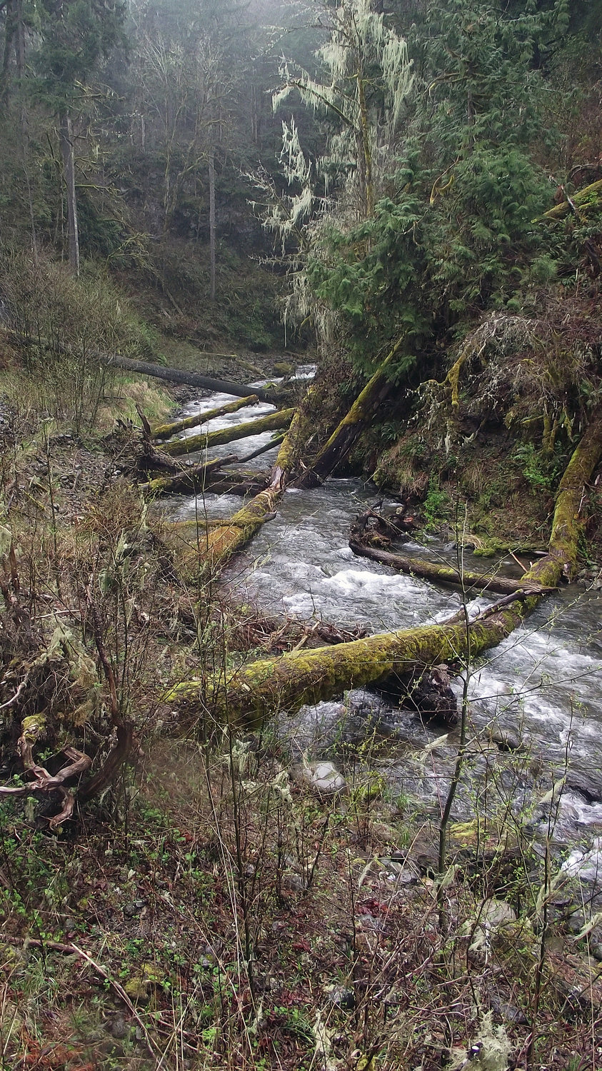
Just west of Davis Creek Road, and directly across from the Cowlitz River at the Khvoroff ranch, is Lower Hopkins Creek Falls. You can actually see this waterfall from SR 12, and there’s a wide spot to pull off of the highway on either side of the falls.
I almost fell into the creek while snapping photos, which was a great reminder to not trust soft creek banks (always check your footing).
There also happened to be two herds of elk bedded down in nearby pastures, on either sides of the highway. Very picturesque.
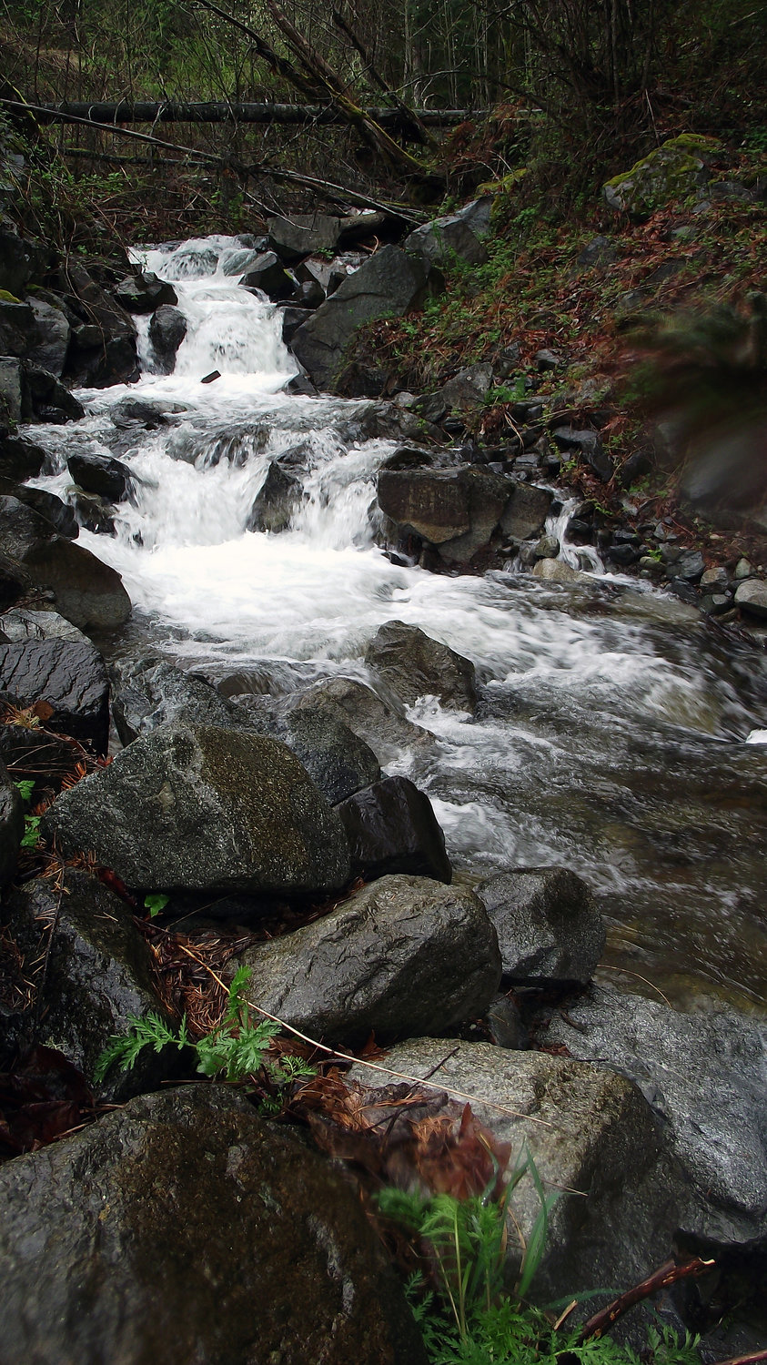
After a great cup of coffee, and an awesome breakfast burrito at the Mt. Adams Cafe, we headed down route 131 (turn off for Windy Ridge, etc.), and hung a left at Cispus Road. We headed east on Forest Road 23, took a left on Forest Road 55, and followed the signs for Forest Road 22 and Forest Road 22 until we met with Forest Road 78. We followed Forest Road 78, stopping to snap photos at several small sets of falls along the way (all with unofficial or unmarked names), until we ended up at Cat Creek Campground, near the Forest Road 21 intersection.
This leg of our journey was a particularly scenic and really enjoyable drive. The roads were a combination of pavement and packed gravel, getting more primitive as we drove farther into the forest. Roads were still brushy with debris from winter, with many downed trees hacked up on either side, but we had no problems navigating the obstacles.
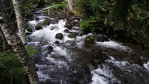
This area also had many options for camping along the way — individual and group sites — that included fire pits (some with grills), picnic tables and restrooms (composting). I definitely recommend you check this area out if you’re looking for campsites that are a bit off the beaten path, but still have some basic amenities. Cat Creek Campground, nestled on an inside bank where the bubbling creek meets the rushing Cispus River, looked particularly inviting for a family, or medium-sized group of families.
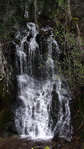
Leaving Cat Creek Campground, we back tracked and headed toward the Cispus Learning Center. On our way out, we had passed the trailhead and marker for Camp Creek Falls, and had made a mental note to check that our on way back.
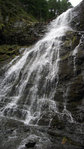
The trail to Camp Creek Falls is about a quarter of a mile long, with a minimal and fairly gradual elevation gain (easy enough for the casual hiker), and winds through a large, mossy grove. As you start to climb a bit, you wind around the side of a hill, until you round the bend that reveals a 40-foot-tall waterfall, flowing over a worn-smooth rock face and framed by lush, green moss. The contrast is stunning to see in person.
The Camp Creek Falls hike would be a great hike with your family, and we traveled it easily with our 14-month-old, Owen, in a Kelty backpack-style child carrier.
To get to Camp Creek Falls, take state Route 131 in Randle, then turn left on Cispus Road. Follow that road, bypassing the turn toward Cispus Learning Center, and the trailhead and marker will be on your left, just past the second Cispus Road turn.
Following Camp Creek Falls, we back tracked again, but this time heading down Cispus Road toward the Cispus Learning Center. We followed this path until we took a slight left, and the road turned into Forest Road 28 above Cispus Learning Center. This road was a bit more primitive as well, but still very easily driveable in two-wheel-drive and little bit of ground clearance (small SUV or crossover type vehicle would be just fine).
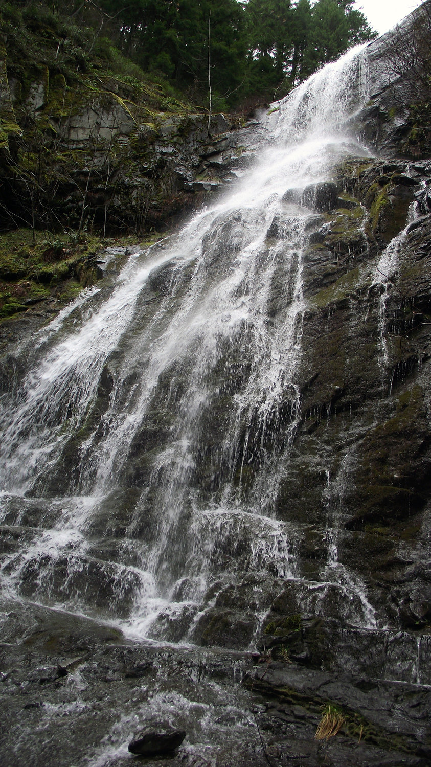
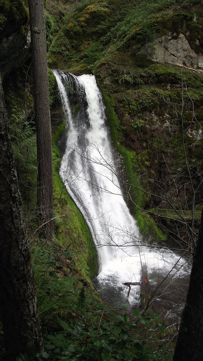
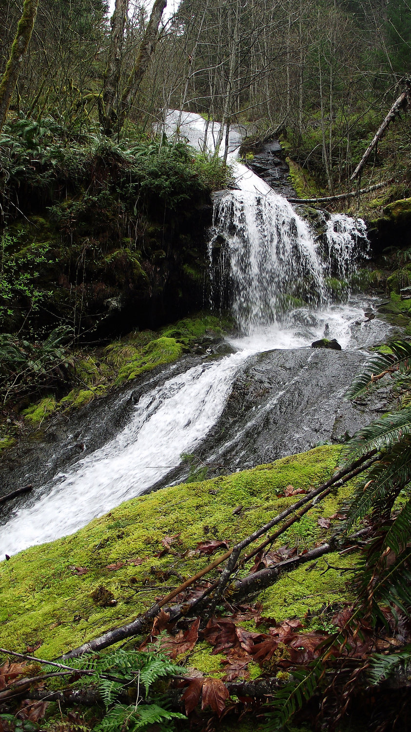
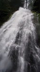
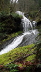
We first encountered Galena Creek at about 1,900 feet on our right, and could hear Galena Falls through the trees. I was able to solo hike up 100 feet and basically stand directly under the 75-foot-tall waterfall. The trail wasn’t apparent, and this required a little more difficult and technical hiking and climbing over natural obstacles, although a short distance off the road (less than a tenth of a mile).
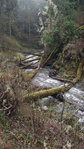
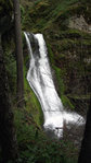
Hopping back in the truck, we continued up Forest Road 28 another mile or two, until we encountered Washout Falls, just before the Lewis-Skamania line. We could just barely see the falls from the road, through the trees. This was another short, but more technical, hike with natural obstacles — and an increased likelihood of getting wet feet! But, the more than 100-foot-tall waterfall is definitely worth seeing in person.
Both Galena Falls and Washout Falls would be relatively easy drives and hikes for the casual hiker who isn’t afraid to get a little wet — or get a little off of the beaten path. There are also lots of nearby campground options, interpretive centers,and recreational opportunities in the Cispus area, including Layser Cave, Purcell Lookout and Tower Rock. One could easily spend a weekend in this rich and vast eden.
Thoroughly invigorated and inspired, we traveled toward the last leg of our daytrip — to find the majestic Cathedral Falls above Lake Scanewa and Goat Creek.
Once back out on state Route 12, we headed west toward Glenoma, and took the turn off at Glenoma Road, followed by a left at the stop sign. Before we even hit the stop sign, we could see hang gliders at the base of Dog Mountain, above Riffe Lake and the Rainey Valley lakeshore. As we passed the gliders, we rounded the bend into Tacoma Power’s Taidnapam Park. We continued through the park, passed the campground and went over the bridge, took a wrong turn, and ended up at the Lewis County PUD’s Cowlitz Falls Project (the dam), and drove up around Lake Scanewa.
If you’re looking for Cathedral Falls, take a right at the intersection at the end of the Taidnapam Bridge — but take the left if you’re looking for another scenic and interesting drive, and have about 30 minutes to spare.
After passing the bridge (taking the right), we headed up Forest Road 27, then taking the left onto Forest Road 2750. The road climbs about 1,500 feet or so for about 4 miles. As you drive, there are lots of opportunities for scenic views, small waterfalls and creeks. No camping is allowed on Port Blakely property, and we encountered very few people or vehicles along the way. Eventually, the road ended at a creek, and a trailhead was visible on left. We knew that we’d have to hike about a mile, with an elevation gain of a few hundred feet.
The trail to Cathedral Falls is carved around the side of a hill, through a pristine forested landscape — a peaceful scene that was frequently interrupted with interesting quartz, sandstone, shale and clay rock formations, jutting out awkwardly from the steep hillsides. We even rounded one bend to find a cave. And where we didn’t find caves, we found trickling streams of water and small brooks.
As we continued to climb, we could hear roaring water, but couldn’t see it. The sound grew louder and louder with each rounded bend. As the sound grew louder, so it seemed the trail got steeper — the last 10th of a mile of the hike was the steepest, but still manageable for the casual hiker, even if you have to take it a little slow.
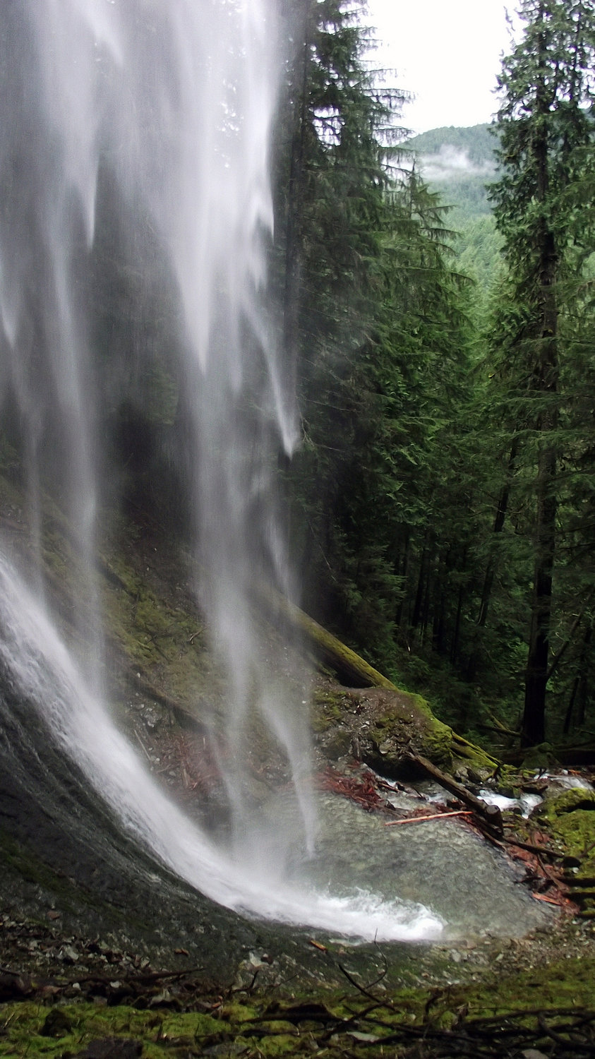
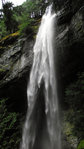
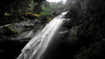
Before, where peaceful streams of trickling water had dribbled along fallen logs and rocks, towered a massive waterfall — estimated in our trail guides to be more than 248 feet tall. As we worked our way toward the underside of the falls, a massive rocky cavern came into view. And, we were able to easily navigate our way behind the waterfall for a quick photo op.
The hike was definitely worth it to see this beauty of a waterfall. Like with the Grove of the Patriarchs hike, near Ohanapecosh at Mount Rainier, it’s so majestic that you feel like you should be whispering. Perhaps that’s, in part, why they call it Cathedral Falls — either because it’s just so darn beautiful, that you compare to a great work of art, such as a cathedral … or because of the spiritual experience it gives you, and how you cannot see it without stirring something inside your own soul.
Although I only highlighted a handful of waterfalls we were able to see, we certainly got to see more than 10 waterfalls in a day, thanks in part to the massive rainfall the night before. Many of these waterfalls are dry by the time summer rolls around, so don’t miss the opportunity to see these majestic beauties in all their glory within the coming weeks, before summer arrives.


