
Residents of the Chehalis Avenue Apartments prepare to evacuate Monday evening.
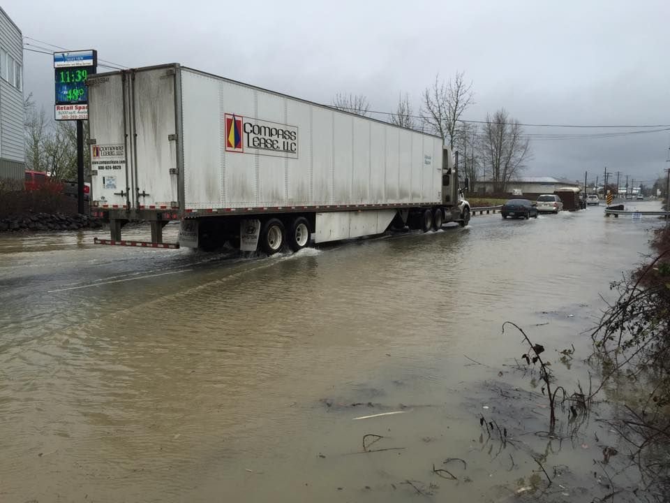
Vehicles drive through water on Kresky Avenue Monday morning.
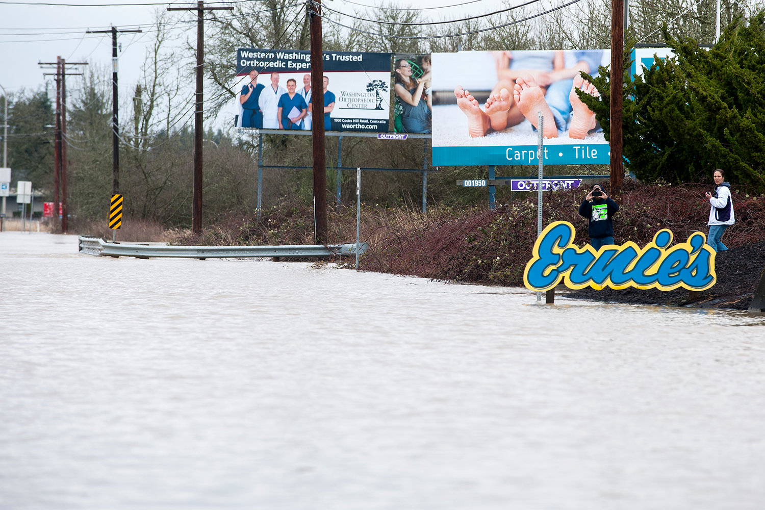
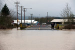
People take pictures of a flooded Kresky Avenue on Monday afternoon in Chehalis.
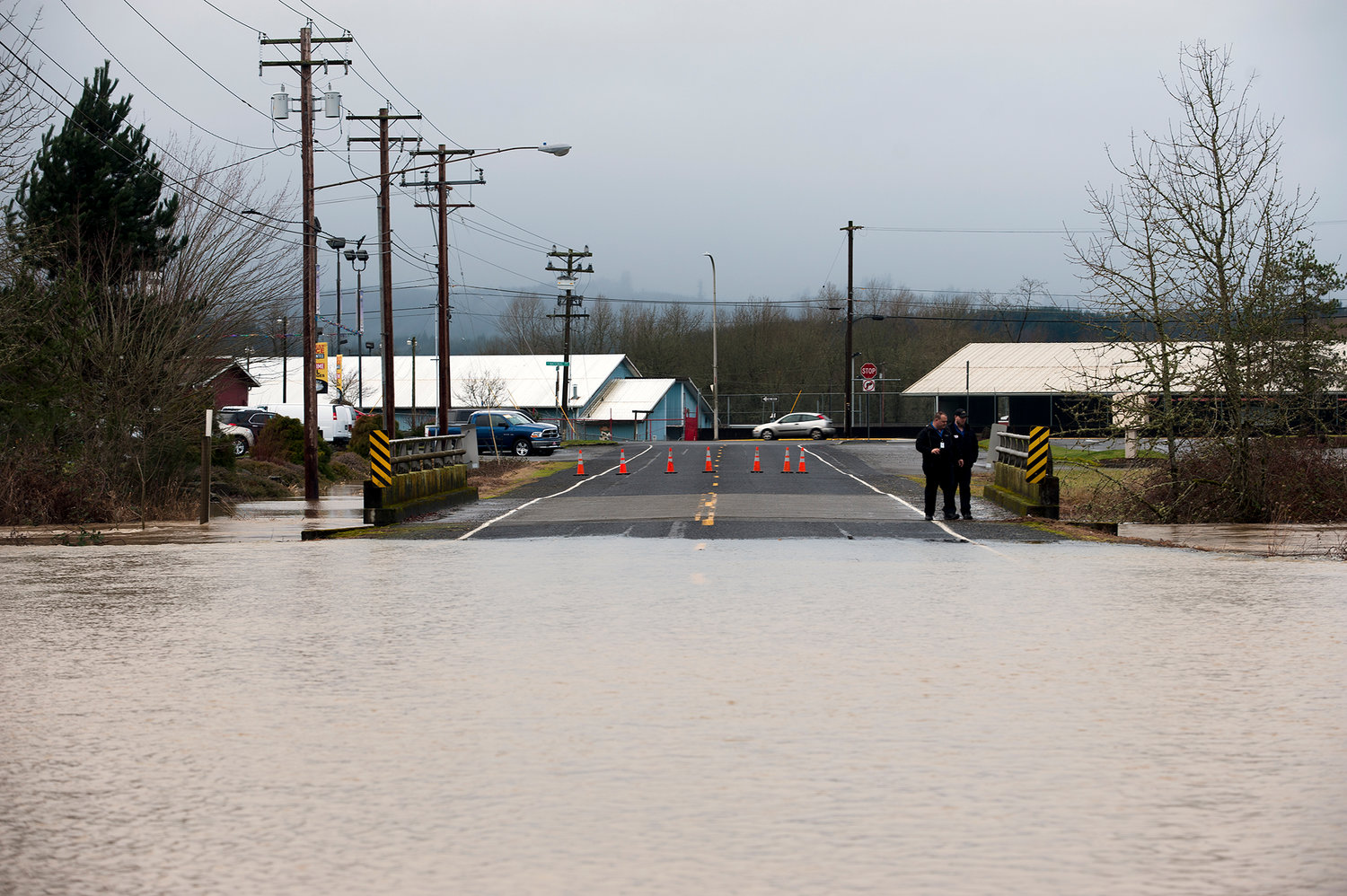
People walk along NE Exhibitor Road where water from a flooded Salzer Creek forced authorities to close the road along with Kresky Avenue on Monday afternoon in Chehalis.

Kresky Avenue floods Monday morning.

People line the doorways of a building on Maple Street with sandbags as flood waters from China Creek creep up the sidewalk on Monday morning in downtown Centralia.

With surveying equipment in hand, Lorna Smith, of Schinnell Surveying, walks along the waters edge at the corner of Ash Street and Centralia College Boulevard while measuring the water levels near her company's office on Monday morning in Centralia.

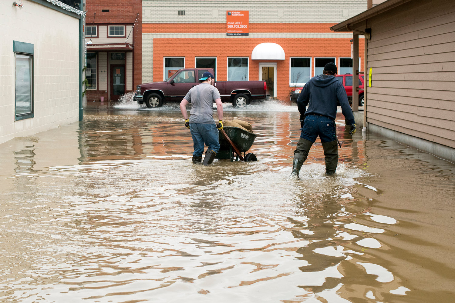
A man walks through water along Maple Street in Centralia on Monday morning.
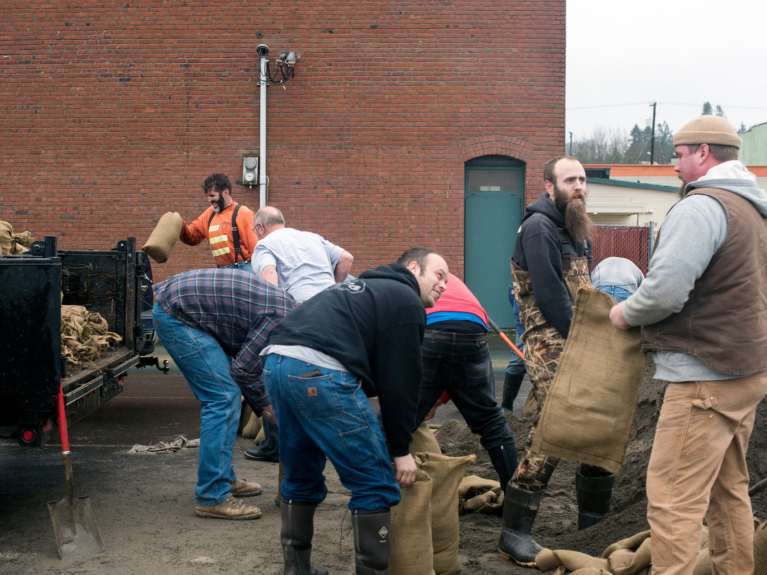
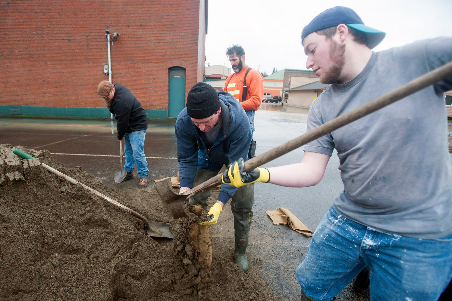
Volunteers fill sandbags behind Bethel Church on Monday morning in Centralia.
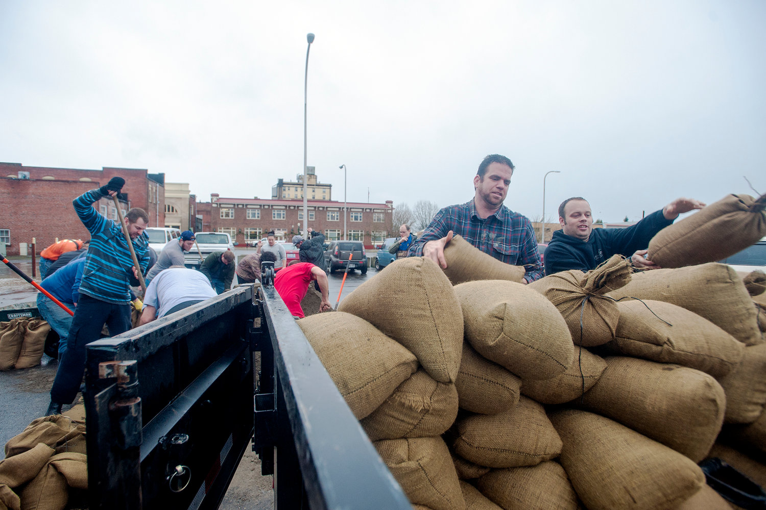
Volunteers load sandbags onto a trailer behind Bethel Church on Monday morning in Centralia.
Ben Howard, left, and Matt Howard, the facilities director at Bethel Church, move sandbags towards the front of the church building along Tower Avenue in downtown Centralia on Monday morning.
Ben Howard, right, and Matt Howard, the facilities director at Bethel Church, fill sandbags behind the church on Monday morning in Centralia.


12:15 p.m.
River levels continue to drop, and with no rain in the immediate forecast, it appears things are winding down. Here's the latest statement from the National Weather Service in Seattle:
FLOOD STATEMENT NATIONAL WEATHER SERVICE SEATTLE WA 1053 AM PST TUE JAN 6 2015 ...THE FLOOD WARNING CONTINUES FOR THE FOLLOWING RIVERS IN WASHINGTON... CHEHALIS RIVER AT CENTRALIA AFFECTING LEWIS COUNTY. CHEHALIS RIVER NEAR GRAND MOUND AFFECTING THURSTON COUNTY. CHEHALIS RIVER AT PORTER AFFECTING GRAYS HARBOR COUNTY. SKOOKUMCHUCK RIVER NEAR BUCODA AFFECTING THURSTON COUNTY. .FLOOD BULLETIN NO. 30 MINOR TO MODERATE MAJOR FLOODING WILL CONTINUE ON THE LOWER REACH OF THE SNOQUALMIE RIVER TODAY...WITH MINOR TO MODERATE FLOODING ON THE SKOOKUMCHUCK... CHEHALIS...SKOKOMISH...AND SNOHOMISH RIVERS. NOTE: THE GAGE READING FOR CHEHALIS RIVER AT CENTRALIA IS LIKELY NOT CORRECT AND TOO LOW. THE UPPER REACHES OF WESTERN WASHINGTON RIVERS CRESTED LATE MONDAY... AND THE CRESTS ARE MOVING DOWNSTREAM EARLY THIS MORNING. THE CREST ON THE CHEHALIS WILL MOVE THROUGH CENTRALIA MIDDAY TODAY...GRAND MOUND LATE THIS AFTERNOON...AND THEN MAKE ITS WAY SLOWLY DOWNSTREAM THROUGH THE LOWER REACHES IN GRAYS HARBOR COUNTY TO THE MOUTH TONIGHT AND WEDNESDAY. PRECAUTIONARY/PREPAREDNESS ACTIONS... DO NOT DRIVE CARS...VANS...OR TRUCKS THROUGH FLOODED AREAS...THIS IS THE CAUSE OF MOST FLOOD RELATED DEATHS IN WASHINGTON. BE ALERT FOR RAPID CHANGES AND MONITOR DEVELOPMENTS BY LISTENING TO NOAA WEATHER RADIO OR OTHER LOCAL MEDIA.
10 a.m.
The Lewis County Emergency Operations Center has been deactivated. The Centralia Emergency Operations Center was deactivated at 5 p.m. Monday Below is the full press release from the sheriff's office:
Lewis County Department of Emergency Management de-activated the Emergency Operations Center this morning after Lewis County Rivers crested overnight. The Newaukum River crested at 1600 hours yesterday afternoon at 13.16 feet which was barely below record flood stage (13.5 feet). The Chehalis River crested at 0530 hours this morning at 62.25 which was below minor flood stage. The Skookumchuck River crested at 0300 hours which was below minor flood stage at 83.78 feet.
Only four houses in the county reported water damage. Two of the houses were on Rosebrook Road. The other two were off of Jackson Highway near the Newaukum River.
Anyone with damage to report should call (360) 740-1152.
Several roads were closed throughout the day and some still remain closed due to water over the roadway. Status of roads affected by flooding can be checked at the following link http://roads.lewiscountywa.gov/ .
No injuries were reported due to flooding.
Sheriff Rob Snaza said, “I am thankful conditions were not worse and did not rise to the level of the 2007 floods, but we were ready if conditions became worse. The teamwork and partnership between Lewis County Public Works and the Sheriff’s Office yesterday made a big difference in getting issues taken care of quickly”.
Tim Elsea, Public Works Director and County Engineer stated, “I am proud of the work the road crews did yesterday. We were inundated with roads being closed. The crews worked tirelessly to get roadways opened as soon as possible for the traveling public. Crews worked into the night, gravelling and grating Guerrier Road so residents, who were otherwise stranded, could travel to and from their homes”.
8 p.m.
Trevor Dahlberg and his girlfriend and two daughters live on the first floor of the Chehalis Avenue apartments and are leaving now.
He said he is taking collectibles, beds and toys in hopes of saving them from rising floodwaters.
He said he's lived at the apartments for three years.
"Had a couple close calls, but this is the worst yet," he said.
"The kids think it's awesome. They want their bedrooms to be a swimming pool, but I told them no," he said.
Teresa Steffens said she believes the water is still rising. She's lived at the apartments since 1994.
She said she walked to the store ealier in the day because she thought the weather would take a turn. She lives on the second floor and plans to stay.
"There's nowhere to go. There's no shelter for us," she said. "And I don't want to leave my animals."
More to come
7:52 p.m.
A Chronicle reporter has spoken with Lewis County Central Dispatch, which reported that emergency workers have been actively looking for a supposed breach in a dike or berm in the area of Chehalis Avenue, but have not found one.
Water continues to rise in the area.
According to a dispatcher, numerous citizens have reported a breach, prompting the search.
She said water might be overtopping the flood prevention structure.
7:30 p.m.
The Chehalis Avenue Apartments are currently being evacuated.
Residents of the first floor are carrying out possessions and loading trucks.
Damian Garcia, of Napavine, is helping.
"The police made their final run about 20 minutes ago and told us we should leave," he said, adding that he had been there since early this afternoon.
7:15 p.m.
Still no confirmation following scattered reports of a dike or berm breach near Chehalis Avenue, but water continues to rise in the area.
Some residents in the area say they have been advised by police to elevate their belongings and evacuate.
Chronicle reporters are at the scene and will bring updates as they are available.
7:00 p.m.
Water reported over both lanes on Airport Road.
6:47 p.m.
Water is rising fast in several Chehalis neighborhoods.
A call has been placed to the Lewis County Emergency Operations Center, and more information will be published as soon as it is available.
5:20 p.m.
Old Highway 99 has been closed just south of The Junction due to water over the roadway.
Meanwhile, the Newaukum River has crested and is beginning to subside.
The Chehalis and Skookumchuck rivers continue to rise, but neither is expected to cause major flooding.
Check www.chronline.com and www.lewiscountywatch.com for more detailed updates.
4:10 p.m.
The city of Centralia will be closing its emergency operations center at 5 p.m. The full press release is below:
The City of Centralia Emergency Operations Center (EOC) is expected to be closing at 5pm today.
Citizens within the City of Centralia can call and report any water damage to homes and businesses to the City of Centralia Community Development Department on January 6, 2014 at (360)330-7662. Paperwork for water damage can be completed over the telephone; if this incident is later determined to be a eligible for benefits.
Please remember that many roads are still closed and it is unlawful to drive past road closure signs. Driving past a road closure sign is a $124 traffic infraction. Although you may not see excessive water over the roadway or extensive damage, the roads are closed for the safety of the public.
3:15 p.m.
Floodwaters on streets in downtown Centralia and surrounding areas have receded significantly, though many roads continue to be impassable.
Meanwhile, the Newaukum River is nearing 13.15 feet, close to where the National Weather Service predicts it will crest.
1:45 p.m.
From the Rochester School District:
Due to water and/or debris over the roadway bus routes 1 & 6 will be impacted this afternoon (1/5/2015) and likely again tomorrow (1/6/2015).
Students north of 6410 Mima Road will not be transported due to a road closure.
Students south of 6410 Mima Road will get off at 170th and Mima or Hunter at Hunter Loop - per emergency routes.
Students on Littlerock Road north of Sargent will not be able to transport due to a road closure.
1:40 p.m.
Three Thurston County roads are closed as the Skookumchuck and Chehalis rivers continue to rise. Here is the full press release from Thurston County Public Works:
Three roads in south Thurston County are closed today due to water over the roadways. More rain and some river flooding is forecast for the area through Tuesday, January 6, so drivers are reminded to use caution and not to drive on any flooded roads, even if there are no “Road Closed” signs posted:
“More rain is expected, and we’ll likely be adding to this list of closed roads, so we want to remind drivers to stay safe and avoid all flooded roads,” says Thurston County Emergency Manager Sandy Johnson, “even if they don’t see any signs or barricades.”
The National Weather Service has issued a Flood Warning for the Skookumchuck and Chehalis rivers, and a Flood Watch for other rivers in Thurston County through Tuesday afternoon, January 6. Current forecasts predict that both the Skookumchuck River and the Chehalis River will exceed flood stage.
The Skookumchuck River at the Bucoda gage reached flood stage (13.5 feet) at about 10:30 a.m. today, and will crest at about 14.27 feet around 10 p.m. tonight. This minor level of flooding is likely to flood local roads in spots and may flood low lying structures.
The Chehalis River at the Grand Mound gage is predicted to reach flood stage (14 feet) at about 10 p.m. today and crest at about 15.39 feet around midnight tonight. This moderate level of flooding is likely to cause several roads in the Independence Valley area to flood, including James Road, Independence Road, Moon Road and Anderson Road. Drivers are reminded to use caution and not to drive on flooded roads.
Thurston County emergency management officials are also keeping a close eye on the Deschutes River. Currently, the Deschutes River is predicted to crest below flood stage this afternoon.
River conditions can change rapidly, so residents should stay tuned to the National Weather Service website, NOAA weather radio, the Thurston County Emergency Management website and local news for updates.
1:16 p.m.
Crews have also blocked off Northeast Exhibitor Road, which connects Northeast Kresky Avenue and North National Avenue/South Gold Street.
12:53 p.m.
The Morton Senior Center is closed today due to a weather-related sewer backup.
12:31 p.m.
Kresky Avenue is being closed as water continues to rise. Check back for additional updates.
12:30 p.m.
All K-8 after school programs in the Centralia School District are canceled Monday night due to weather conditions.
12:25 p.m.
The latest update from the city of Centralia includes news that China Creek levels appear to be dropping, though several roads are still inundated. Here's the full press release:
The City of Centralia Emergency Operations Center (EOC) is still activated due to high water in the downtown Centralia area.
China Creek is the main current water source causing flooding; however it appears the creek water is going down.
The water levels at Salzer Creek appears to be increasing slightly or remaining the same.
There is a current Level 1 (minor) flood warning for the Skookumchuck River near Bucoda, WA (Thurston County).
The following roads are closed due to water over the roadway (as of 12:15pm):
If you live on or near a hill in danger of landslides, please be aware of the following landslide warnings:
* Soil moving away from foundations
* Tilting or cracking of concrete floors and foundations
* Leaning telephone poles, tress, retaining walls or fences
* Faint rumbling sound that increases in volume as the landslide nears
* Unusual sounds, such as trees cracking or boulders knocking together
11:15 a.m.
Here are a few stories from chronline.com. We'll have more throughout the day. Check www.chronline.com and lewiscountywatch.com frequently, as not all posts will be repeated in this thread.
Bucoda Dry for Now:
http://www.chronline.com/crime/article_dd36dffe-950a-11e4-a2c6-c7c95a46298b.html
Sandbags Offered:
http://www.chronline.com/crime/article_6d7eecc4-9505-11e4-abe2-cb1c3d32108e.html
City Hall Flooded:
http://www.chronline.com/crime/article_c605a38e-9504-11e4-905b-1f129ae79100.html
10:30 a.m.
The city of Centralia has issued the following press release:
As of 7:30am, the City of Centralia has activated the Emergency Operations Center (EOC) due to high water in downtown Centralia.
The following roads are closed due to water over the roadway (as of 10am):
Drivers are reminded to slow down when driving through standing water on the streets. Going too fast can cause drivers to lose control of their vehicles. Also the wake from the vehicles can cause houses and property to be flooded with additional water.
It is unlawful to drive past road closure signs. Driving past road closure sign is a $124 traffic infraction.
Sandbags are available to citizens at:
100 block of W. Center Street
10:15 a.m.
Centralia College is keeping a rolling update of canceled classes and events. See the updates here: http://www.centralia.edu/academics/cancellations.html
9:50 a.m.
Centralia City Hall is currently taking on water. City officials say it's the first time floodwaters have entered the building in recent memory. Look for a full story at www.chronline.com and www.lewiscountywatch.com.
9:29 a.m.
Several schools are affected by the flooding situation this morning.
Morton School District has closed for the day and all preschool classes are canceled.
Pe Ell School District is operating two hours later than normal due to water on state Route 6.
Buses in Centralia and Chehalis operated on the safest routes possible, according to the transportation department that oversees both bus operations. However, school has continued as normal in Centralia and Chehalis so far.
9:15 a.m.
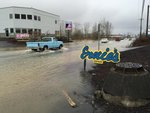
Urban flooding is occurring in Centralia, with China Creek overtopping its banks in several areas.
Travel in the Hub City is impacted, with Main Street being closed just east of Yew. Water was flowing over the roadway at Centralia College Boulevard and Washington Avenue also, but college classes appeared to still be ongoing.
At 9 a.m., public works crews began to block off Maple Street between Tower and Pearl in downtown Centralia. Traffic was moving slowly through several inches of water on both Pearl and Tower.
Several other streets in the area are impacted along China Creek.
We'll have more information on this story as soon as it becomes available.
7:41 a.m.
Several areas have experienced flooding this morning as more than 3 inches of rain have fallen over the past 24 hours in some areas of Lewis County.
The National Weather Service has issued a flood warning for the Newaukum River through Tuesday morning. That warning is now in effect as the river has reached 10.6 feet, a Phase 2 flood in the Lewis County flood system. It is expected to crest at 13.4 feet this afternoon, just below record level.
Heavy rains have caused urban and small stream flooding in several areas. Water was reported over roadways in several low-lying areas around the Twin Cities. China Creek in downtown Centralia has spilled its banks also.
According to observations at several stations that report to National Weather Service, rain totals in some places have approached three to five inches over the past 24 hours. The Tilton River near Cinebar received 4.6 inches of rain, Chehalis received 2.9 and Onalaska received more than 3.5 inches.
A flood watch for Lewis County has been extended through Tuesday as several rivers can experience minor to moderate flooding. Locations include the Chehalis River at Centralia and Grand Mound, Skookumchuck at Bucoda and the Cowlitz River at Randle.
Meanwhile, the Lewis County Department of Emergency Management has activated the Emergency Operations Center.
The department reports water over roads in several places near the Newaukum River and urges people in low-lying areas to move animals to higher ground. People needing sandbags can buy them at Martin Sand and Gravel, Home Depot and Sunbird.
The Chronicle will stay on top of the flooding situation with frequent updates on Chronline.com and LewisCountyWatch.com.


