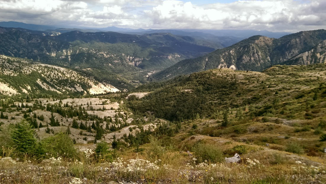
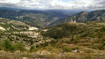
Even on days in which Mount St. Helens isn't completely visible due to clouds, you can still be rewarded with sweeping views of the Gifford Pinchot National Forest to the east from the Truman Trail a couple miles from Windy Ridge.
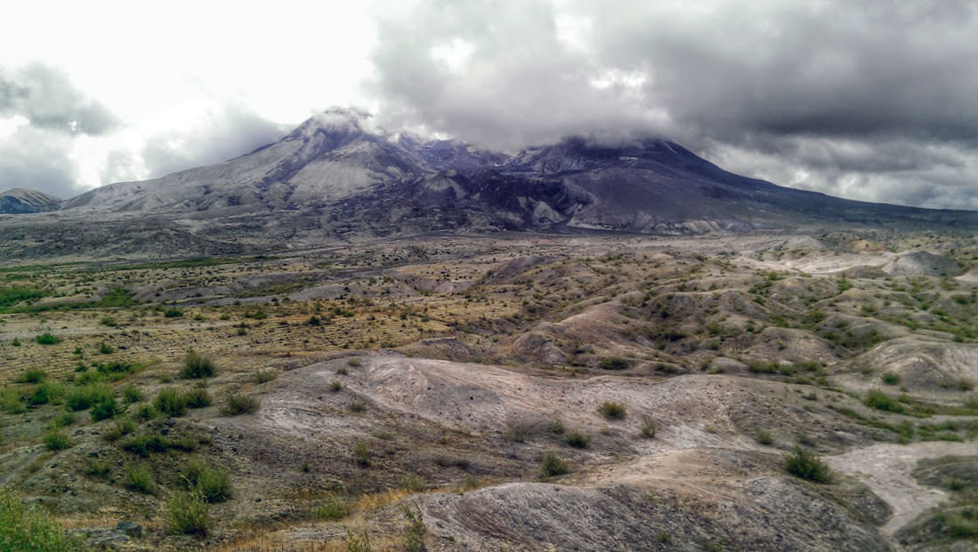
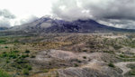
Sometimes Mount St. Helens opts to hide behind a veil of clouds, but that doesn't make a hike in the National Volcanic Monument any less impressive. The mountain still looms despite the clouds surrounding it in this photo shot Sunday.

Part of the Truman Trail near Windy Ridge traverses a service road used to get to a pumping station near Spirit Lake. It's closed to general vehicluar traffic, but as a path it is easily navigable and provides some good views.
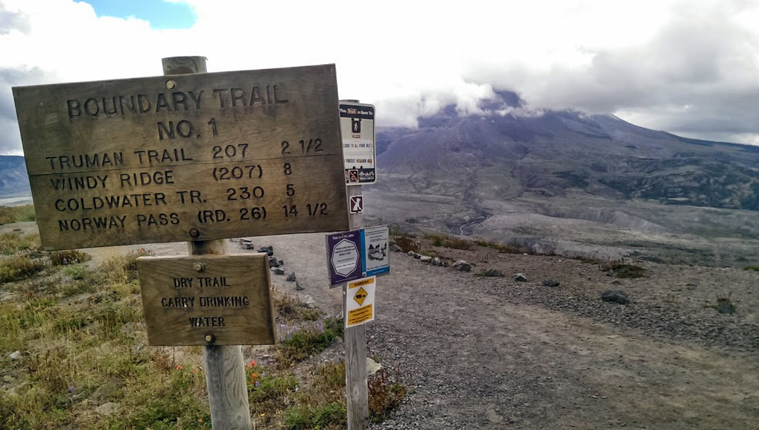
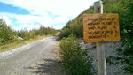
A sign at the Johnston Ridge Observatory states Windy Ridge is eight miles away, but it is closer to nine in reality.
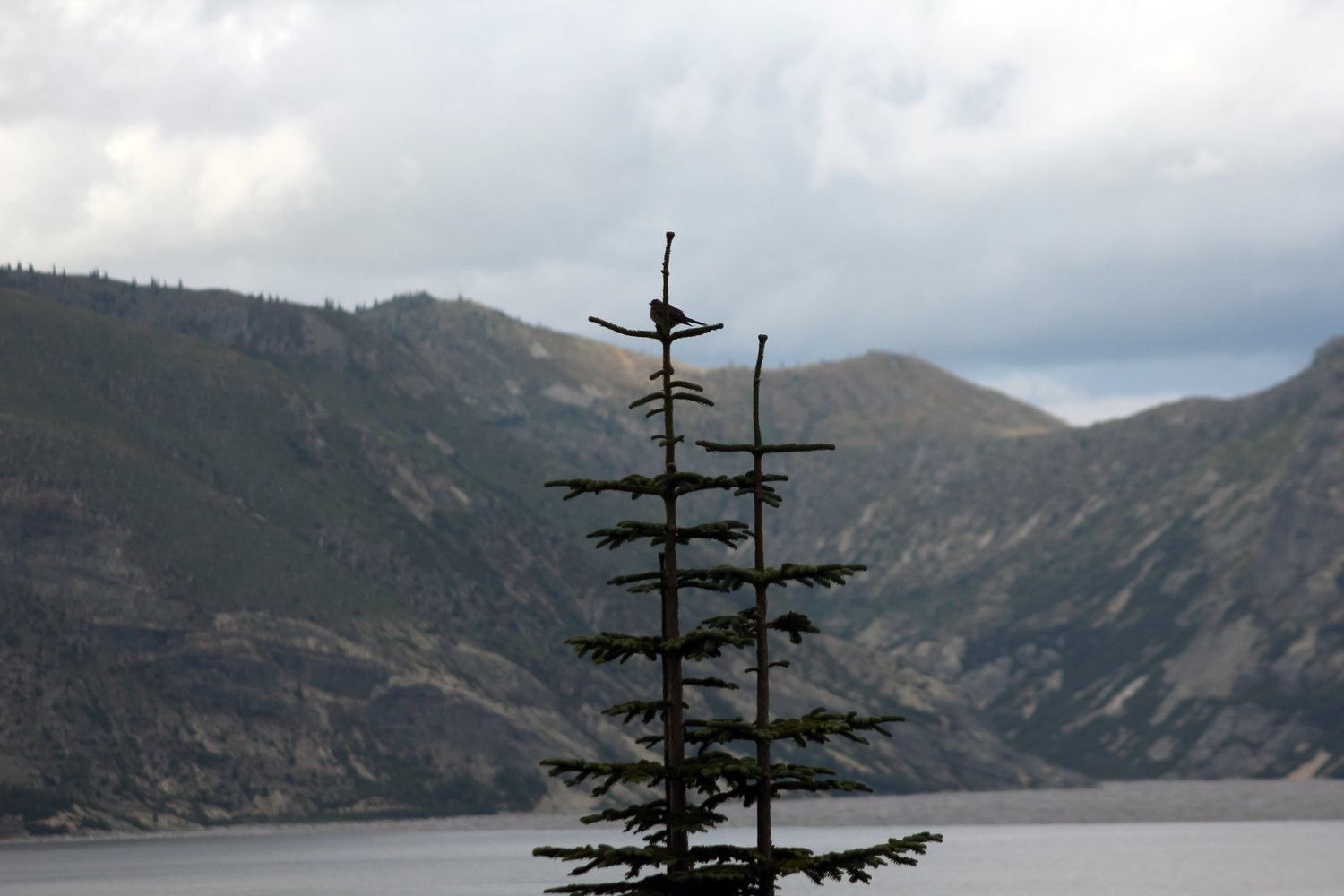
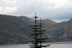
A small bird is perched on the top of a tree with Spirit Lake in the background in September 2014.

Have you ever wondered why there isn't a road that runs east-west on the north side of Mount St. Helens?
For travelers to the Mount St. Helens National Volcanic Monument, a road connecting Johnston Ridge Observatory and Windy Ridge would make sense, enabling tourists to visit both monuments and viewpoints in one day. But alas, no such extension of either state Route 504 or Forest Road 99 exists or is even remotely in the works, rendering a trip by vehicle to both points a long and arduous journey, a nearly three-hour trek between viewpoints that lie a mere 9 miles apart.
That's not to say you still can't visit both viewpoints in one day, however. The adventurous will have to do the next best thing, transitioning from four wheels to two feet for a roughly 18-mile round-trip journey that visits two of Mount St. Helens' most-visited tourist sites.
You can start from either Windy Ridge on the east side of the mountain — many know the drill, take U.S. 12 to Randle, then head south on Forest Road 25, and take FR 99 to the end — or Johnston Ridge Observatory, in which you drive through Toledo and eventually meet up with SR 504 east of Toutle, and drive that to its end.
My hike between both points on Sunday started at the Johnston Ridge Observatory in Skamania County, so that's where this informal guide will begin.
Park at the observatory's large parking lot and find the trailhead for Boundary Trail 1 on the lot's north side. Make sure you have shoes with good tread, plenty of water, some food and a couple trekking poles (I got a pair at Sunbird for $20), and hit the trail.
The first mile especially is big for tourists who wish to venture out a fair amount from the observatory, so note there might be a lot of traffic on this portion of the trail. Exercise some patience and take a minute or two to appreciate the view directly into the crater on a sunny day; even on a day filled with clouds, the mountain still stands impressively.
At about mile 1.6, you'll encounter your first challenge. A narrow stretch of trail with a steep dropoff to your right will test those with trepidation of heights, but as long as your footing is sure, you'll be through it in no time. You will be rewarded with an unobstructed view of the mountain and pumice plains below — you'll be headed that direction in no time.
The Boundary Trail greets the Truman Trail at the 2.5-mile mark, and you'll take the Truman Trail as it descends down into hummocks, which are pieces of the mountain deposited in the 1980 eruption. Cross a couple streams using rocks as a makeshift bridge and continue following the trail until it flattens out at about the 3.6-mile mark.
Now you're in the pumice plains, and the landscape has shifted dramatically to a rather flat area. For the next two miles, you'll hike with the mountain looming directly in front of you, with Loowit becoming larger with each step. The lava dome in the middle becomes easier to see, and it's hard to not take a second, stare at it and marvel at its size — then the realization hits that the mountain is rebuilding itself.
Yogi Berra once said, "When you come to a fork in the road, take it." I appreciate a good Yogi-ism, but it helps on a hike such as this to know which fork to take once you happen upon the intersection with the Willow Springs Trail. Bear left to continue on the Truman Trail, and before long you'll notice that you're circumventing Spirit Lake's southern shore.
One area can prove tough to navigate, as the Truman Trail seems to disappear at a crossing over a rushing creek. A couple man-made obelisks of rocks help guide the way, however, and point you back to where the trail ducks under some trees and back into the open again.
About 6.5 miles in — you're only 2.5 miles from Windy Ridge! — you'll step over a bunch of rocks that have slid off a facade of the mountain and cover the trail. Once you're through that, the trail will gently ascend for the next couple miles.
After its intersection with the Windy Trail, Truman Trail widens considerably and makes a big turn as it follows an old service road to the Windy Ridge Trailhead. Look to your right and you can see the vast expanse of the Gifford Pinchot National Forest with a seemingly painted-on array of hills, trees and mountains; look back and to your left and you can see Mount St. Helens keeping watch over your journey. Listen closely at certain times and you can hear a melodious cacophony of elk calling, birds singing, wind whipping and insects fluttering.
Truman Trail begins to descend over the last mile as you get closer to the Windy Ridge Viewpoint. In the distance, the cars in the parking lot and the trail of stairs leading to the viewpoint itself become clearer, until — voila! — you've successfully bridged a gap that cars cannot do, while taking in the surreal views of Mount St. Helens and the landscape around.
If you're in great shape or feeling extra adventurous, feel free to head up the trail of stairs to the viewpoint. On a clear day, the view at the top can serve as a wonderful view with which to celebrate reaching the halfway point of your journey, before you have to turn around and retrace your steps for a trip you'll be all too excited to tell your friends and family about.
•••
Christopher Brewer: (360) 807-8235


