
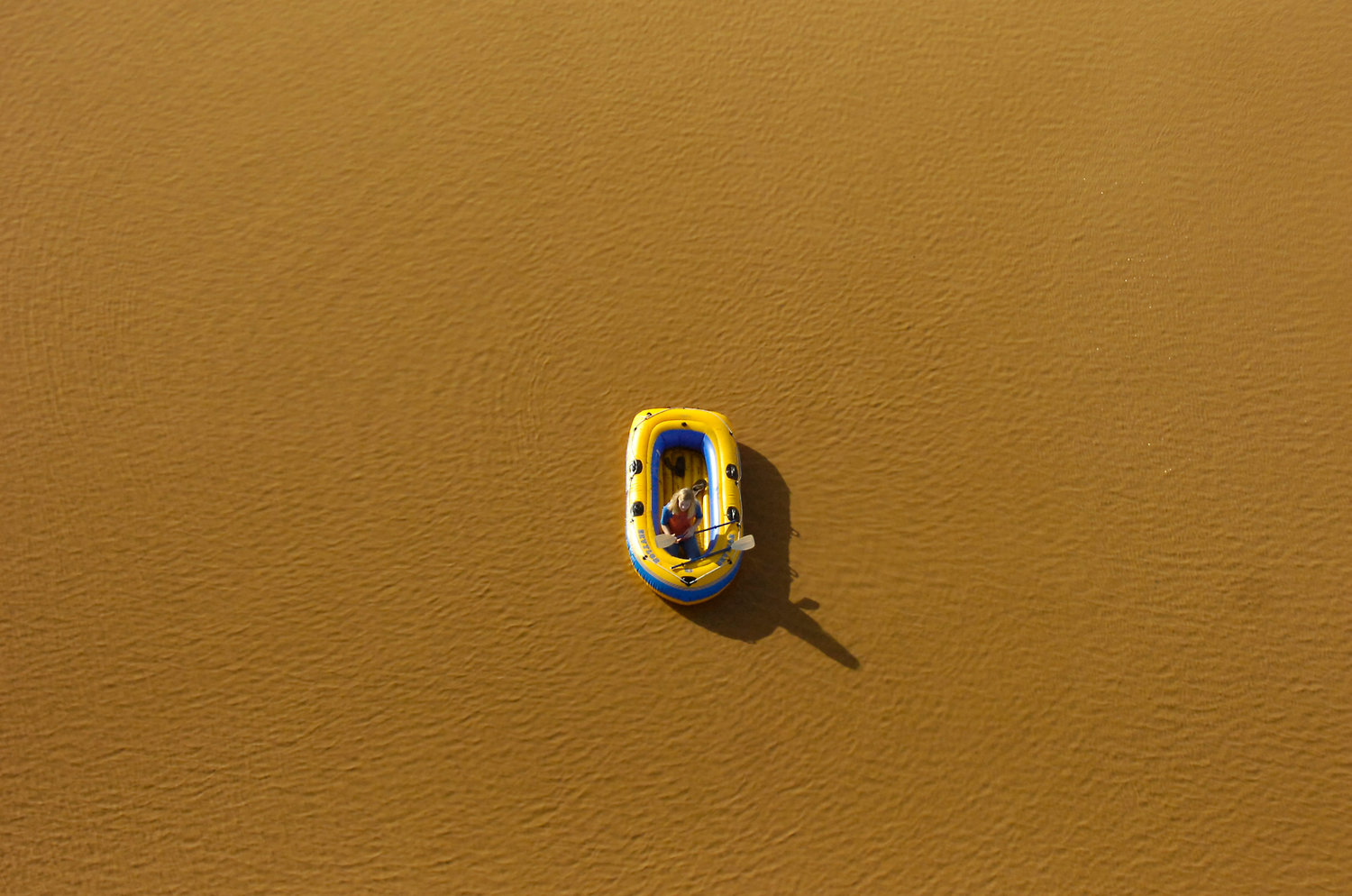
A young rafter is surrounded by floodwater in this photography taken from the air in December 2007.
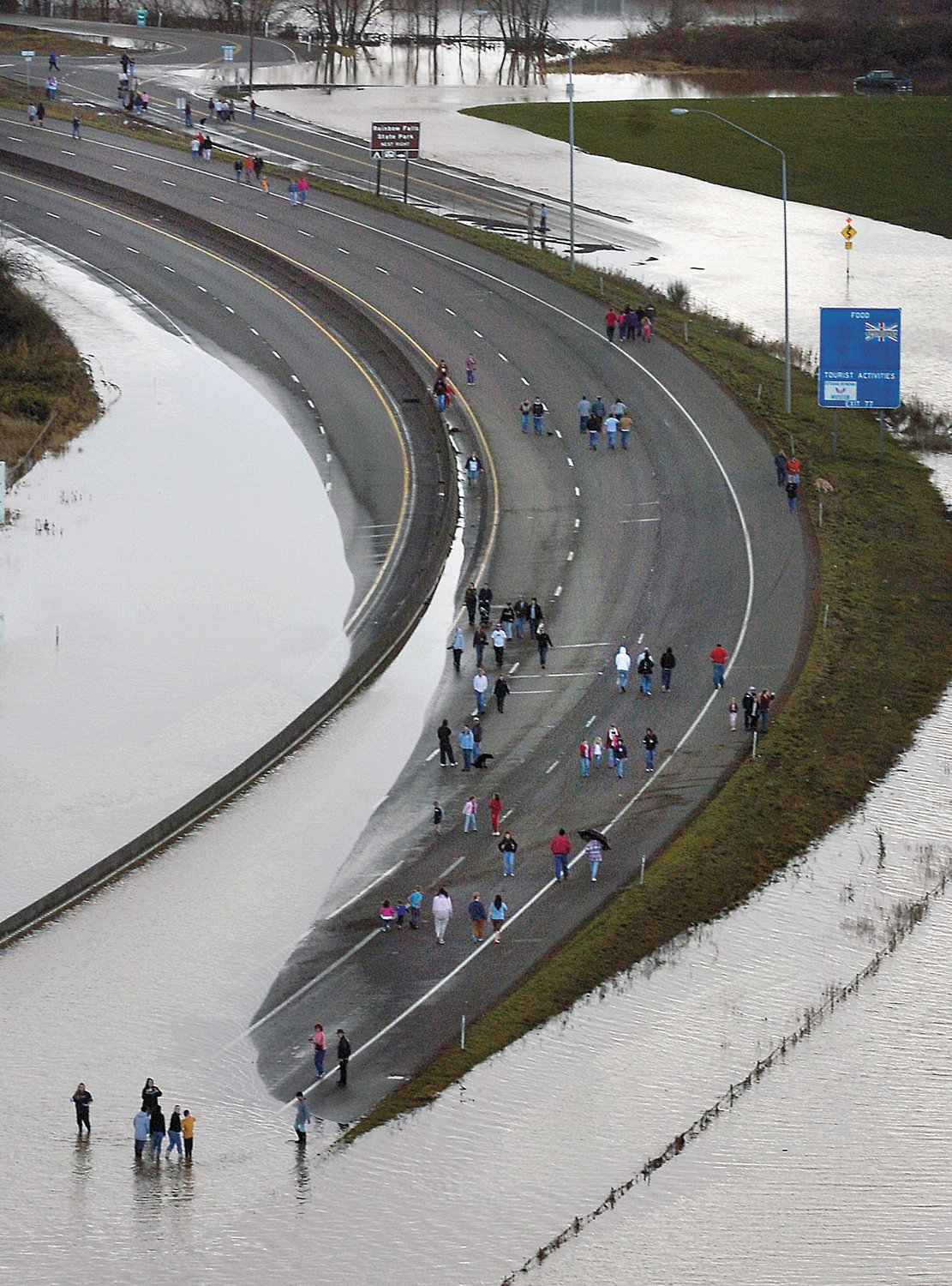
People gather on the lanes of flooded Interstate 5 near Chehalis on Tuesday, Dec. 4, 2007 after severe flooding in Lewis County, Washington caused the major north/south freeway to shut down.
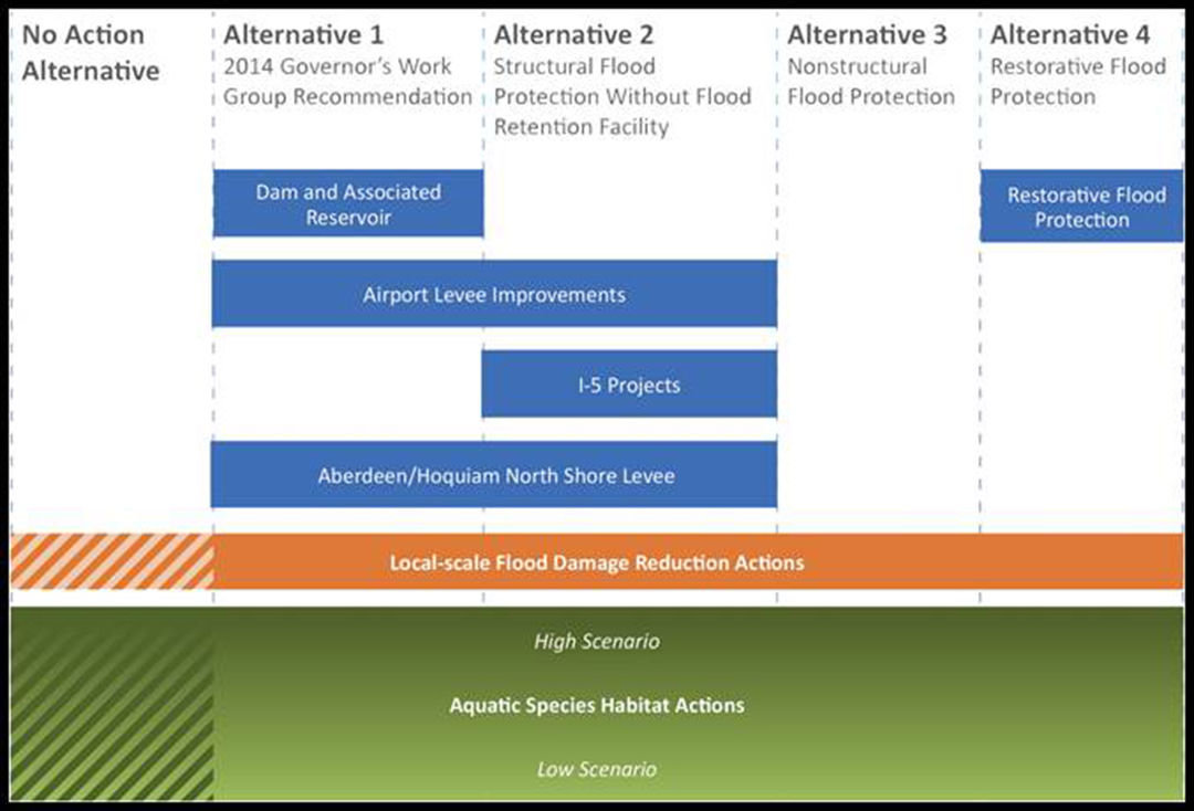
Programmatic Environmental Impact Statement Alternatives
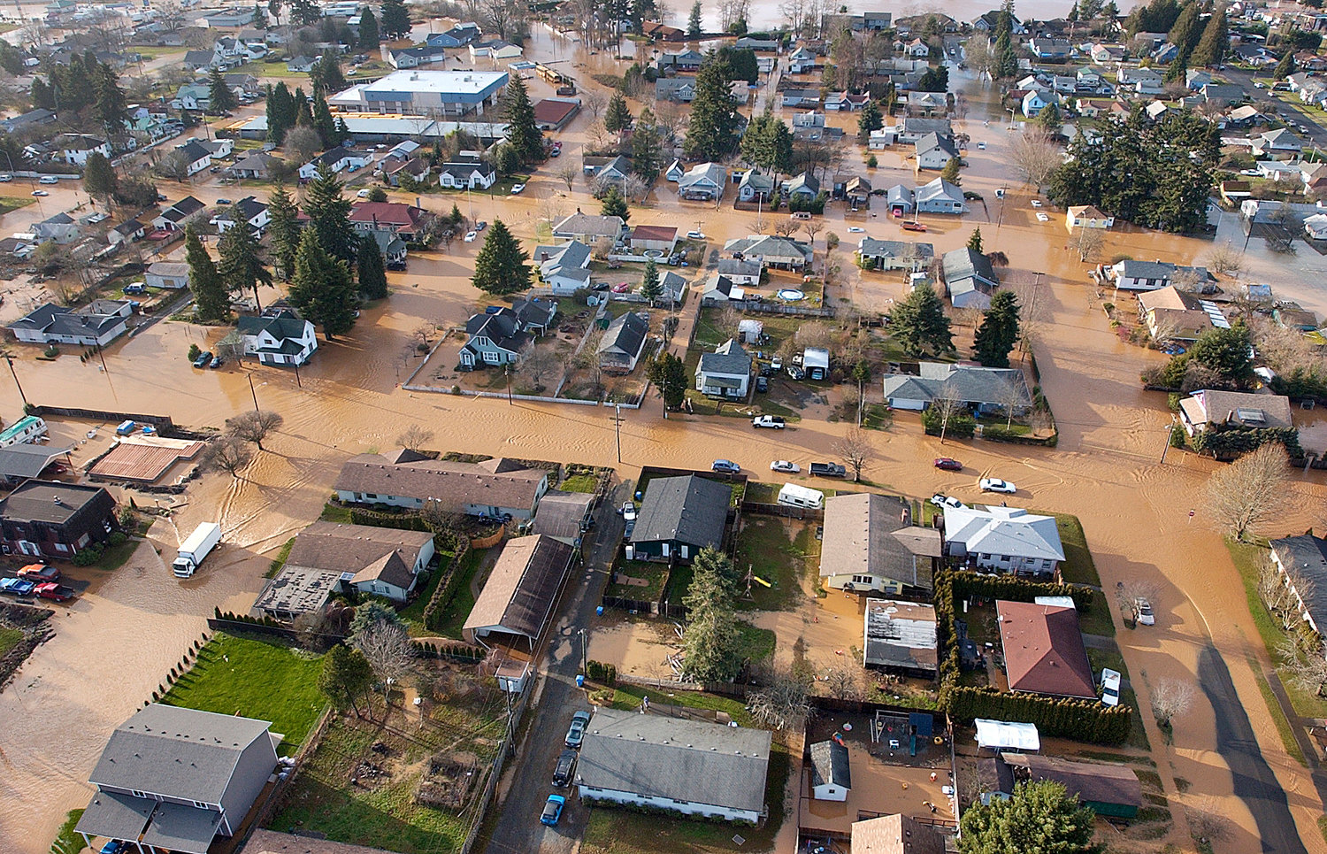
A Centralia neighborhood sits flooded as a result of severe storms that hit in December 2007.


Today, the state Department of Ecology released a comprehensive, 1,000-page report that represents decades of studies, volumes of recent research and a period of unprecedented collaboration between the governments of the Chehalis River Basin on the topics of flooding and aquatic species habitat restoration.
The draft of the long-awaited Programmatic Environmental Impact Statement also reflects the culmination of nine years of local flood prevention work since the disaster of December 2007.
At its core, the report outlines four specific alternatives for restoring or creating salmon and aquatic species habitat while also reducing flooding in the basin, from the headwaters of Pe Ell to Grays Harbor.
The accomplishment of both goals — flood protection and fishery enhancement — will be pursued amid the backdrop of climate change, the impacts of which are analyzed within the report. In short, it predicts an increase in the severity of flooding with a parallel decline in the populations of salmon and other aquatic species unless action is taken.
As always, doing nothing is an option, according to five people close to the efforts who met with The Chronicle for a briefing on the report Tuesday. They caution, though, that to do nothing would be to accept environmental consequences along with billions of dollars in damage, economic and otherwise.
Failure to arrive at a decision on the available options would likely result in a colossal setback following years of advances, said J. Vander Stoep, a member of the Chehalis Basin Flood Authority and the Governor’s Work Group.
The state Legislature allocated about $50 million to the basin in 2015, funding many local flood protection and habitat enhancement projects, along with work on the programmatic environmental impact statement
It’s unlikely there will be similar state investments in the future if leaders are unable to seize the momentum now, Vander Stoep said.
“I believe given the time, focus, money, energy and thought that’s gone into this, we are at a generational crossroads,” Vander Stoep said. “This will either come together … or it’s going to fall apart, and I can’t imagine there is enough energy in the basin to come this far again in this generation.”
The four alternatives include elements of many proposals and ideas familiar to those who have followed the long, complicated and sometimes controversial pursuit of a successful, major flood mitigation project. It also includes new research and accompanying proposals on the health of the aquatic species of the basin compiled over the last several years.
All of the scenarios include a common backbone: they would each be paired with actions geared toward local-scale flood damage reduction and improvement of aquatic species habitat, from the purchase of land from willing owners to ongoing projects by cities, counties and tribes. The scope of those efforts, and the investment needed to make them happen, will in the end vary depending on what alternative — and which aspects of the others — are included in the final draft.
Alternative One represents the 2014 recommendation of the Governor’s Work Group, a plan that includes a dam and reservoir in the upper reaches of the basin near Pe Ell, along with improvements to the Airport Levee and the construction of the Aberdeen/Hoquiam North Shore Levee.
Alternative Two doesn’t include a dam, but instead relies on a series of new and improved levees and dikes in the Twin Cities, elements similar to those found in a previously abandoned proposal by the U.S. Army Corps of Engineers. It also includes the Aberdeen/Hoquiam North Shore Levee.
Alternative Three focuses on non-structural flood protection, hinging largely on the potential purchase of property from willing landowners.
Likewise, Alternative Four proposes returning the upper portion of the basin — beginning at the confluence of the Newaukum River — to a more natural state, allowing for the retention of more water in the natural floodplain and easing the flow during high-water events. It, too, would require the state’s purchase of property from willing landowners.
“Landowners will decide what makes sense and whether or not it’s going to be successful here,” said Jim Kramer, a consultant who helps facilitate the Governor’s Work Group and the Flood Authority. “It’s the landowners who will determine if this happens or not.”
While the proposals are packaged in four categories, the chosen path will likely include elements of several of them, said Chrissy Bailey, EIS project manager for the Department of Ecology. Exactly what makes the final report, which is expected sometime next year, will depend in part on input from the public.
In the next month, two public meetings have been scheduled to educate residents and provide the experts and government leaders behind the report an opportunity to address the community directly. Meanwhile, some 5,000 postcards with details of the Programmatic Environmental Impact Statement have been sent to residents of the basin, highlighting the upcoming public meetings and other ways to submit comments.
The input, to be collected for the next month, will be weighed by the Governor’s Work Group, which will consider the comments from the public and input from government leaders and experts to determine which of the four alternatives — or variations thereof — will be recommended to the governor by late November for inclusion in his 2017 budget requests. From there, it would be up to the state Legislature, which convenes in January, to approve funding and create a way for the chosen alternative to move forward.
That would include funding for the Office of the Chehalis River Basin, a body formed by lawmakers last year that is primed to become the successor to the current Governor’s Work Group. The Office of the Chehalis River Basin was modeled after the only other office of its kind in the state, the Office of the Columbia River Basin.
No matter what proposed solution is chosen, it will likely be costly.
Estimates provided within the report show cumulative costs, depending on the actions chosen, of anywhere from $400 million to $1.8 billion. That is being weighed against a projected $3.5 billion in predicted damage due to flooding over the next 100 years without action being taken. That doesn’t include the effects of climate change.
After early years of occasional infighting and a lack of cooperation between governments in the basin, the state’s lead floodplain manager told The Chronicle there is reason to be optimistic about the current effort.
“Sometimes we get situations where relationships are hard, but we’ve been most impressed with the respect and trust they have in each other,” Gordon White, the Department of Ecology’s state floodplain manager, said in regard to the Governor’s Work Group. “I’ve seen members who are from one interest advocate for the other interest across the table and vice versa. I’ve seen it in the communities too, when we’ve gone on tours with landowners, with fishery people. They get the equation. They need to do something and do it together, and so we feel quite honored to be able to participate in this programmatic EIS process and hopefully into the future.”
Here are some additional details of each of the proposed alternatives:
Alternative One: 2014 Governor’s Work Group Recommendation
Cost: $600 million to $1.2 billion
Alternative One includes building a dam and an associated reservoir 1 mile south of Pe Ell. Two variations of the dam are being considered. One would be a flood retention only dam with no permanent reservoir. The dam would be approximately 228 feet tall and have a base width of about 220 feet at the maximum section of the dam, according to the final Water Retention and Fish Passage Report prepared by HDR Engineering in October 2014.
With this option, there would be gates in the middle of the dam, with three different conduits that allow for fish travel.
Vander Stoep said the only time water would be held by the gates is when there is a storm big enough to generate a flood event.
“Slowly you lower (the water level) back down and then in most days the river is flowing at its same pace, its same volume that it’s flowing today,” he said.
The flood retention only dam is an innovative approach because one of this size has never been built before, said Steve Malloch, a member of the Governor’s Work Group and an environmental activist.
“I think it’s a good thing we are considering this innovative approach that gets around at least some of the impacts of dams that have long been a concern to the environmental community, but it is innovative, which means we don’t have an example of exactly this dam having been built,” he said.
The second option is a dam with a reservoir that would store water and slowly release it in the spring and summer months.
According to Kramer, this option will probably generate more negative comments from the community.
“The dam is so high and the water fluctuations in the reservoir are so great, passage is very challenging to do for the one that holds water and releases it in the summer,” he said. “The cost of the passage facilities we are looking at are in the $100 million range for that type of dam, and they have some success for some species, but, as an example, lamprey couldn’t move up.”
If selected, this version of the dam would likely see the elimination of lamprey in the upper basin, Kramer said, along with a measurable local decrease in spring chinook and other species.
Vander Stoep said both of the dams have the same flood reduction effects. What changes is flow augmentation and fish passages.
Alternative One would cost between $600 and $900 million dollars with the low end of aquatic species habitat actions, while higher restoration efforts bring the price tag between $900 million and $1.2 billion.
Those costs include the entire scope of the project, not only the dam, but also flood proofing and smaller projects such as the levees.
Numbers provided by Kramer indicated the frequency of big storms will not increase, but the magnitude of them will. The 100-year flood is expected to increase 66 percent in terms of flow, resulting in a dramatically larger flood event than that of 2007. Since 1986, the basin has experienced the five highest flood peaks since 1932, resulting in the modeled 100-year flood level increasing 33 percent in the last 30 years.
“The huge storms that hit this basin every five or 10 years have increased significantly in the last 30 years. That’s not an opinion — that’s data,” said Vander Stoep. “And the sobering scientific forecast is that this trend will increase.”
Alternative Two: Structural Flood Protection Without Flood Retention Facility
Cost: $400 million to $750 million
Alternative Two consists of creating a series of walls and levees along Interstate 5 to protect the freeway. The work is founded on research from the Washington State Department of Transportation funded over the last couple bienniums. It aims to find ways to protect the freeway in case a flood retention facility is not constructed.
The specific combination of walls and levees would be located primarily between Centralia and Chehalis. It would also include replacing the bridges over Salzer and Dellenbaugh creeks.
The plan includes engineering different from a project proposed by the U.S. Army Corps of Engineers, which focused on a similar concept. If that plan was in place during the 2007 flood, it would have made flooding worse, Vander Stoep said.
“It’s not the same design as the old Corps plan but it’s the same policy,” he said. “WSDOT I think genuinely looked at how you would redesign it.”
Alternatives one and two both include improvements to the Chehalis-Centralia Airport Levee and the construction of the Aberdeen/Hoquiam North Shore Levee.
The levee in Chehalis would be raised between 4 and 7 feet, which according to Bailey would provide flood protection to the area behind the levee in a 100-year flood. It is essential in keeping Interstate 5 from flooding, Kramer added.
A portion of the road south of the airport would also be raised to alleviate flooding. Vander Stoep said the road is the lowest point of Interstate 5 when compared to the local water table.
“It’s the most likely place to flood probably along I-5 between Canada and Mexico,” he said.
Alternative Three: Nonstructural Flood Protection
Cost: $300 million to $600 million
The third alternative presented in the study leaves out large state-funded structural improvements altogether, instead focusing on the underlying local municipalities and environmental improvements. While it is the cheapest of the options, costing between $300 and $600 million, its benefits would likely be piecemeal.
It also has significant overlap with the fourth option in terms of land acquisition and restoration, only at a smaller scale.
Local municipalities would continue to flood-proof critical assets, such as installing water pumps at water sanitation facilities, building their own levees and barricades and restoring wetlands. The cost to municipalities is estimated to be between $40 to $70 million.
The state would also continue to search for property owners along the Chehalis willing to sell easements on portions of their land to allow restoration of the river and creekside environments.
The restoration is divided into two strata: low and high impact.
Low impact restoration would include working on some 60 miles of riverfront, compared with the high impact option, which could see up to 200 miles restored.
Environmental protections implemented in forest lands 15 years ago have helped protect the local fish, and particularly salmon, populations. These include some replanting of vegetation and regulations on restoring or letting little-used roads deteriorate, but the effects of the protections already in place will still be overshadowed by damage caused by climate change. This is forecast to result in a decline in basin salmon population by 30 to 90 percent over coming decades.
Salmon runs are important to both Native American nations and fishermen, and striking a balance between flood protection and aquatic restoration is critical to the success of the options.
Alternative Four: Restorative Flood Protection
Cost: $1.6 billion to $1.8 billion
Alternative Four is the most expensive option, relying on purchasing some 21,000 acres of land in the upper basin along and around the Chehalis River beginning at the confluence of the Newaukum River.
Up to 16,000 acres of that land is being utilized, with possibly as much as 12,000 acres used for agriculture.
This option would cost between $1.6 and $1.8 billion, according to initial estimates, and would allow significant restoration of the natural floodplain in the upper flood basin, lower the 100-year floodplain downstream and move people out of harm’s way.
Former agriculture practices, such as straightening the river and clearing vegetation, has resulted in lower high-water marks in the upper basin. These lower marks mean floodwater is not able to get high enough to spill over into historic floodplains, which both slows the flow of floodwater and act as a natural reservoir.
If approved, the state would begin negotiating with landowners on purchase prices, but the state cannot condemn property for environmental purposes, meaning land sales must be voluntary.
One option presented at a recent Chehalis River Basin Flood Authority meeting included clearing surrounding hillsides of trees and moving the farms onto them.
On state-acquired property, trees would be planted along the river, wood obstacles would be submerged in the water and floodplains would be reconnected.
The alternative actually aims to increase flooding in the upper Chehalis basin, according to Kramer said.
In addition to lessening flooding in the lower basin, this option would also replenish groundwater supplies.
“You’re essentially using the floodplain as a natural reservoir,” Malloch said.
This option would create significant salmon habitat. The Quinault Indian Nation had previously asked the state to examine the option, but has not endorsed any option.
The approach is a novel one, never having been tried on such a large scale, though if it succeeds, the environmental benefits could be far reaching since it facilitates natural processes instead of interrupting ecosystems like the Pe Ell dam would.
“(The environmental community) likes it because it is resilient to climate change,” Malloch said. “But it also gets people out of the way.”
Vander Stoep said conservation districts and the Washington state Department of Fish and Wildlife have identified landowners and farmers interested in participating in the aquatic species habitat plan through conservation easements or purchases of strips of their property bordering the 70 river miles. That’s a feature consistent across all four alternatives as part of the aquatic species plan.
This feature of the proposals hinges on support from landowners willing to sell to the state, and a public outreach campaign is being mounted on the topic.
According to Vander Stoep, one farmer in particular welcomed the state’s offer after riverfront portions of his farmland he inherited from his grandfather had become nearly unworkable following years of severe flooding.
But no one has yet agreed to sell their land. Those close to the EIS anticipate it will likely be among the most contentious and debated aspects of the proposals.
“Anybody who has participated in an EIS process knows that multiple options must be evaluated,” Vander Stoep said. “It is possible that there won’t be enough consensus and support to take any of these actions. I pray that will not be the result — but it is possible. It is also possible that one of these alternatives will move forward or some combination of elements will move forward. We will know by the end of this year.”


